About Fueguino
Fueguino is a lava dome(s) rising to 157 meters (515 feet) in Chile's South America Volcanic Regions. Its last known eruption was in 1820 CE. The volcano has produced 2 recorded eruptions, with a maximum Volcanic Explosivity Index (VEI) of 2.
Geography & Climate
Fueguino is located in Chile, within the Austral Andean Volcanic Arc of the broader South America Volcanic Regions. Situated at 54.97° S, 70.26° W in the Southern Hemisphere, the volcano lies within a temperate climate zone. At just 157 meters above sea level, Fueguino is a relatively low-elevation volcanic feature. Despite its modest height, it remains an active geological formation with the same underlying magmatic processes as its taller counterparts. The volcanic landform is characterized as a minor (silicic), which describes the physical shape and structure of the volcanic edifice as observed from the surface.
Geological Context
Fueguino sits in a subduction zone, where one tectonic plate dives beneath another, creating intense heat and pressure that generates magma. Subduction zones are responsible for many of the world's most explosive volcanoes and deadliest eruptions. For communities in Chile near Fueguino, this tectonic setting means the volcano is capable of producing powerful explosive eruptions, pyroclastic flows, and lahars that can threaten populated areas within tens of kilometers of the summit. The dominant rock type is andesite / basaltic andesite, a dark, fine-grained volcanic rock that forms from rapidly cooling, low-viscosity lava. Basaltic eruptions tend to be less explosive and produce fluid lava flows that can travel long distances. While less immediately dangerous than explosive eruptions, basaltic lava flows can destroy structures and infrastructure in their path, and volcanic gases released during these eruptions can affect air quality over a wide area.
Eruption History Summary
Fueguino has 2 recorded eruptions in the geological database, spanning from 1712 CE to 1820 CE. The most powerful recorded event was an explosive event producing ash plumes up to several kilometers in 1820 CE, reaching VEI 2 on the Volcanic Explosivity Index. These eruptions span roughly 108 years of volcanic history.
GVP Reference Summary
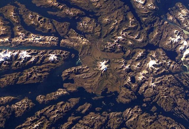
A group of andesitic, columnar-jointed lava domes and pyroclastic cones up to 150 m high on Isla Cook mark the southernmost Holocene volcanoes of the Andes. The volcanoes, known as Volcán Cook or Volcán Fueguino, occupy a broad peninsula forming the SE end of the island. One of the cones, S of Bahía del Volcán, contains a 150-m-wide crater with a small lake. The lava domes and pyroclastic cones, possibly emplaced along N-S-trending faults, are unaffected by glacial erosion that scoured the underlying plutonic rocks. Passing navigators observed possible eruptive activity in the direction of Cook in 1712 and the eruption of incandescent ejecta in 1820.
— Smithsonian Institution, Global Volcanism Program
2 Recorded Eruptions
| Year | VEI | Type | Area |
|---|---|---|---|
| 1820 | 2 | Confirmed Eruption | — |
| 1712 | — | Uncertain Eruption | — |
Real-Time Data
Frequently Asked Questions About Fueguino
Is Fueguino an active volcano?+
Fueguino is classified as active based on credible evidence of past eruptions. Although its last known eruption was in 1820 CE, volcanologists consider it capable of erupting again.
When did Fueguino last erupt?+
The most recent recorded eruption of Fueguino occurred in 1820 CE with a Volcanic Explosivity Index (VEI) of 2. The eruption was classified as a "Confirmed Eruption." Fueguino has 2 recorded eruptions in total.
How high is Fueguino?+
Fueguino has a summit elevation of 157 meters (515 feet) above sea level. At 157 meters, it is a relatively low-elevation volcano.
What type of volcano is Fueguino?+
Fueguino is classified as a Lava dome(s). Lava domes are mounds of viscous lava that pile up around a volcanic vent. They grow by expansion from within and can collapse to produce dangerous pyroclastic flows.
Where is Fueguino located?+
Fueguino is located in Chile, in the South America Volcanic Regions. More specifically, it lies within the Austral Andean Volcanic Arc. Its exact coordinates are -54.970° latitude, -70.262° longitude.
Is it safe to visit Fueguino?+
Fueguino can generally be visited, but as with any volcano, visitors should check local conditions and any advisory notices before traveling. Chile may have specific regulations for accessing volcanic areas. Guided tours are often the safest and most informative way to experience a volcano.