About Aguilera
Aguilera is a stratovolcano rising to 2,546 meters (8,353 feet) in Chile's South America Volcanic Regions. Its last known eruption dates to 1253 BCE, in prehistoric times. The volcano has produced 2 recorded eruptions, with a maximum Volcanic Explosivity Index (VEI) of 5.
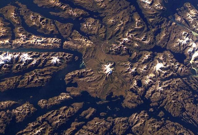
Geography & Climate
Aguilera is located in Chile, within the Austral Andean Volcanic Arc of the broader South America Volcanic Regions. Situated at 50.33° S, 73.75° W in the Southern Hemisphere, the volcano lies within a temperate climate zone. At 2,546 meters above sea level, Aguilera rises above the surrounding terrain into montane or subalpine conditions. The elevation creates distinct ecological zones along its flanks, from forested lower slopes to exposed rocky terrain near the summit. The volcanic landform is characterized as a composite, which describes the physical shape and structure of the volcanic edifice as observed from the surface.
Geological Context
Aguilera sits in a subduction zone, where one tectonic plate dives beneath another, creating intense heat and pressure that generates magma. Subduction zones are responsible for many of the world's most explosive volcanoes and deadliest eruptions. For communities in Chile near Aguilera, this tectonic setting means the volcano is capable of producing powerful explosive eruptions, pyroclastic flows, and lahars that can threaten populated areas within tens of kilometers of the summit. The dominant rock type is dacite, an intermediate to silica-rich volcanic rock. This composition typically produces more viscous magma, leading to more explosive eruptions with ash columns and pyroclastic flows. Andesitic and dacitic magmas build pressure before erupting, which is why volcanoes with this rock chemistry are often associated with Plinian-style eruptions that can send ash tens of kilometers into the atmosphere and disrupt aviation across entire regions.
Eruption History Summary
Aguilera has 2 recorded eruptions in the geological database, spanning from 2610 BCE to 1253 BCE. The most powerful recorded event was a paroxysmal eruption with devastating regional consequences in 1253 BCE, reaching VEI 5 on the Volcanic Explosivity Index. These eruptions span roughly 1,357 years of volcanic history.
Significance
With a maximum recorded VEI of 5, Aguilera has demonstrated the capacity for paroxysmal eruptions comparable to the 1980 eruption of Mount St. Helens. Eruptions of this scale can devastate areas within 20-30 kilometers and produce ash fall that disrupts aviation and agriculture across hundreds of kilometers.
GVP Reference Summary
Aguilera, located west of Lake Argentina and NE of Peel Fjiord, is part of the Austral Volcanic Zone (AVZ) in the southernmost Chilean Andes. Geochemical evidence indicated that the dacitic volcano was the source of a major late Holocene tephra layer that was erupted around 3,200 years ago (Stern, 2008).
— Smithsonian Institution, Global Volcanism Program
2 Recorded Eruptions
| Year | VEI | Type | Area |
|---|---|---|---|
| 1253 BCE | 5 | Confirmed Eruption | — |
| 2610 BCE | — | Confirmed Eruption | — |
Real-Time Data
Frequently Asked Questions About Aguilera
Is Aguilera an active volcano?+
Aguilera is not currently classified as active. Its activity evidence is listed as "Eruption Dated." The last known eruption was in 1253 BCE. However, no volcano is ever considered permanently extinct.
When did Aguilera last erupt?+
The most recent recorded eruption of Aguilera occurred in 1253 BCE with a Volcanic Explosivity Index (VEI) of 5. The eruption was classified as a "Confirmed Eruption." Aguilera has 2 recorded eruptions in total.
How high is Aguilera?+
Aguilera has a summit elevation of 2,546 meters (8,353 feet) above sea level. At 2,546 meters, it is comparable in height to many significant mountain peaks and stands well above the tree line.
What type of volcano is Aguilera?+
Aguilera is classified as a Stratovolcano. Stratovolcanoes (also called composite volcanoes) are steep, conical volcanoes built up by many layers of hardened lava, tephra, and volcanic ash. They are among the most common and dangerous types, known for explosive eruptions.
Where is Aguilera located?+
Aguilera is located in Chile, in the South America Volcanic Regions. More specifically, it lies within the Austral Andean Volcanic Arc. Its exact coordinates are -50.330° latitude, -73.750° longitude.
Is it safe to visit Aguilera?+
Aguilera can generally be visited, but as with any volcano, visitors should check local conditions and any advisory notices before traveling. Chile may have specific regulations for accessing volcanic areas. Guided tours are often the safest and most informative way to experience a volcano.