About Burney, Monte
Burney, Monte is a stratovolcano rising to 1,758 meters (5,768 feet) in Chile's South America Volcanic Regions. It last erupted in 1910 CE, and volcanologists consider it an active volcanic system. The volcano has produced 7 recorded eruptions, with a maximum Volcanic Explosivity Index (VEI) of 5.
Geography & Climate
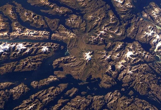
Burney, Monte is located in Chile, within the Austral Andean Volcanic Arc of the broader South America Volcanic Regions. Situated at 52.33° S, 73.40° W in the Southern Hemisphere, the volcano lies within a temperate climate zone. With a summit elevation of 1,758 meters above sea level, Burney, Monte is a moderately sized peak that remains accessible to hikers and researchers for much of the year. The volcanic landform is characterized as a composite, which describes the physical shape and structure of the volcanic edifice as observed from the surface.
Geological Context
Burney, Monte sits in a subduction zone, where one tectonic plate dives beneath another, creating intense heat and pressure that generates magma. Subduction zones are responsible for many of the world's most explosive volcanoes and deadliest eruptions. For communities in Chile near Burney, Monte, this tectonic setting means the volcano is capable of producing powerful explosive eruptions, pyroclastic flows, and lahars that can threaten populated areas within tens of kilometers of the summit. The dominant rock type is andesite / basaltic andesite, a dark, fine-grained volcanic rock that forms from rapidly cooling, low-viscosity lava. Basaltic eruptions tend to be less explosive and produce fluid lava flows that can travel long distances. While less immediately dangerous than explosive eruptions, basaltic lava flows can destroy structures and infrastructure in their path, and volcanic gases released during these eruptions can affect air quality over a wide area.
Eruption History Summary
Burney, Monte has 7 recorded eruptions in the geological database, spanning from 7450 BCE to 1910 CE. The most powerful recorded event was a paroxysmal eruption with devastating regional consequences in 2320 BCE, reaching VEI 5 on the Volcanic Explosivity Index. Notable eruptions include 2320 BCE (VEI 5), 7450 BCE (VEI 5). This eruption frequency indicates a moderately active volcanic system with periodic reawakenings. The most recent eruption in 1910 CE places this volcano within the modern era of volcanological observation.
Significance
With a maximum recorded VEI of 5, Burney, Monte has demonstrated the capacity for paroxysmal eruptions comparable to the 1980 eruption of Mount St. Helens. Eruptions of this scale can devastate areas within 20-30 kilometers and produce ash fall that disrupts aviation and agriculture across hundreds of kilometers. With 7 recorded eruptions on file, Burney, Monte has enough documented activity to help scientists identify patterns in its eruptive behavior.
GVP Reference Summary
Monte Burney, a large ice-covered volcano in the Patagonian region of Chile, lies about 200 km NW of the town of Punta Arenas. It was constructed on the western rim of a 6-km-wide caldera, which is partially filled with and surrounded by an unglaciated pyroclastic-flow deposit. Flank vents produced andesitic-dacitic lava flows and pyroclastic material. Collapse of the edifice produced a major debris avalanche that traveled to the SSW. Two large Plinian eruptions have been documented during the Holocene. The only known historical eruption took place in 1910.
— Smithsonian Institution, Global Volcanism Program
7 Recorded Eruptions
| Year | VEI | Type | Area |
|---|---|---|---|
| 1910 | 2 | Confirmed Eruption | — |
| 90 BCE | — | Confirmed Eruption | — |
| 800 BCE | — | Confirmed Eruption | — |
| 2320 BCE | 5 | Confirmed Eruption | — |
| 3740 BCE | — | Confirmed Eruption | — |
| 7390 BCE | — | Confirmed Eruption | — |
| 7450 BCE | 5 | Confirmed Eruption | — |
Real-Time Data
Frequently Asked Questions About Burney, Monte
Is Burney, Monte an active volcano?+
Yes, Burney, Monte is considered an active volcano. Its most recent eruption was in 1910 CE. The volcano is monitored by geological agencies, and its activity status is based on observed eruptions within recorded history.
When did Burney, Monte last erupt?+
The most recent recorded eruption of Burney, Monte occurred in 1910 CE with a Volcanic Explosivity Index (VEI) of 2. The eruption was classified as a "Confirmed Eruption." Burney, Monte has 7 recorded eruptions in total.
How high is Burney, Monte?+
Burney, Monte has a summit elevation of 1,758 meters (5,768 feet) above sea level. At 1,758 meters, it is a moderately sized volcanic peak, roughly comparable to Mount Vesuvius (1,281m).
What type of volcano is Burney, Monte?+
Burney, Monte is classified as a Stratovolcano. Stratovolcanoes (also called composite volcanoes) are steep, conical volcanoes built up by many layers of hardened lava, tephra, and volcanic ash. They are among the most common and dangerous types, known for explosive eruptions.
Where is Burney, Monte located?+
Burney, Monte is located in Chile, in the South America Volcanic Regions. More specifically, it lies within the Austral Andean Volcanic Arc. Its exact coordinates are -52.330° latitude, -73.400° longitude.
Is it safe to visit Burney, Monte?+
Visiting Burney, Monte requires checking current volcanic activity and alert levels. As an active volcano with eruptions as recent as 1910 CE, conditions can change rapidly. Always consult local geological authorities and follow official warnings before visiting. Many active volcanoes have designated safe viewing areas and guided tour options.

