About Atuel, Caldera del
Atuel, Caldera del is a caldera rising to 5,189 meters (17,025 feet) in Argentina's South America Volcanic Regions. No historical eruptions have been recorded, though the volcano is classified based on geological evidence of past activity.
Geography & Climate
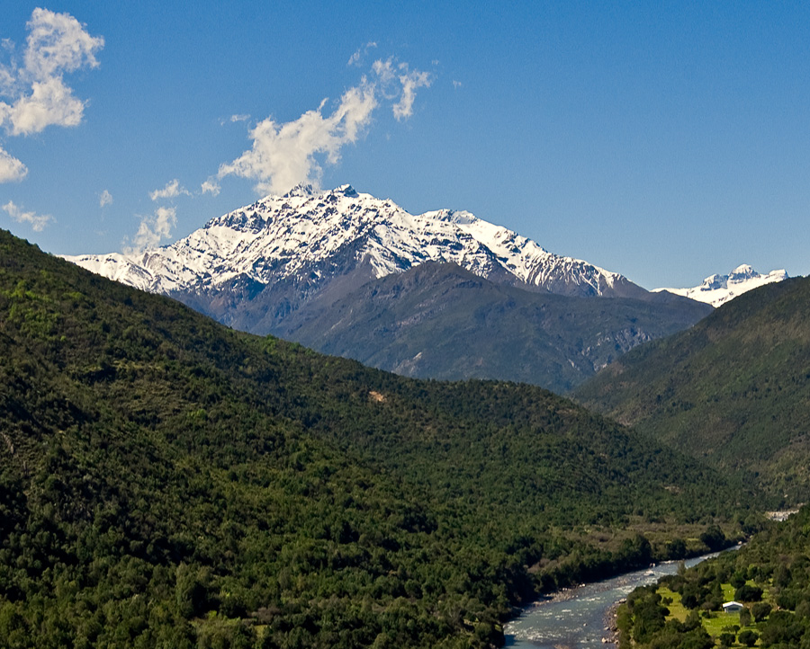
Atuel, Caldera del is located in Argentina, within the Southern Andean Volcanic Arc of the broader South America Volcanic Regions. Situated at 34.59° S, 69.92° W in the Southern Hemisphere, the volcano lies within a subtropical climate zone. At 5,189 meters above sea level, Atuel, Caldera del reaches well into the permanent snow and ice zone. Glaciers and snowpack on the upper slopes create the potential for lahars — destructive volcanic mudflows — during eruptions, as heat rapidly melts ice and snow. The volcanic landform is characterized as a caldera, which describes the physical shape and structure of the volcanic edifice as observed from the surface.
Geological Context
Atuel, Caldera del sits in a subduction zone, where one tectonic plate dives beneath another, creating intense heat and pressure that generates magma. Subduction zones are responsible for many of the world's most explosive volcanoes and deadliest eruptions. For communities in Argentina near Atuel, Caldera del, this tectonic setting means the volcano is capable of producing powerful explosive eruptions, pyroclastic flows, and lahars that can threaten populated areas within tens of kilometers of the summit. The dominant rock type is andesite / basaltic andesite, a dark, fine-grained volcanic rock that forms from rapidly cooling, low-viscosity lava. Basaltic eruptions tend to be less explosive and produce fluid lava flows that can travel long distances. While less immediately dangerous than explosive eruptions, basaltic lava flows can destroy structures and infrastructure in their path, and volcanic gases released during these eruptions can affect air quality over a wide area.
GVP Reference Summary
The 30 x 45 km Caldera del Atuel complex, ~30 km NW-SE and 45 km NE-SW, lies just east of the Argentina-Chile border and 18 km SSW of the rim of the Pleistocene Diamante caldera. The western rim in part follows the international border, and the headwaters of the Río del Atuel drain to the SE through a wide breach in the caldera rim. The broad floor of the caldera contains with 15 dacitic lava domes and 25 basaltic andesite to andesitic stratovolcanoes and cinder cones. A group of cones known as Las Lágrimas overlies the SW rim of the caldera, and Volcán Guanaqueros on the NE flank of the caldera is a group of young basaltic-to-andesitic cinder cones. The Volcán Overo complex in the E-central part of the caldera and the Volcán Sosneado complex in the S part of the caldera contain numerous very youthful basaltic-to-andesitic pyroclastic cones and lava flows. The Overo complex contains 20 centers, and lava flows of the Sosneado complex cover an area of 200 km2.
— Smithsonian Institution, Global Volcanism Program
0 Recorded Eruptions
No eruption records available for Atuel, Caldera del.
Real-Time Data
Frequently Asked Questions About Atuel, Caldera del
Is Atuel, Caldera del an active volcano?+
Atuel, Caldera del is classified as active based on credible evidence of past eruptions. Although its last known eruption was in prehistoric times, volcanologists consider it capable of erupting again.
How high is Atuel, Caldera del?+
Atuel, Caldera del has a summit elevation of 5,189 meters (17,025 feet) above sea level. At 5,189 meters, it stands taller than Mount Rainier (4,392m) and is among the world's major volcanic peaks.
What type of volcano is Atuel, Caldera del?+
Atuel, Caldera del is classified as a Caldera. Calderas are large volcanic depressions formed when a volcano erupts so powerfully that its magma chamber collapses, creating a basin that can be kilometers wide. They are often sites of some of Earth's largest eruptions.
Where is Atuel, Caldera del located?+
Atuel, Caldera del is located in Argentina, in the South America Volcanic Regions. More specifically, it lies within the Southern Andean Volcanic Arc. Its exact coordinates are -34.592° latitude, -69.921° longitude.
Is it safe to visit Atuel, Caldera del?+
Atuel, Caldera del can generally be visited, but as with any volcano, visitors should check local conditions and any advisory notices before traveling. Argentina may have specific regulations for accessing volcanic areas. Guided tours are often the safest and most informative way to experience a volcano.