About Palomo
Palomo is a stratovolcano rising to 4,860 meters (15,946 feet) in Chile's South America Volcanic Regions. No historical eruptions have been recorded, though the volcano is classified based on geological evidence of past activity.
Geography & Climate
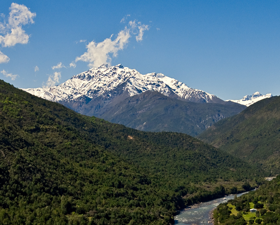
Palomo is located in Chile, within the Southern Andean Volcanic Arc of the broader South America Volcanic Regions. Situated at 34.61° S, 70.30° W in the Southern Hemisphere, the volcano lies within a subtropical climate zone. Standing at 4,860 meters above sea level, Palomo towers above the alpine zone, where vegetation gives way to bare rock, snow, and ice for much of the year. The high elevation means the upper slopes experience significantly colder temperatures than surrounding lowlands. The volcanic landform is characterized as a composite, which describes the physical shape and structure of the volcanic edifice as observed from the surface.
Geological Context
Palomo sits in a subduction zone, where one tectonic plate dives beneath another, creating intense heat and pressure that generates magma. Subduction zones are responsible for many of the world's most explosive volcanoes and deadliest eruptions. For communities in Chile near Palomo, this tectonic setting means the volcano is capable of producing powerful explosive eruptions, pyroclastic flows, and lahars that can threaten populated areas within tens of kilometers of the summit. The dominant rock type is andesite / basaltic andesite, a dark, fine-grained volcanic rock that forms from rapidly cooling, low-viscosity lava. Basaltic eruptions tend to be less explosive and produce fluid lava flows that can travel long distances. While less immediately dangerous than explosive eruptions, basaltic lava flows can destroy structures and infrastructure in their path, and volcanic gases released during these eruptions can affect air quality over a wide area.
GVP Reference Summary
Palomo is a small stratovolcano that is somewhat dissected by glaciers. A NE-flank cone, Andres, is postglacial in age and has produced andesitic lava flows. The volcano lies W of the massive Caldera del Atuel and was constructed within double calderas 3 and 5 km in diameter. The largely ice-covered volcano has erupted basaltic andesite to dacitic lava flows; the double crater indicates migration of activity to the NE. The youthful morphology suggests a very recent, perhaps pre-Hispanic, age.
— Smithsonian Institution, Global Volcanism Program
0 Recorded Eruptions
No eruption records available for Palomo.
Real-Time Data
Frequently Asked Questions About Palomo
Is Palomo an active volcano?+
Palomo is classified as active based on credible evidence of past eruptions. Although its last known eruption was in prehistoric times, volcanologists consider it capable of erupting again.
How high is Palomo?+
Palomo has a summit elevation of 4,860 meters (15,946 feet) above sea level. At 4,860 meters, it stands taller than Mount Rainier (4,392m) and is among the world's major volcanic peaks.
What type of volcano is Palomo?+
Palomo is classified as a Stratovolcano. Stratovolcanoes (also called composite volcanoes) are steep, conical volcanoes built up by many layers of hardened lava, tephra, and volcanic ash. They are among the most common and dangerous types, known for explosive eruptions.
Where is Palomo located?+
Palomo is located in Chile, in the South America Volcanic Regions. More specifically, it lies within the Southern Andean Volcanic Arc. Its exact coordinates are -34.608° latitude, -70.295° longitude.
Is it safe to visit Palomo?+
Palomo can generally be visited, but as with any volcano, visitors should check local conditions and any advisory notices before traveling. Chile may have specific regulations for accessing volcanic areas. Guided tours are often the safest and most informative way to experience a volcano.