About Lanzarote
Lanzarote is a fissure vent(s) rising to 670 meters (2,198 feet) in Spain's Northern Africa Volcanic Regions. Its last known eruption was in 1824 CE. The volcano has produced 4 recorded eruptions, with a maximum Volcanic Explosivity Index (VEI) of 3.
Geography & Climate
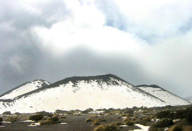
Lanzarote is located in Spain, within the Canary Volcanic Province of the broader Northern Africa Volcanic Regions. Situated at 29.03° N, 13.63° W in the Northern Hemisphere, the volcano lies within a subtropical climate zone. With a summit elevation of 670 meters above sea level, Lanzarote is a moderately sized peak that remains accessible to hikers and researchers for much of the year. The volcanic landform is characterized as a cluster, which describes the physical shape and structure of the volcanic edifice as observed from the surface.
Geological Context
Lanzarote is an intraplate volcano, meaning it formed away from any plate boundary. These volcanoes are often powered by hotspots — plumes of abnormally hot mantle material rising from deep within the Earth. Hotspot volcanoes like Lanzarote tend to produce effusive eruptions with lava flows that can be relatively predictable, giving nearby communities in Spain more time to prepare. However, they can also produce explosive phases, particularly when magma interacts with groundwater. The dominant rock type is basalt / picro-basalt, a dark, fine-grained volcanic rock that forms from rapidly cooling, low-viscosity lava. Basaltic eruptions tend to be less explosive and produce fluid lava flows that can travel long distances. While less immediately dangerous than explosive eruptions, basaltic lava flows can destroy structures and infrastructure in their path, and volcanic gases released during these eruptions can affect air quality over a wide area.
Eruption History Summary
Lanzarote has 4 recorded eruptions in the geological database, spanning from 500 CE to 1824 CE. The most powerful recorded event was a severe eruption capable of regional ash fall and pyroclastic flows in 1730 CE, reaching VEI 3 on the Volcanic Explosivity Index. These eruptions span roughly 1,324 years of volcanic history.
Significance
With a maximum recorded VEI of 3, Lanzarote has produced eruptions capable of generating pyroclastic flows and significant ash fall in the surrounding area. While not among the largest eruptions globally, VEI 3 events pose serious hazards to local populations and can disrupt regional air travel.
GVP Reference Summary
The 60-km-long island of Lanzarote at the NE end of the Canary Islands contains the largest concentration of youthful volcanism in the Canaries. Pleistocene-and-Holocene cinder cones and lava flows erupted along NE-SW fissures are found throughout the low-altitude arid island and on smaller islands to the north. The largest historical eruption of the Canary Islands took place during 1730-36, when long-term eruptions from a fissure formed the Montañas del Fuego and produced voluminous lava flows that covered about 200 km2. The lava flows reached the western coast along a broad, 20-km-wide front. The villages of Maretas and Santa Catalina were destroyed, along with the most fertile valleys and estates on the island. An eruption during 1824 produced a much smaller lava flow that reached the SW coast.
— Smithsonian Institution, Global Volcanism Program
4 Recorded Eruptions
| Year | VEI | Type | Area |
|---|---|---|---|
| 1824 | 2 | Confirmed Eruption | Tao, Nuevo del Fuego, Tinguatón |
| 1730 | 3 | Confirmed Eruption | Montañas del Fuego |
| 700 | — | Confirmed Eruption | Mazo, Santa Catalina, Corazoncillo |
| 500 | — | Confirmed Eruption | Montaña de Juan Perdomo |
Real-Time Data
Frequently Asked Questions About Lanzarote
Is Lanzarote an active volcano?+
Lanzarote is classified as active based on credible evidence of past eruptions. Although its last known eruption was in 1824 CE, volcanologists consider it capable of erupting again.
When did Lanzarote last erupt?+
The most recent recorded eruption of Lanzarote occurred in 1824 CE with a Volcanic Explosivity Index (VEI) of 2. The eruption was classified as a "Confirmed Eruption." Lanzarote has 4 recorded eruptions in total.
How high is Lanzarote?+
Lanzarote has a summit elevation of 670 meters (2,198 feet) above sea level. At 670 meters, it is a relatively low-elevation volcano.
What type of volcano is Lanzarote?+
Lanzarote is classified as a Fissure vent(s). Fissure vent(s) volcanoes have distinct geological characteristics that set them apart from other volcanic types.
Where is Lanzarote located?+
Lanzarote is located in Spain, in the Northern Africa Volcanic Regions. More specifically, it lies within the Canary Volcanic Province. Its exact coordinates are 29.030° latitude, -13.630° longitude.
Is it safe to visit Lanzarote?+
Lanzarote can generally be visited, but as with any volcano, visitors should check local conditions and any advisory notices before traveling. Spain may have specific regulations for accessing volcanic areas. Guided tours are often the safest and most informative way to experience a volcano.