About Gran Canaria
Gran Canaria is a fissure vent(s) rising to 1,950 meters (6,398 feet) in Spain's Northern Africa Volcanic Regions. Its last known eruption was in 40 CE. The volcano has produced 11 recorded eruptions.
Geography & Climate
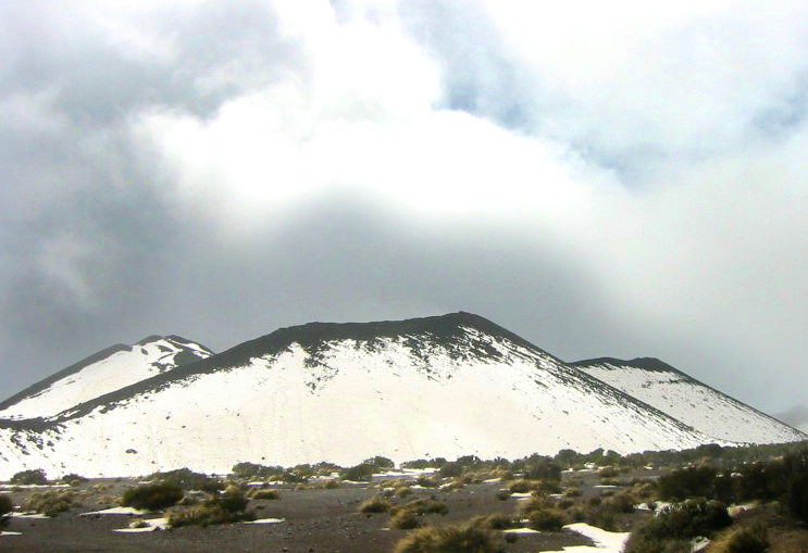
Gran Canaria is located in Spain, within the Canary Volcanic Province of the broader Northern Africa Volcanic Regions. Situated at 28.00° N, 15.58° W in the Northern Hemisphere, the volcano lies within a subtropical climate zone. With a summit elevation of 1,950 meters above sea level, Gran Canaria is a moderately sized peak that remains accessible to hikers and researchers for much of the year. The volcanic landform is characterized as a cluster, which describes the physical shape and structure of the volcanic edifice as observed from the surface.
Geological Context
Gran Canaria is an intraplate volcano, meaning it formed away from any plate boundary. These volcanoes are often powered by hotspots — plumes of abnormally hot mantle material rising from deep within the Earth. Hotspot volcanoes like Gran Canaria tend to produce effusive eruptions with lava flows that can be relatively predictable, giving nearby communities in Spain more time to prepare. However, they can also produce explosive phases, particularly when magma interacts with groundwater. The dominant rock type is trachybasalt / tephrite basanite, a dark, fine-grained volcanic rock that forms from rapidly cooling, low-viscosity lava. Basaltic eruptions tend to be less explosive and produce fluid lava flows that can travel long distances. While less immediately dangerous than explosive eruptions, basaltic lava flows can destroy structures and infrastructure in their path, and volcanic gases released during these eruptions can affect air quality over a wide area.
Eruption History Summary
Gran Canaria has 11 recorded eruptions in the geological database, spanning from 4670 BCE to 40 CE. This level of eruptive frequency indicates a persistently active volcanic system that warrants ongoing monitoring.
Significance
With 11 recorded eruptions, Gran Canaria has a substantial eruptive history that provides valuable data for understanding volcanic behavior and assessing future hazards in the Northern Africa Volcanic Regions region.
GVP Reference Summary
The circular 60-km-wide island of Gran Canaria in the middle of the Canary archipelago includes three major volcanic structures, and has been modified by caldera collapse, gravitational edifice failure, and extensive erosion resulting in steep-walled radial gorges called barrancos. Although the island is largely Miocene-to-Pliocene, middle Quaternary scoria cones and lava flows are found in the northern and eastern parts of the massive shield volcano, which is cut by a major NW-SE-trending rift zone that extends across the island and fed flows primarily to the NE. Basaltic cones and lava flows of Holocene age are situated within a NW-trending zone from Berrazales to Bandama, and at Las Isletas, a peninsula on the NE coast. One cinder cone was radiocarbon dated at about 3,000 years before present, and other cones and flows may be less than 1,000 years old.
— Smithsonian Institution, Global Volcanism Program
11 Recorded Eruptions
| Year | VEI | Type | Area |
|---|---|---|---|
| 40 | — | Confirmed Eruption | Bandama |
| 10 | — | Confirmed Eruption | El Garañón |
| 580 BCE | — | Confirmed Eruption | Doramas and El Lentiscal |
| 590 BCE | — | Confirmed Eruption | Sima de Jinámar |
| 620 BCE | — | Confirmed Eruption | Montaña Negra de Jinámar |
| 920 BCE | — | Confirmed Eruption | Jabalobos |
| 1010 BCE | — | Confirmed Eruption | Pinos de Gáldar |
| 1180 BCE | — | Confirmed Eruption | Montañón Negro |
| 1250 BCE | — | Confirmed Eruption | Fagajesto |
| 4630 BCE | — | Confirmed Eruption | San Mateo |
| 4670 BCE | — | Confirmed Eruption | El Hoyo |
Real-Time Data
Frequently Asked Questions About Gran Canaria
Is Gran Canaria an active volcano?+
Gran Canaria is not currently classified as active. Its activity evidence is listed as "Eruption Dated." The last known eruption was in 40 CE. However, no volcano is ever considered permanently extinct.
When did Gran Canaria last erupt?+
The most recent recorded eruption of Gran Canaria occurred in 40 CE. The eruption was classified as a "Confirmed Eruption." Gran Canaria has 11 recorded eruptions in total.
How high is Gran Canaria?+
Gran Canaria has a summit elevation of 1,950 meters (6,398 feet) above sea level. At 1,950 meters, it is a moderately sized volcanic peak, roughly comparable to Mount Vesuvius (1,281m).
What type of volcano is Gran Canaria?+
Gran Canaria is classified as a Fissure vent(s). Fissure vent(s) volcanoes have distinct geological characteristics that set them apart from other volcanic types.
Where is Gran Canaria located?+
Gran Canaria is located in Spain, in the Northern Africa Volcanic Regions. More specifically, it lies within the Canary Volcanic Province. Its exact coordinates are 28.000° latitude, -15.580° longitude.
Is it safe to visit Gran Canaria?+
Gran Canaria can generally be visited, but as with any volcano, visitors should check local conditions and any advisory notices before traveling. Spain may have specific regulations for accessing volcanic areas. Guided tours are often the safest and most informative way to experience a volcano.