About La Palma
La Palma is a stratovolcano(es) rising to 2,426 meters (7,960 feet) in Spain's Northern Africa Volcanic Regions. The volcano is currently active, with its most recent eruption in 2021 CE. The volcano has produced 14 recorded eruptions, with a maximum Volcanic Explosivity Index (VEI) of 3.
Geography & Climate
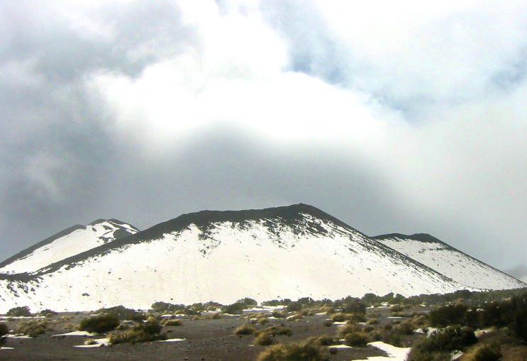
La Palma is located in Spain, within the Canary Volcanic Province of the broader Northern Africa Volcanic Regions. Situated at 28.57° N, 17.83° W in the Northern Hemisphere, the volcano lies within a subtropical climate zone. At 2,426 meters above sea level, La Palma rises above the surrounding terrain into montane or subalpine conditions. The elevation creates distinct ecological zones along its flanks, from forested lower slopes to exposed rocky terrain near the summit. The volcanic landform is characterized as a composite, which describes the physical shape and structure of the volcanic edifice as observed from the surface.
Geological Context
La Palma is an intraplate volcano, meaning it formed away from any plate boundary. These volcanoes are often powered by hotspots — plumes of abnormally hot mantle material rising from deep within the Earth. Hotspot volcanoes like La Palma tend to produce effusive eruptions with lava flows that can be relatively predictable, giving nearby communities in Spain more time to prepare. However, they can also produce explosive phases, particularly when magma interacts with groundwater. The dominant rock type is trachybasalt / tephrite basanite, a dark, fine-grained volcanic rock that forms from rapidly cooling, low-viscosity lava. Basaltic eruptions tend to be less explosive and produce fluid lava flows that can travel long distances. While less immediately dangerous than explosive eruptions, basaltic lava flows can destroy structures and infrastructure in their path, and volcanic gases released during these eruptions can affect air quality over a wide area.
Eruption History Summary
La Palma has 14 recorded eruptions in the geological database, spanning from 6050 BCE to 2021 CE. The most powerful recorded event was a severe eruption capable of regional ash fall and pyroclastic flows in 2021 CE, reaching VEI 3 on the Volcanic Explosivity Index. This level of eruptive frequency indicates a persistently active volcanic system that warrants ongoing monitoring. With eruptive activity as recently as 2021 CE, La Palma remains an actively monitored volcano.
Significance
With a maximum recorded VEI of 3, La Palma has produced eruptions capable of generating pyroclastic flows and significant ash fall in the surrounding area. While not among the largest eruptions globally, VEI 3 events pose serious hazards to local populations and can disrupt regional air travel. With 14 recorded eruptions, La Palma has a substantial eruptive history that provides valuable data for understanding volcanic behavior and assessing future hazards in the Northern Africa Volcanic Regions region. Given its recent activity, La Palma is closely monitored by geological survey organizations to provide early warning of future unrest.
GVP Reference Summary
The 47-km-long wedge-shaped island of La Palma, the NW-most of the Canary Islands, is composed of two large volcanic centers. The older northern one is cut by the steep-walled Caldera Taburiente, one of several massive collapse scarps produced by edifice failure to the SW. On the south, the younger Cumbre Vieja volcano is one of the most active in the Canaries. The elongated volcano dates back to about 125,000 years ago and is oriented N-S. Eruptions during the past 7,000 years have formed abundant cinder cones and craters along the axis, producing fissure-fed lava flows that descend steeply to the sea. Eruptions recorded since the 15th century have produced mild explosive activity and lava flows that damaged populated areas. The southern tip of the island is mantled by a broad lava field emplaced during the 1677-1678 eruption. Lava flows also reached the sea in 1585, 1646, 1712, 1949, 1971, and 2021.
— Smithsonian Institution, Global Volcanism Program
14 Recorded Eruptions
| Year | VEI | Type | Area |
|---|---|---|---|
| 2021 | 3 | Confirmed Eruption | Tajogaite eruption |
| 1971 | 2 | Confirmed Eruption | Teneguia |
| 1949 | 2 | Confirmed Eruption | San Juan, Llano del Banco, Hoyo Negro |
| 1712 | 2 | Confirmed Eruption | El Charco |
| 1677 | 2 | Confirmed Eruption | N & S flanks of San Antonio (Fuentecaliente) |
| 1646 | 2 | Confirmed Eruption | South flank of San Martín (Tigalate) |
| 1585 | 2 | Confirmed Eruption | Tahuya |
| 1481 | 2 | Confirmed Eruption | Tacande (Montaña Quemada) |
| 900 | — | Confirmed Eruption | Nambroque II-Malforada |
| 360 BCE | — | Confirmed Eruption | El Fraile |
| 1320 BCE | — | Confirmed Eruption | La Fajana (Volcán Fuego) |
| 4050 BCE | — | Confirmed Eruption | L'Amendrita, Birigoyo |
| 4900 BCE | — | Confirmed Eruption | — |
| 6050 BCE | — | Confirmed Eruption | — |
Real-Time Data
Frequently Asked Questions About La Palma
Is La Palma an active volcano?+
Yes, La Palma is considered an active volcano. Its most recent eruption was in 2021 CE. The volcano is monitored by geological agencies, and its activity status is based on observed eruptions within recorded history.
When did La Palma last erupt?+
The most recent recorded eruption of La Palma occurred in 2021 CE with a Volcanic Explosivity Index (VEI) of 3. The eruption was classified as a "Confirmed Eruption." La Palma has 14 recorded eruptions in total.
How high is La Palma?+
La Palma has a summit elevation of 2,426 meters (7,960 feet) above sea level. At 2,426 meters, it is comparable in height to many significant mountain peaks and stands well above the tree line.
What type of volcano is La Palma?+
La Palma is classified as a Stratovolcano(es). Stratovolcano(es) volcanoes have distinct geological characteristics that set them apart from other volcanic types.
Where is La Palma located?+
La Palma is located in Spain, in the Northern Africa Volcanic Regions. More specifically, it lies within the Canary Volcanic Province. Its exact coordinates are 28.570° latitude, -17.830° longitude.
Is it safe to visit La Palma?+
Visiting La Palma requires checking current volcanic activity and alert levels. As an active volcano with eruptions as recent as 2021 CE, conditions can change rapidly. Always consult local geological authorities and follow official warnings before visiting. Many active volcanoes have designated safe viewing areas and guided tour options.