About Hierro
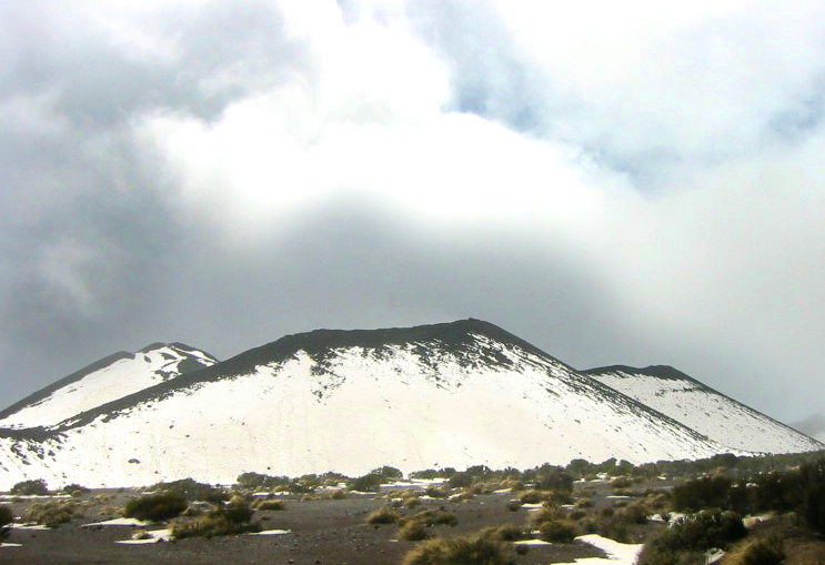
Hierro is a shield rising to 1,500 meters (4,922 feet) in Spain's Northern Africa Volcanic Regions. It has been active in recent decades, with its last eruption in 2012 CE. The volcano has produced 7 recorded eruptions, with a maximum Volcanic Explosivity Index (VEI) of 2.
Geography & Climate
Hierro is located in Spain, within the Canary Volcanic Province of the broader Northern Africa Volcanic Regions. Situated at 27.73° N, 18.03° W in the Northern Hemisphere, the volcano lies within a subtropical climate zone. With a summit elevation of 1,500 meters above sea level, Hierro is a moderately sized peak that remains accessible to hikers and researchers for much of the year. The volcanic landform is characterized as a shield, which describes the physical shape and structure of the volcanic edifice as observed from the surface.
Geological Context
Hierro is an intraplate volcano, meaning it formed away from any plate boundary. These volcanoes are often powered by hotspots — plumes of abnormally hot mantle material rising from deep within the Earth. Hotspot volcanoes like Hierro tend to produce effusive eruptions with lava flows that can be relatively predictable, giving nearby communities in Spain more time to prepare. However, they can also produce explosive phases, particularly when magma interacts with groundwater. The dominant rock type is trachybasalt / tephrite basanite, a dark, fine-grained volcanic rock that forms from rapidly cooling, low-viscosity lava. Basaltic eruptions tend to be less explosive and produce fluid lava flows that can travel long distances. While less immediately dangerous than explosive eruptions, basaltic lava flows can destroy structures and infrastructure in their path, and volcanic gases released during these eruptions can affect air quality over a wide area.
Eruption History Summary
Hierro has 7 recorded eruptions in the geological database, spanning from 4790 BCE to 2011 CE. The most powerful recorded event was an explosive event producing ash plumes up to several kilometers in 2011 CE, reaching VEI 2 on the Volcanic Explosivity Index. This eruption frequency indicates a moderately active volcanic system with periodic reawakenings. With eruptive activity as recently as 2011 CE, Hierro remains an actively monitored volcano.
Significance
With 7 recorded eruptions on file, Hierro has enough documented activity to help scientists identify patterns in its eruptive behavior. Given its recent activity, Hierro is closely monitored by geological survey organizations to provide early warning of future unrest.
GVP Reference Summary
The triangular island of Hierro is the SW-most and least studied of the Canary Islands. The massive shield volcano is truncated by a large NW-facing escarpment formed as a result of gravitational collapse of El Golfo volcano about 130,000 years ago. The steep-sided scarp towers above a low lava platform bordering 12-km-wide El Golfo Bay, and three other large submarine landslide deposits occur to the SW and SE. Three prominent rifts oriented NW, NE, and S form prominent topographic ridges. The subaerial portion of the volcano consists of flat-lying Quaternary basaltic and trachybasaltic lava flows and tuffs capped by numerous young cinder cones and lava flows. Holocene cones and flows are found both on the outer flanks and in the El Golfo depression. Hierro contains the greatest concentration of young vents in the Canary Islands. Uncertainty surrounds the report of an eruption in 1793. A submarine eruption took place about 2 km SSW off the southern point of the island during 2011-12.
— Smithsonian Institution, Global Volcanism Program
7 Recorded Eruptions
| Year | VEI | Type | Area |
|---|---|---|---|
| 2011 | 2 | Confirmed Eruption | Submarine S flank, Tagaro cone |
| 1793 | 0 | Uncertain Eruption | NW rift (Volcán de Lomo Negro)? |
| 1692 | — | Uncertain Eruption | — |
| 1677 | — | Uncertain Eruption | — |
| 550 BCE | — | Confirmed Eruption | Montañas Chamuscada-Entremontañas |
| 950 BCE | — | Confirmed Eruption | East flank (Soliman) |
| 4790 BCE | — | Confirmed Eruption | — |
Real-Time Data
Frequently Asked Questions About Hierro
Is Hierro an active volcano?+
Yes, Hierro is considered an active volcano. Its most recent eruption was in 2012 CE. The volcano is monitored by geological agencies, and its activity status is based on observed eruptions within recorded history.
When did Hierro last erupt?+
The most recent recorded eruption of Hierro occurred in 2011 CE with a Volcanic Explosivity Index (VEI) of 2. The eruption was classified as a "Confirmed Eruption." Hierro has 7 recorded eruptions in total.
How high is Hierro?+
Hierro has a summit elevation of 1,500 meters (4,922 feet) above sea level. At 1,500 meters, it is a moderately sized volcanic peak, roughly comparable to Mount Vesuvius (1,281m).
What type of volcano is Hierro?+
Hierro is classified as a Shield. Shield volcanoes have distinct geological characteristics that set them apart from other volcanic types.
Where is Hierro located?+
Hierro is located in Spain, in the Northern Africa Volcanic Regions. More specifically, it lies within the Canary Volcanic Province. Its exact coordinates are 27.730° latitude, -18.030° longitude.
Is it safe to visit Hierro?+
Visiting Hierro requires checking current volcanic activity and alert levels. As an active volcano with eruptions as recent as 2012 CE, conditions can change rapidly. Always consult local geological authorities and follow official warnings before visiting. Many active volcanoes have designated safe viewing areas and guided tour options.