About Payun Matru
Payun Matru is a volcanic field rising to 3,715 meters (12,189 feet) in Argentina's South America Volcanic Regions. The volcano is currently active, with its most recent eruption in 5050 BCE. The volcano has produced 1 recorded eruption.
Geography & Climate
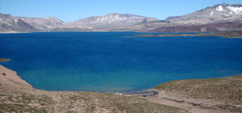
Payun Matru is located in Argentina, within the Southern Andean Volcanic Arc of the broader South America Volcanic Regions. Situated at 36.42° S, 69.24° W in the Southern Hemisphere, the volcano lies within a temperate climate zone. Standing at 3,715 meters above sea level, Payun Matru towers above the alpine zone, where vegetation gives way to bare rock, snow, and ice for much of the year. The high elevation means the upper slopes experience significantly colder temperatures than surrounding lowlands. The volcanic landform is characterized as a cluster, which describes the physical shape and structure of the volcanic edifice as observed from the surface.
Geological Context
Payun Matru sits in a subduction zone, where one tectonic plate dives beneath another, creating intense heat and pressure that generates magma. Subduction zones are responsible for many of the world's most explosive volcanoes and deadliest eruptions. For communities in Argentina near Payun Matru, this tectonic setting means the volcano is capable of producing powerful explosive eruptions, pyroclastic flows, and lahars that can threaten populated areas within tens of kilometers of the summit. The dominant rock type is trachybasalt / tephrite basanite, a dark, fine-grained volcanic rock that forms from rapidly cooling, low-viscosity lava. Basaltic eruptions tend to be less explosive and produce fluid lava flows that can travel long distances. While less immediately dangerous than explosive eruptions, basaltic lava flows can destroy structures and infrastructure in their path, and volcanic gases released during these eruptions can affect air quality over a wide area.
Eruption History Summary
Payun Matru has 1 recorded eruption in the geological database, spanning from 5050 BCE to 5050 BCE.
GVP Reference Summary
The Payún Matrú volcanic field in Argentina includes a massive hawaiian-style shield volcano that lies 530 km from the oceanic trench. The 8 x 10 km alkaline caldera of Cerro Payún Matrú was formed after about 168,000 years ago. The high point of the massif, Cerro Payen stratovolcano, was constructed on the SW flank of the shield. The Pleistocene Pampas Onduladas pahoehoe lava flow traveled 181 km, Earth's longest known Quaternary lava flow. Post-caldera basaltic eruptions produced more than 300 eruptive centers, mostly along E-W fissures that extend across the entire edifice. Fluid lava flows from a concentration of vents on the W flank known as Los Volcanes traveled more than 10 km. Other vent clusters of the 5,200 km2 volcanic field are found on the lower NE and S flanks, and a lava flow from Volcán Santa María on the NW flank traveled 15 km NE. At least 30 trachyandesitic lava domes and basaltic lava flows were erupted contemporaneously with the basaltic fissure eruptions. The Puente and Chapua volcanic units east of the main shield and south of the Ondulas flow are considered part of the field. Oral traditions note that indigenous tribes were present at the time of the latest eruption.
— Smithsonian Institution, Global Volcanism Program
1 Recorded Eruption
| Year | VEI | Type | Area |
|---|---|---|---|
| 5050 BCE | 0 | Confirmed Eruption | Escorial del Matru caldera |
Real-Time Data
Frequently Asked Questions About Payun Matru
Is Payun Matru an active volcano?+
Payun Matru is not currently classified as active. Its activity evidence is listed as "Eruption Dated." The last known eruption was in 5050 BCE. However, no volcano is ever considered permanently extinct.
When did Payun Matru last erupt?+
The most recent recorded eruption of Payun Matru occurred in 5050 BCE with a Volcanic Explosivity Index (VEI) of 0. The eruption was classified as a "Confirmed Eruption." Payun Matru has 1 recorded eruption in total.
How high is Payun Matru?+
Payun Matru has a summit elevation of 3,715 meters (12,189 feet) above sea level. At 3,715 meters, it is comparable in height to many significant mountain peaks and stands well above the tree line.
What type of volcano is Payun Matru?+
Payun Matru is classified as a Volcanic field. Volcanic fields consist of clusters of small volcanic vents and cinder cones spread across a region. Rather than a single central vent, eruptions can occur at many points across the field.
Where is Payun Matru located?+
Payun Matru is located in Argentina, in the South America Volcanic Regions. More specifically, it lies within the Southern Andean Volcanic Arc. Its exact coordinates are -36.422° latitude, -69.241° longitude.
Is it safe to visit Payun Matru?+
Payun Matru can generally be visited, but as with any volcano, visitors should check local conditions and any advisory notices before traveling. Argentina may have specific regulations for accessing volcanic areas. Guided tours are often the safest and most informative way to experience a volcano.