About Maule, Laguna del
Maule, Laguna del is a caldera rising to 2,162 meters (7,094 feet) in Chile's South America Volcanic Regions. Its last known eruption dates to 50 BCE, in prehistoric times. The volcano has produced 4 recorded eruptions.
Geography & Climate
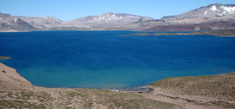
Maule, Laguna del is located in Chile, within the Southern Andean Volcanic Arc of the broader South America Volcanic Regions. Situated at 36.06° S, 70.49° W in the Southern Hemisphere, the volcano lies within a temperate climate zone. At 2,162 meters above sea level, Maule, Laguna del rises above the surrounding terrain into montane or subalpine conditions. The elevation creates distinct ecological zones along its flanks, from forested lower slopes to exposed rocky terrain near the summit. The volcanic landform is characterized as a caldera, which describes the physical shape and structure of the volcanic edifice as observed from the surface.
Geological Context
Maule, Laguna del sits in a subduction zone, where one tectonic plate dives beneath another, creating intense heat and pressure that generates magma. Subduction zones are responsible for many of the world's most explosive volcanoes and deadliest eruptions. For communities in Chile near Maule, Laguna del, this tectonic setting means the volcano is capable of producing powerful explosive eruptions, pyroclastic flows, and lahars that can threaten populated areas within tens of kilometers of the summit. The dominant rock type is andesite / basaltic andesite, a dark, fine-grained volcanic rock that forms from rapidly cooling, low-viscosity lava. Basaltic eruptions tend to be less explosive and produce fluid lava flows that can travel long distances. While less immediately dangerous than explosive eruptions, basaltic lava flows can destroy structures and infrastructure in their path, and volcanic gases released during these eruptions can affect air quality over a wide area.
Eruption History Summary
Maule, Laguna del has 4 recorded eruptions in the geological database, spanning from 4450 BCE to 50 BCE. These eruptions span roughly 4,400 years of volcanic history.
GVP Reference Summary
The Laguna del Maule volcanic complex includes a 15 x 25 km caldera with a cluster of small stratovolcanoes, lava domes, and pyroclastic cones of Pleistocene-to-Holocene age. The caldera lies mostly on the Chilean side of the border, but partially extends into Argentina. Fourteen Pleistocene basaltic lava flows were erupted down the upper part of the Maule river valley. A cluster of Pleistocene cinder cones was constructed on the NW side of Maule lake in the northern part of the caldera. The latest activity produced an explosion crater on the E side of the lake and a series of Holocene rhyolitic lava domes and blocky lava flows that surround it.
— Smithsonian Institution, Global Volcanism Program
4 Recorded Eruptions
| Year | VEI | Type | Area |
|---|---|---|---|
| 50 BCE | 0 | Confirmed Eruption | — |
| 250 BCE | 0 | Confirmed Eruption | — |
| 1550 BCE | 0 | Confirmed Eruption | — |
| 4450 BCE | 0 | Confirmed Eruption | — |
Real-Time Data
Frequently Asked Questions About Maule, Laguna del
Is Maule, Laguna del an active volcano?+
Maule, Laguna del is not currently classified as active. Its activity evidence is listed as "Eruption Dated." The last known eruption was in 50 BCE. However, no volcano is ever considered permanently extinct.
When did Maule, Laguna del last erupt?+
The most recent recorded eruption of Maule, Laguna del occurred in 50 BCE with a Volcanic Explosivity Index (VEI) of 0. The eruption was classified as a "Confirmed Eruption." Maule, Laguna del has 4 recorded eruptions in total.
How high is Maule, Laguna del?+
Maule, Laguna del has a summit elevation of 2,162 meters (7,094 feet) above sea level. At 2,162 meters, it is comparable in height to many significant mountain peaks and stands well above the tree line.
What type of volcano is Maule, Laguna del?+
Maule, Laguna del is classified as a Caldera. Calderas are large volcanic depressions formed when a volcano erupts so powerfully that its magma chamber collapses, creating a basin that can be kilometers wide. They are often sites of some of Earth's largest eruptions.
Where is Maule, Laguna del located?+
Maule, Laguna del is located in Chile, in the South America Volcanic Regions. More specifically, it lies within the Southern Andean Volcanic Arc. Its exact coordinates are -36.058° latitude, -70.492° longitude.
Is it safe to visit Maule, Laguna del?+
Maule, Laguna del can generally be visited, but as with any volcano, visitors should check local conditions and any advisory notices before traveling. Chile may have specific regulations for accessing volcanic areas. Guided tours are often the safest and most informative way to experience a volcano.


