About Azul, Cerro
Azul, Cerro is a stratovolcano rising to 3,788 meters (12,428 feet) in Chile's South America Volcanic Regions. It last erupted in 1967 CE, and volcanologists consider it an active volcanic system. The volcano has produced 11 recorded eruptions, with a maximum Volcanic Explosivity Index (VEI) of 5.
Geography & Climate
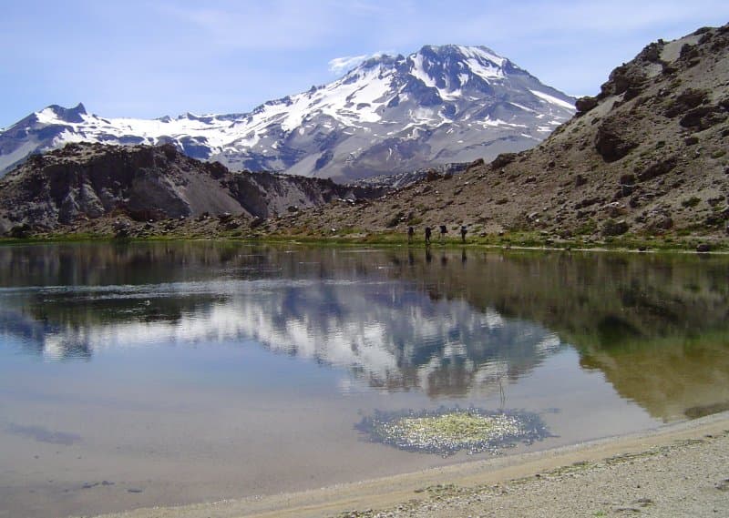
Azul, Cerro is located in Chile, within the Southern Andean Volcanic Arc of the broader South America Volcanic Regions. Situated at 35.65° S, 70.76° W in the Southern Hemisphere, the volcano lies within a temperate climate zone. Standing at 3,788 meters above sea level, Azul, Cerro towers above the alpine zone, where vegetation gives way to bare rock, snow, and ice for much of the year. The high elevation means the upper slopes experience significantly colder temperatures than surrounding lowlands. The volcanic landform is characterized as a composite, which describes the physical shape and structure of the volcanic edifice as observed from the surface.
Geological Context
Azul, Cerro sits in a subduction zone, where one tectonic plate dives beneath another, creating intense heat and pressure that generates magma. Subduction zones are responsible for many of the world's most explosive volcanoes and deadliest eruptions. For communities in Chile near Azul, Cerro, this tectonic setting means the volcano is capable of producing powerful explosive eruptions, pyroclastic flows, and lahars that can threaten populated areas within tens of kilometers of the summit. The dominant rock type is dacite, an intermediate to silica-rich volcanic rock. This composition typically produces more viscous magma, leading to more explosive eruptions with ash columns and pyroclastic flows. Andesitic and dacitic magmas build pressure before erupting, which is why volcanoes with this rock chemistry are often associated with Plinian-style eruptions that can send ash tens of kilometers into the atmosphere and disrupt aviation across entire regions.
Eruption History Summary
Azul, Cerro has 11 recorded eruptions in the geological database, spanning from 1846 CE to 1967 CE. The most powerful recorded event was a paroxysmal eruption with devastating regional consequences in 1916 CE, reaching VEI 5 on the Volcanic Explosivity Index. Notable eruptions include 1916 CE (VEI 5), 1914 CE (VEI 3). This level of eruptive frequency indicates a persistently active volcanic system that warrants ongoing monitoring. The most recent eruption in 1967 CE places this volcano within the modern era of volcanological observation.
Significance
With a maximum recorded VEI of 5, Azul, Cerro has demonstrated the capacity for paroxysmal eruptions comparable to the 1980 eruption of Mount St. Helens. Eruptions of this scale can devastate areas within 20-30 kilometers and produce ash fall that disrupts aviation and agriculture across hundreds of kilometers. With 11 recorded eruptions, Azul, Cerro has a substantial eruptive history that provides valuable data for understanding volcanic behavior and assessing future hazards in the South America Volcanic Regions region. Given its recent activity, Azul, Cerro is closely monitored by geological survey organizations to provide early warning of future unrest.
GVP Reference Summary
The Cerro Azul stratovolcano is at the southern end of the Descabezado Grande-Cerro Azul eruptive system. It is a steep-sided edifice with a 500-m-wide summit crater open to the north. The three basaltic andesite "La Resoloma Craters" scoria vents are located below the W flank and the two "Los Hornitos" scoria cones on the lower SW flank. Quizapu, a major vent on the northern flank of Cerro Azul, formed in 1846 during the first historical eruption, accompanied by the emission of voluminous dacitic lava flows that traveled both east into the Estero Barroso valley and west into the Río Blanquillo valley. Quizapu was later the source of one of the world's largest explosive eruptions of the 20th century in 1932, which created a 600-700 m wide, 150-m-deep crater and ejected 9.5 km3 of dacitic tephra.
— Smithsonian Institution, Global Volcanism Program
11 Recorded Eruptions
| Year | VEI | Type | Area |
|---|---|---|---|
| 1967 | 2 | Confirmed Eruption | Quizapu |
| 1949 | 2 | Confirmed Eruption | Quizapu |
| 1933 | 2 | Confirmed Eruption | Quizapu |
| 1916 | 5 | Confirmed Eruption | Quizapu |
| 1914 | 3 | Confirmed Eruption | Quizapu |
| 1913 | 2 | Uncertain Eruption | Quizapu |
| 1912 | 2 | Confirmed Eruption | Quizapu |
| 1907 | 2 | Confirmed Eruption | Quizapu |
| 1906 | 2 | Confirmed Eruption | Quizapu |
| 1903 | 2 | Uncertain Eruption | Quizapu |
| 1846 | 2 | Confirmed Eruption | Quizapu |
Real-Time Data
Frequently Asked Questions About Azul, Cerro
Is Azul, Cerro an active volcano?+
Yes, Azul, Cerro is considered an active volcano. Its most recent eruption was in 1967 CE. The volcano is monitored by geological agencies, and its activity status is based on observed eruptions within recorded history.
When did Azul, Cerro last erupt?+
The most recent recorded eruption of Azul, Cerro occurred in 1967 CE with a Volcanic Explosivity Index (VEI) of 2. The eruption was classified as a "Confirmed Eruption." Azul, Cerro has 11 recorded eruptions in total.
How high is Azul, Cerro?+
Azul, Cerro has a summit elevation of 3,788 meters (12,428 feet) above sea level. At 3,788 meters, it is comparable in height to many significant mountain peaks and stands well above the tree line.
What type of volcano is Azul, Cerro?+
Azul, Cerro is classified as a Stratovolcano. Stratovolcanoes (also called composite volcanoes) are steep, conical volcanoes built up by many layers of hardened lava, tephra, and volcanic ash. They are among the most common and dangerous types, known for explosive eruptions.
Where is Azul, Cerro located?+
Azul, Cerro is located in Chile, in the South America Volcanic Regions. More specifically, it lies within the Southern Andean Volcanic Arc. Its exact coordinates are -35.653° latitude, -70.761° longitude.
Is it safe to visit Azul, Cerro?+
Visiting Azul, Cerro requires checking current volcanic activity and alert levels. As an active volcano with eruptions as recent as 1967 CE, conditions can change rapidly. Always consult local geological authorities and follow official warnings before visiting. Many active volcanoes have designated safe viewing areas and guided tour options.