About Calabozos
Calabozos is a caldera rising to 3,508 meters (11,510 feet) in Chile's South America Volcanic Regions. No historical eruptions have been recorded, though the volcano is classified based on geological evidence of past activity.
Geography & Climate
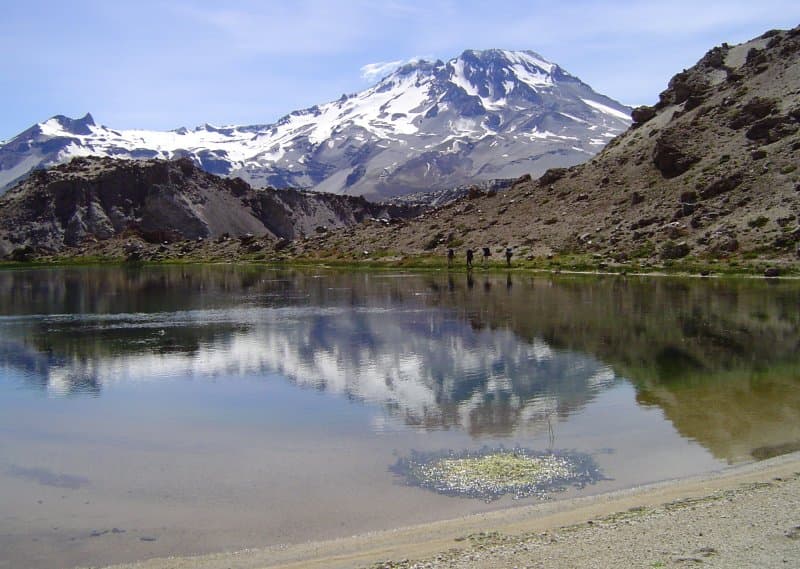
Calabozos is located in Chile, within the Southern Andean Volcanic Arc of the broader South America Volcanic Regions. Situated at 35.56° S, 70.50° W in the Southern Hemisphere, the volcano lies within a temperate climate zone. Standing at 3,508 meters above sea level, Calabozos towers above the alpine zone, where vegetation gives way to bare rock, snow, and ice for much of the year. The high elevation means the upper slopes experience significantly colder temperatures than surrounding lowlands. The volcanic landform is characterized as a composite, which describes the physical shape and structure of the volcanic edifice as observed from the surface.
Geological Context
Calabozos sits in a subduction zone, where one tectonic plate dives beneath another, creating intense heat and pressure that generates magma. Subduction zones are responsible for many of the world's most explosive volcanoes and deadliest eruptions. For communities in Chile near Calabozos, this tectonic setting means the volcano is capable of producing powerful explosive eruptions, pyroclastic flows, and lahars that can threaten populated areas within tens of kilometers of the summit. The dominant rock type is dacite, an intermediate to silica-rich volcanic rock. This composition typically produces more viscous magma, leading to more explosive eruptions with ash columns and pyroclastic flows. Andesitic and dacitic magmas build pressure before erupting, which is why volcanoes with this rock chemistry are often associated with Plinian-style eruptions that can send ash tens of kilometers into the atmosphere and disrupt aviation across entire regions.
GVP Reference Summary
The composite late-Pleistocene Calabozos caldera (14 x 26 km) produced major rhyodacitic-to-dacitic ashflow sheets of ~200-500 km3 each, collectively referred to as the Loma Seca Tuff, at 800,000, 300,000, and 150,000 years ago. Eruptive activity has continued into the Holocene, forming the 20-25 km3 and the four clustered vents of Descabezado Chico near the western caldera rim. The late-Holocene 2.5 km3 Escorias dacitic lava flow from Descabezado Chico traveled more than 30 km S. Several hot-spring clusters are present along the margin of the central resurgent uplift within the caldera.
— Smithsonian Institution, Global Volcanism Program
0 Recorded Eruptions
No eruption records available for Calabozos.
Real-Time Data
Frequently Asked Questions About Calabozos
Is Calabozos an active volcano?+
Calabozos is classified as active based on credible evidence of past eruptions. Although its last known eruption was in prehistoric times, volcanologists consider it capable of erupting again.
How high is Calabozos?+
Calabozos has a summit elevation of 3,508 meters (11,510 feet) above sea level. At 3,508 meters, it is comparable in height to many significant mountain peaks and stands well above the tree line.
What type of volcano is Calabozos?+
Calabozos is classified as a Caldera. Calderas are large volcanic depressions formed when a volcano erupts so powerfully that its magma chamber collapses, creating a basin that can be kilometers wide. They are often sites of some of Earth's largest eruptions.
Where is Calabozos located?+
Calabozos is located in Chile, in the South America Volcanic Regions. More specifically, it lies within the Southern Andean Volcanic Arc. Its exact coordinates are -35.558° latitude, -70.496° longitude.
Is it safe to visit Calabozos?+
Calabozos can generally be visited, but as with any volcano, visitors should check local conditions and any advisory notices before traveling. Chile may have specific regulations for accessing volcanic areas. Guided tours are often the safest and most informative way to experience a volcano.