About Descabezado Grande
Descabezado Grande is a stratovolcano(es) rising to 3,953 meters (12,970 feet) in Chile's South America Volcanic Regions. It last erupted in 1933 CE, and volcanologists consider it an active volcanic system. The volcano has produced 1 recorded eruption, with a maximum Volcanic Explosivity Index (VEI) of 3.
Geography & Climate
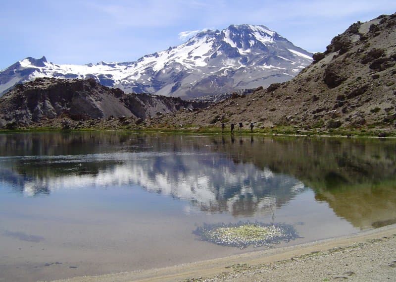
Descabezado Grande is located in Chile, within the Southern Andean Volcanic Arc of the broader South America Volcanic Regions. Situated at 35.58° S, 70.75° W in the Southern Hemisphere, the volcano lies within a temperate climate zone. Standing at 3,953 meters above sea level, Descabezado Grande towers above the alpine zone, where vegetation gives way to bare rock, snow, and ice for much of the year. The high elevation means the upper slopes experience significantly colder temperatures than surrounding lowlands. The volcanic landform is characterized as a composite, which describes the physical shape and structure of the volcanic edifice as observed from the surface.
Geological Context
Descabezado Grande sits in a subduction zone, where one tectonic plate dives beneath another, creating intense heat and pressure that generates magma. Subduction zones are responsible for many of the world's most explosive volcanoes and deadliest eruptions. For communities in Chile near Descabezado Grande, this tectonic setting means the volcano is capable of producing powerful explosive eruptions, pyroclastic flows, and lahars that can threaten populated areas within tens of kilometers of the summit. The dominant rock type is andesite / basaltic andesite, a dark, fine-grained volcanic rock that forms from rapidly cooling, low-viscosity lava. Basaltic eruptions tend to be less explosive and produce fluid lava flows that can travel long distances. While less immediately dangerous than explosive eruptions, basaltic lava flows can destroy structures and infrastructure in their path, and volcanic gases released during these eruptions can affect air quality over a wide area.
Eruption History Summary
Descabezado Grande has 1 recorded eruption in the geological database, spanning from 1932 CE to 1932 CE. The most powerful recorded event was a severe eruption capable of regional ash fall and pyroclastic flows in 1932 CE, reaching VEI 3 on the Volcanic Explosivity Index. The most recent eruption in 1932 CE places this volcano within the modern era of volcanological observation.
Significance
With a maximum recorded VEI of 3, Descabezado Grande has produced eruptions capable of generating pyroclastic flows and significant ash fall in the surrounding area. While not among the largest eruptions globally, VEI 3 events pose serious hazards to local populations and can disrupt regional air travel.
GVP Reference Summary
Volcán Descabezado Grande is a late-Pleistocene to Holocene andesitic-to-rhyodacitic stratovolcano with a 1.4-km-wide ice-filled summit crater. It lies at the center of a 20 x 30 km volcanic complex, 7 km N of the Cerro Azul stratovolcano. A lateral crater, which formed on the upper NNE flank in 1932 shortly after the end of the major 1932 eruption from nearby Quizapu cone on the N flank of Cerro Azul, was the site of the only recorded eruption. The Holocene Alto de las Mulas fissure on the lower NW flank produced young rhyodacitic lava flows. Numerous small late-Pleistocene to Holocene volcanic centers are located N of the volcano. The northernmost of these, Lengua de Vulcano (or Mondaca), produced a very youthful rhyodacitic lava flow that dammed the Río Lentué.
— Smithsonian Institution, Global Volcanism Program
1 Recorded Eruption
| Year | VEI | Type | Area |
|---|---|---|---|
| 1932 | 3 | Confirmed Eruption | Upper NNE slope |
Real-Time Data
Frequently Asked Questions About Descabezado Grande
Is Descabezado Grande an active volcano?+
Yes, Descabezado Grande is considered an active volcano. Its most recent eruption was in 1933 CE. The volcano is monitored by geological agencies, and its activity status is based on observed eruptions within recorded history.
When did Descabezado Grande last erupt?+
The most recent recorded eruption of Descabezado Grande occurred in 1932 CE with a Volcanic Explosivity Index (VEI) of 3. The eruption was classified as a "Confirmed Eruption." Descabezado Grande has 1 recorded eruption in total.
How high is Descabezado Grande?+
Descabezado Grande has a summit elevation of 3,953 meters (12,970 feet) above sea level. At 3,953 meters, it is comparable in height to many significant mountain peaks and stands well above the tree line.
What type of volcano is Descabezado Grande?+
Descabezado Grande is classified as a Stratovolcano(es). Stratovolcano(es) volcanoes have distinct geological characteristics that set them apart from other volcanic types.
Where is Descabezado Grande located?+
Descabezado Grande is located in Chile, in the South America Volcanic Regions. More specifically, it lies within the Southern Andean Volcanic Arc. Its exact coordinates are -35.580° latitude, -70.750° longitude.
Is it safe to visit Descabezado Grande?+
Visiting Descabezado Grande requires checking current volcanic activity and alert levels. As an active volcano with eruptions as recent as 1933 CE, conditions can change rapidly. Always consult local geological authorities and follow official warnings before visiting. Many active volcanoes have designated safe viewing areas and guided tour options.


