About Tutupaca
Tutupaca is a stratovolcano(es) rising to 5,801 meters (19,033 feet) in Peru's South America Volcanic Regions. Its last known eruption was in 1802 CE. The volcano has produced 5 recorded eruptions, with a maximum Volcanic Explosivity Index (VEI) of 4.
Geography & Climate
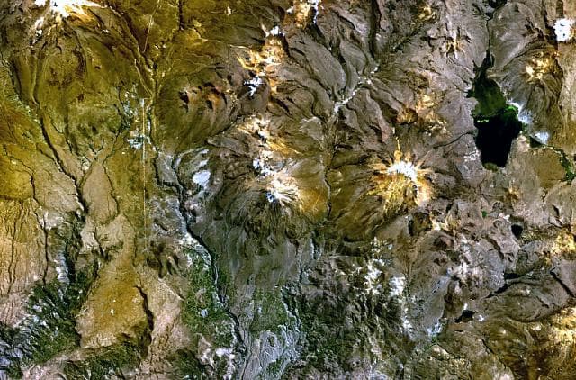
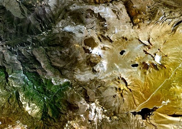
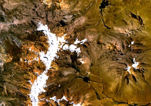
Tutupaca is located in Peru, within the Central Andean Volcanic Arc of the broader South America Volcanic Regions. Situated at 17.03° S, 70.37° W in the Southern Hemisphere, the volcano lies within a tropical climate zone. At 5,801 meters above sea level, Tutupaca reaches well into the permanent snow and ice zone. Glaciers and snowpack on the upper slopes create the potential for lahars — destructive volcanic mudflows — during eruptions, as heat rapidly melts ice and snow. The volcanic landform is characterized as a composite, which describes the physical shape and structure of the volcanic edifice as observed from the surface.
Geological Context
Tutupaca sits in a subduction zone, where one tectonic plate dives beneath another, creating intense heat and pressure that generates magma. Subduction zones are responsible for many of the world's most explosive volcanoes and deadliest eruptions. For communities in Peru near Tutupaca, this tectonic setting means the volcano is capable of producing powerful explosive eruptions, pyroclastic flows, and lahars that can threaten populated areas within tens of kilometers of the summit. The dominant rock type is andesite / basaltic andesite, a dark, fine-grained volcanic rock that forms from rapidly cooling, low-viscosity lava. Basaltic eruptions tend to be less explosive and produce fluid lava flows that can travel long distances. While less immediately dangerous than explosive eruptions, basaltic lava flows can destroy structures and infrastructure in their path, and volcanic gases released during these eruptions can affect air quality over a wide area.
Eruption History Summary
Tutupaca has 5 recorded eruptions in the geological database, spanning from 1780 CE to 1902 CE. The most powerful recorded event was a cataclysmic eruption with ash columns reaching the stratosphere in 1802 CE, reaching VEI 4 on the Volcanic Explosivity Index. This eruption frequency indicates a moderately active volcanic system with periodic reawakenings. The most recent eruption in 1902 CE places this volcano within the modern era of volcanological observation.
Significance
With a maximum recorded VEI of 4, Tutupaca has demonstrated the capacity for significant explosive eruptions that can impact regional aviation, agriculture, and communities tens of kilometers from the summit. VEI 4 eruptions produce ash columns reaching 15-25 kilometers into the atmosphere. With 5 recorded eruptions on file, Tutupaca has enough documented activity to help scientists identify patterns in its eruptive behavior.
GVP Reference Summary
Tutupaca consists of two dissected volcanic edifices, of which the southern appears more youthful. Collapse of the northern edifice produced a debris avalanche that traveled 7 km N. Postglacial lava flows are present, the largest of which originated from the saddle between the two edifices. Solfataric activity was noted in the Catalog of Active Volcanoes of the World. Based on morphological evidence, de Silva and Francis (1990) suggested that reported historical eruptions in the 18th and 19th centuries (listed in the Catalog of Active Volcanoes of the World) more likely originated from the more youthful-looking Yucamane volcano. Work by Samaniego et al. (2015) showed that activity in 1787-89 and 1802 CE originated at Tutupaca, and they considered the 1780, 1862, and 1902 reports to be valid as well.
— Smithsonian Institution, Global Volcanism Program
5 Recorded Eruptions
| Year | VEI | Type | Area |
|---|---|---|---|
| 1902 | 2 | Uncertain Eruption | Volcano Uncertain: reported from Tutupaca |
| 1862 | 2 | Uncertain Eruption | Volcano Uncertain: reported from Tutupaca |
| 1802 | 4 | Confirmed Eruption | — |
| 1787 | 2 | Confirmed Eruption | — |
| 1780 | 2 | Uncertain Eruption | Volcano Uncertain: reported from Tutupaca |
Real-Time Data
Frequently Asked Questions About Tutupaca
Is Tutupaca an active volcano?+
Tutupaca is classified as active based on credible evidence of past eruptions. Although its last known eruption was in 1802 CE, volcanologists consider it capable of erupting again.
When did Tutupaca last erupt?+
The most recent recorded eruption of Tutupaca occurred in 1902 CE with a Volcanic Explosivity Index (VEI) of 2. The eruption was classified as a "Uncertain Eruption." Tutupaca has 5 recorded eruptions in total.
How high is Tutupaca?+
Tutupaca has a summit elevation of 5,801 meters (19,033 feet) above sea level. At 5,801 meters, it stands taller than Mount Rainier (4,392m) and is among the world's major volcanic peaks.
What type of volcano is Tutupaca?+
Tutupaca is classified as a Stratovolcano(es). Stratovolcano(es) volcanoes have distinct geological characteristics that set them apart from other volcanic types.
Where is Tutupaca located?+
Tutupaca is located in Peru, in the South America Volcanic Regions. More specifically, it lies within the Central Andean Volcanic Arc. Its exact coordinates are -17.026° latitude, -70.372° longitude.
Is it safe to visit Tutupaca?+
Tutupaca can generally be visited, but as with any volcano, visitors should check local conditions and any advisory notices before traveling. Peru may have specific regulations for accessing volcanic areas. Guided tours are often the safest and most informative way to experience a volcano.