About Negra, Sierra
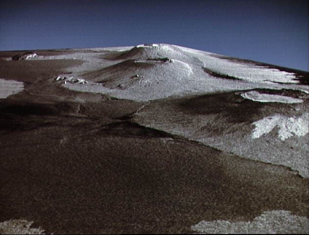
Negra, Sierra is a shield rising to 1,124 meters (3,688 feet) in Ecuador's Eastern Pacific Volcanic Regions. It has been active in recent decades, with its last eruption in 2018 CE. The volcano has produced 18 recorded eruptions, with a maximum Volcanic Explosivity Index (VEI) of 3.
Geography & Climate
Negra, Sierra is located in Ecuador, within the Galapagos Hotspot Volcano Group of the broader Eastern Pacific Volcanic Regions. Situated at 0.83° S, 91.17° W in the Southern Hemisphere, the volcano lies within a tropical climate zone. With a summit elevation of 1,124 meters above sea level, Negra, Sierra is a moderately sized peak that remains accessible to hikers and researchers for much of the year. The volcanic landform is characterized as a shield, which describes the physical shape and structure of the volcanic edifice as observed from the surface.
Geological Context
Negra, Sierra is situated along a rift zone, where tectonic plates are pulling apart. As the crust thins and fractures, magma rises to fill the gap, creating volcanic activity. Rift volcanism typically produces more fluid lava flows rather than explosive blasts, which means communities near Negra, Sierra in Ecuador generally face slower-moving hazards like lava flows and ground fissures rather than sudden pyroclastic events. However, rift volcanoes can still generate significant ash emissions and gas releases that affect local air quality. The dominant rock type is basalt / picro-basalt, a dark, fine-grained volcanic rock that forms from rapidly cooling, low-viscosity lava. Basaltic eruptions tend to be less explosive and produce fluid lava flows that can travel long distances. While less immediately dangerous than explosive eruptions, basaltic lava flows can destroy structures and infrastructure in their path, and volcanic gases released during these eruptions can affect air quality over a wide area.
Eruption History Summary
Negra, Sierra has 18 recorded eruptions in the geological database, spanning from 8250 BCE to 2018 CE. The most powerful recorded event was a severe eruption capable of regional ash fall and pyroclastic flows in 2005 CE, reaching VEI 3 on the Volcanic Explosivity Index. Notable eruptions include 2005 CE (VEI 3), 1979 CE (VEI 3), 1953 CE (VEI 3). This level of eruptive frequency indicates a persistently active volcanic system that warrants ongoing monitoring. With eruptive activity as recently as 2018 CE, Negra, Sierra remains an actively monitored volcano.
Significance
With a maximum recorded VEI of 3, Negra, Sierra has produced eruptions capable of generating pyroclastic flows and significant ash fall in the surrounding area. While not among the largest eruptions globally, VEI 3 events pose serious hazards to local populations and can disrupt regional air travel. With 18 recorded eruptions, Negra, Sierra has a substantial eruptive history that provides valuable data for understanding volcanic behavior and assessing future hazards in the Eastern Pacific Volcanic Regions region. Given its recent activity, Negra, Sierra is closely monitored by geological survey organizations to provide early warning of future unrest.
GVP Reference Summary
The broad shield volcano of Sierra Negra at the southern end of Isabela Island contains a shallow 7 x 10.5 km caldera that is the largest in the Galápagos Islands. Flank vents abound, including cinder cones and spatter cones concentrated along an ENE-trending rift system and tuff cones along the coast and forming offshore islands. Although it is the largest of the five major Isabela volcanoes, it has the flattest slopes, averaging less than 5° and diminishing to 2° near the coast. A sinuous 14-km-long, N-S-trending ridge occupies the west part of the caldera floor, which lies only about 100 m below its rim. The Volcán de Azufre fumarolic area lies within a graben between this ridge and the west caldera wall. Lava flows from a major eruption in 1979 extend all the way to the north coast from circumferential fissure vents on the upper northern flank.
— Smithsonian Institution, Global Volcanism Program
18 Recorded Eruptions
| Year | VEI | Type | Area |
|---|---|---|---|
| 2018 | 2 | Confirmed Eruption | Summit crater and NNW flank, Volcan Chico fissure vent |
| 2005 | 3 | Confirmed Eruption | North caldera rim |
| 1979 | 3 | Confirmed Eruption | Upper NW and NE flanks (Volcán Chico) |
| 1963 | 2 | Confirmed Eruption | Volcán Chico area & NW caldera rim |
| 1957 | — | Confirmed Eruption | Volcano Uncertain: Isabela Island |
| 1954 | 2 | Confirmed Eruption | Volcano Uncertain: originally Alcedo |
| 1953 | 3 | Confirmed Eruption | Volcán Chico area & NW caldera rim |
| 1948 | 2 | Confirmed Eruption | — |
| 1911 | — | Confirmed Eruption | — |
| 1860 | 2 | Confirmed Eruption | Volcano Uncertain: Isabela Island |
| 1844 | 0 | Confirmed Eruption | Volcano Uncertain: Isabela Island |
| 1817 | — | Confirmed Eruption | Volcano Uncertain: Isabela Island |
| 1813 | 2 | Confirmed Eruption | Volcano Uncertain: South end of Isabela Island |
| 1350 | 0 | Confirmed Eruption | — |
| 1060 | 0 | Confirmed Eruption | — |
| 370 | 0 | Confirmed Eruption | — |
| 1250 BCE | 0 | Confirmed Eruption | SE flank |
| 8250 BCE | 0 | Confirmed Eruption | — |
Real-Time Data
Frequently Asked Questions About Negra, Sierra
Is Negra, Sierra an active volcano?+
Yes, Negra, Sierra is considered an active volcano. Its most recent eruption was in 2018 CE. The volcano is monitored by geological agencies, and its activity status is based on observed eruptions within recorded history.
When did Negra, Sierra last erupt?+
The most recent recorded eruption of Negra, Sierra occurred in 2018 CE with a Volcanic Explosivity Index (VEI) of 2. The eruption was classified as a "Confirmed Eruption." Negra, Sierra has 18 recorded eruptions in total.
How high is Negra, Sierra?+
Negra, Sierra has a summit elevation of 1,124 meters (3,688 feet) above sea level. At 1,124 meters, it is a moderately sized volcanic peak, roughly comparable to Mount Vesuvius (1,281m).
What type of volcano is Negra, Sierra?+
Negra, Sierra is classified as a Shield. Shield volcanoes have distinct geological characteristics that set them apart from other volcanic types.
Where is Negra, Sierra located?+
Negra, Sierra is located in Ecuador, in the Eastern Pacific Volcanic Regions. More specifically, it lies within the Galapagos Hotspot Volcano Group. Its exact coordinates are -0.830° latitude, -91.170° longitude.
Is it safe to visit Negra, Sierra?+
Visiting Negra, Sierra requires checking current volcanic activity and alert levels. As an active volcano with eruptions as recent as 2018 CE, conditions can change rapidly. Always consult local geological authorities and follow official warnings before visiting. Many active volcanoes have designated safe viewing areas and guided tour options.