About Quilotoa
Quilotoa is a caldera rising to 3,914 meters (12,842 feet) in Ecuador's South America Volcanic Regions. Its last known eruption was in 1280 CE. The volcano has produced 5 recorded eruptions, with a maximum Volcanic Explosivity Index (VEI) of 6.
Geography & Climate
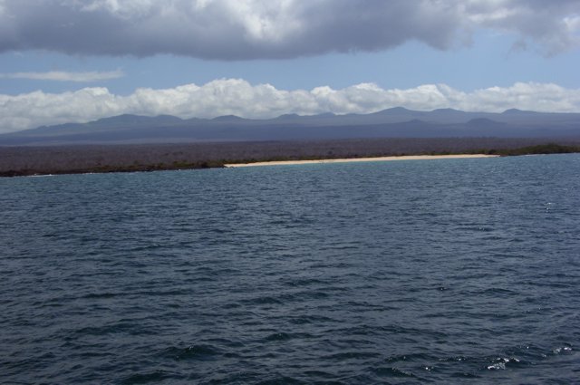
Quilotoa is located in Ecuador, within the Northern Andean Volcanic Arc of the broader South America Volcanic Regions. Situated at 0.86° S, 78.90° W in the Southern Hemisphere, the volcano lies within a tropical climate zone. Standing at 3,914 meters above sea level, Quilotoa towers above the alpine zone, where vegetation gives way to bare rock, snow, and ice for much of the year. The high elevation means the upper slopes experience significantly colder temperatures than surrounding lowlands. The volcanic landform is characterized as a caldera, which describes the physical shape and structure of the volcanic edifice as observed from the surface.
Geological Context
Quilotoa sits in a subduction zone, where one tectonic plate dives beneath another, creating intense heat and pressure that generates magma. Subduction zones are responsible for many of the world's most explosive volcanoes and deadliest eruptions. For communities in Ecuador near Quilotoa, this tectonic setting means the volcano is capable of producing powerful explosive eruptions, pyroclastic flows, and lahars that can threaten populated areas within tens of kilometers of the summit. The dominant rock type is dacite, an intermediate to silica-rich volcanic rock. This composition typically produces more viscous magma, leading to more explosive eruptions with ash columns and pyroclastic flows. Andesitic and dacitic magmas build pressure before erupting, which is why volcanoes with this rock chemistry are often associated with Plinian-style eruptions that can send ash tens of kilometers into the atmosphere and disrupt aviation across entire regions.
Eruption History Summary
Quilotoa has 5 recorded eruptions in the geological database, spanning from 1280 CE to 1797 CE. The most powerful recorded event was a colossal eruption capable of affecting global climate for years in 1280 CE, reaching VEI 6 on the Volcanic Explosivity Index. This eruption frequency indicates a moderately active volcanic system with periodic reawakenings.
Significance
Quilotoa has produced at least one eruption of VEI 6 or higher, placing it among the most powerful volcanic systems on Earth. Eruptions of this magnitude inject massive quantities of sulfur dioxide into the stratosphere, affecting global climate by lowering average temperatures for one to three years after the event. With 5 recorded eruptions on file, Quilotoa has enough documented activity to help scientists identify patterns in its eruptive behavior.
GVP Reference Summary
Quilotoa is a truncated, dacitic cone in the Western Cordillera of Ecuador, 35 km WNW of the city of Latacunga, that contains a 3-km-wide caldera with steep-sided walls that rise 400 m above the surface of 240-m-deep caldera lake. Multiple lava domes are present along the caldera's perimeter. This small volcano has produced eight major explosive eruptions during the past 200,000 years. Its most recent major eruption about 800 radiocarbon years ago produced voluminous pyroclastic flows, lahars that reached the Pacific Ocean, and one of the largest airfall-tephra deposits of the northern Andes. Formation of the caldera was followed by extrusion of a small lava dome. Reports of observed eruptions from the caldera lake are somewhat ambiguous. Fumaroles are present on the lake floor and hot springs occur on the E flank.
— Smithsonian Institution, Global Volcanism Program
5 Recorded Eruptions
| Year | VEI | Type | Area |
|---|---|---|---|
| 1797 | — | Uncertain Eruption | — |
| 1759 | 2 | Uncertain Eruption | — |
| 1740 | 2 | Uncertain Eruption | — |
| 1725 | 2 | Uncertain Eruption | — |
| 1280 | 6 | Confirmed Eruption | — |
Real-Time Data
Frequently Asked Questions About Quilotoa
Is Quilotoa an active volcano?+
Quilotoa is not currently classified as active. Its activity evidence is listed as "Eruption Dated." The last known eruption was in 1280 CE. However, no volcano is ever considered permanently extinct.
When did Quilotoa last erupt?+
The most recent recorded eruption of Quilotoa occurred in 1797 CE. The eruption was classified as a "Uncertain Eruption." Quilotoa has 5 recorded eruptions in total.
How high is Quilotoa?+
Quilotoa has a summit elevation of 3,914 meters (12,842 feet) above sea level. At 3,914 meters, it is comparable in height to many significant mountain peaks and stands well above the tree line.
What type of volcano is Quilotoa?+
Quilotoa is classified as a Caldera. Calderas are large volcanic depressions formed when a volcano erupts so powerfully that its magma chamber collapses, creating a basin that can be kilometers wide. They are often sites of some of Earth's largest eruptions.
Where is Quilotoa located?+
Quilotoa is located in Ecuador, in the South America Volcanic Regions. More specifically, it lies within the Northern Andean Volcanic Arc. Its exact coordinates are -0.859° latitude, -78.904° longitude.
Is it safe to visit Quilotoa?+
Quilotoa can generally be visited, but as with any volcano, visitors should check local conditions and any advisory notices before traveling. Ecuador may have specific regulations for accessing volcanic areas. Guided tours are often the safest and most informative way to experience a volcano.