About Cotopaxi
Cotopaxi is a stratovolcano rising to 5,911 meters (19,394 feet) in Ecuador's South America Volcanic Regions. The volcano is currently active, with its most recent eruption in 2023 CE. The volcano has produced 20 recorded eruptions, with a maximum Volcanic Explosivity Index (VEI) of 3.
Geography & Climate
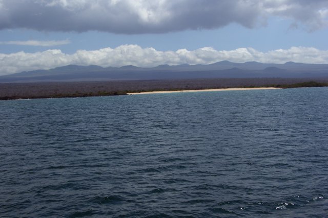
Cotopaxi is located in Ecuador, within the Northern Andean Volcanic Arc of the broader South America Volcanic Regions. Situated at 0.68° S, 78.44° W in the Southern Hemisphere, the volcano lies within a tropical climate zone. At 5,911 meters above sea level, Cotopaxi reaches well into the permanent snow and ice zone. Glaciers and snowpack on the upper slopes create the potential for lahars — destructive volcanic mudflows — during eruptions, as heat rapidly melts ice and snow. The volcanic landform is characterized as a composite, which describes the physical shape and structure of the volcanic edifice as observed from the surface.
Geological Context
Cotopaxi sits in a subduction zone, where one tectonic plate dives beneath another, creating intense heat and pressure that generates magma. Subduction zones are responsible for many of the world's most explosive volcanoes and deadliest eruptions. For communities in Ecuador near Cotopaxi, this tectonic setting means the volcano is capable of producing powerful explosive eruptions, pyroclastic flows, and lahars that can threaten populated areas within tens of kilometers of the summit. The dominant rock type is andesite / basaltic andesite, a dark, fine-grained volcanic rock that forms from rapidly cooling, low-viscosity lava. Basaltic eruptions tend to be less explosive and produce fluid lava flows that can travel long distances. While less immediately dangerous than explosive eruptions, basaltic lava flows can destroy structures and infrastructure in their path, and volcanic gases released during these eruptions can affect air quality over a wide area.
Eruption History Summary
Cotopaxi has 20 recorded eruptions in the geological database, spanning from 1880 CE to 2022 CE. The most powerful recorded event was a severe eruption capable of regional ash fall and pyroclastic flows in 1942 CE, reaching VEI 3 on the Volcanic Explosivity Index. Notable eruptions include 1903 CE (VEI 3), 1880 CE (VEI 3). With an average interval of roughly 7 years between eruptions over a span of 142 years, this is one of the more frequently active volcanoes in the database. This persistent activity suggests a robust and well-supplied magma system beneath the volcano. With eruptive activity as recently as 2022 CE, Cotopaxi remains an actively monitored volcano.
Significance
With a maximum recorded VEI of 3, Cotopaxi has produced eruptions capable of generating pyroclastic flows and significant ash fall in the surrounding area. While not among the largest eruptions globally, VEI 3 events pose serious hazards to local populations and can disrupt regional air travel. Its 20 recorded eruptions make it one of the most prolific volcanoes in our database, reflecting a persistent and well-documented eruptive history that has provided volcanologists with extensive data for understanding eruption patterns and forecasting future activity. Given its recent activity, Cotopaxi is closely monitored by geological survey organizations to provide early warning of future unrest.
GVP Reference Summary
The symmetrical, glacier-covered, Cotopaxi stratovolcano is Ecuador's most well-known volcano and one of its most active. The steep-sided cone is capped by nested summit craters, the largest of which is about 550 x 800 m in diameter. Deep valleys scoured by lahars radiate from the summit of the andesitic volcano, and large andesitic lava flows extend to its base. The modern edifice has been constructed since a major collapse sometime prior to about 5,000 years ago. Pyroclastic flows (often confused in historical accounts with lava flows) have accompanied many explosive eruptions, and lahars have frequently devastated adjacent valleys. Strong eruptions took place in 1744, 1768, and 1877. Pyroclastic flows descended all sides of the volcano in 1877, and lahars traveled more than 100 km into the Pacific Ocean and western Amazon basin. Smaller eruptions have been frequent since that time.
— Smithsonian Institution, Global Volcanism Program
20 Recorded Eruptions
| Year | VEI | Type | Area |
|---|---|---|---|
| 2022 | 2 | Confirmed Eruption | Summit crater |
| 2015 | 2 | Confirmed Eruption | Summit crater |
| 1942 | 3 | Uncertain Eruption | — |
| 1940 | 2 | Confirmed Eruption | — |
| 1939 | 2 | Confirmed Eruption | — |
| 1931 | 2 | Confirmed Eruption | — |
| 1926 | 2 | Confirmed Eruption | — |
| 1922 | 2 | Confirmed Eruption | — |
| 1908 | 1 | Confirmed Eruption | — |
| 1907 | 2 | Confirmed Eruption | — |
| 1906 | 2 | Confirmed Eruption | — |
| 1905 | 2 | Confirmed Eruption | — |
| 1903 | 3 | Confirmed Eruption | — |
| 1895 | 2 | Confirmed Eruption | — |
| 1886 | 2 | Confirmed Eruption | — |
| 1885 | 2 | Confirmed Eruption | — |
| 1883 | 2 | Confirmed Eruption | — |
| 1883 | 2 | Confirmed Eruption | — |
| 1882 | 2 | Confirmed Eruption | — |
| 1880 | 3 | Confirmed Eruption | — |
Real-Time Data
Frequently Asked Questions About Cotopaxi
Is Cotopaxi an active volcano?+
Yes, Cotopaxi is considered an active volcano. Its most recent eruption was in 2023 CE. The volcano is monitored by geological agencies, and its activity status is based on observed eruptions within recorded history.
When did Cotopaxi last erupt?+
The most recent recorded eruption of Cotopaxi occurred in 2022 CE with a Volcanic Explosivity Index (VEI) of 2. The eruption was classified as a "Confirmed Eruption." Cotopaxi has 20 recorded eruptions in total.
How high is Cotopaxi?+
Cotopaxi has a summit elevation of 5,911 meters (19,394 feet) above sea level. At 5,911 meters, it stands taller than Mount Rainier (4,392m) and is among the world's major volcanic peaks.
What type of volcano is Cotopaxi?+
Cotopaxi is classified as a Stratovolcano. Stratovolcanoes (also called composite volcanoes) are steep, conical volcanoes built up by many layers of hardened lava, tephra, and volcanic ash. They are among the most common and dangerous types, known for explosive eruptions.
Where is Cotopaxi located?+
Cotopaxi is located in Ecuador, in the South America Volcanic Regions. More specifically, it lies within the Northern Andean Volcanic Arc. Its exact coordinates are -0.677° latitude, -78.436° longitude.
Is it safe to visit Cotopaxi?+
Visiting Cotopaxi requires checking current volcanic activity and alert levels. As an active volcano with eruptions as recent as 2023 CE, conditions can change rapidly. Always consult local geological authorities and follow official warnings before visiting. Many active volcanoes have designated safe viewing areas and guided tour options.