About San Salvador
San Salvador is a stratovolcano rising to 1,893 meters (6,211 feet) in El Salvador's Middle America-Caribbean Volcanic Regions. It last erupted in 1917 CE, and volcanologists consider it an active volcanic system. The volcano has produced 6 recorded eruptions, with a maximum Volcanic Explosivity Index (VEI) of 4.
Geography & Climate
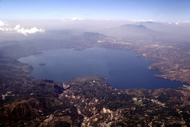
San Salvador is located in El Salvador, within the Central America Volcanic Arc of the broader Middle America-Caribbean Volcanic Regions. Situated at 13.73° N, 89.29° W in the Northern Hemisphere, the volcano lies within a tropical climate zone. With a summit elevation of 1,893 meters above sea level, San Salvador is a moderately sized peak that remains accessible to hikers and researchers for much of the year. The volcanic landform is characterized as a composite, which describes the physical shape and structure of the volcanic edifice as observed from the surface.
Geological Context
San Salvador sits in a subduction zone, where one tectonic plate dives beneath another, creating intense heat and pressure that generates magma. Subduction zones are responsible for many of the world's most explosive volcanoes and deadliest eruptions. For communities in El Salvador near San Salvador, this tectonic setting means the volcano is capable of producing powerful explosive eruptions, pyroclastic flows, and lahars that can threaten populated areas within tens of kilometers of the summit. The dominant rock type is andesite / basaltic andesite, a dark, fine-grained volcanic rock that forms from rapidly cooling, low-viscosity lava. Basaltic eruptions tend to be less explosive and produce fluid lava flows that can travel long distances. While less immediately dangerous than explosive eruptions, basaltic lava flows can destroy structures and infrastructure in their path, and volcanic gases released during these eruptions can affect air quality over a wide area.
Eruption History Summary
San Salvador has 6 recorded eruptions in the geological database, spanning from 640 CE to 1917 CE. The most powerful recorded event was a cataclysmic eruption with ash columns reaching the stratosphere in 1200 CE, reaching VEI 4 on the Volcanic Explosivity Index. Notable eruptions include 1917 CE (VEI 3), 1658 CE (VEI 3), 1575 CE (VEI 3). This eruption frequency indicates a moderately active volcanic system with periodic reawakenings. The most recent eruption in 1917 CE places this volcano within the modern era of volcanological observation.
Significance
With a maximum recorded VEI of 4, San Salvador has demonstrated the capacity for significant explosive eruptions that can impact regional aviation, agriculture, and communities tens of kilometers from the summit. VEI 4 eruptions produce ash columns reaching 15-25 kilometers into the atmosphere. With 6 recorded eruptions on file, San Salvador has enough documented activity to help scientists identify patterns in its eruptive behavior.
GVP Reference Summary
The massive compound San Salvador volcano dominates the landscape W of El Salvador's capital city of San Salvador. The dominantly andesitic Boquerón stratovolcano has grown within a 6-km-wide caldera whose rim is partially exposed at Picacho and Jabalí peaks, which themselves were formed by collapse of an older edifice about 40,000 years ago. The summit of Boquerón is truncated by a steep-walled crater 1.5 km wide and ~500 m deep that formed during a major eruption around 800 years ago. It contained a crater lake prior to an eruption during 1917 that formed a small cinder cone on the crater floor; a major N-flank lava flow also erupted in this year. Three fracture zones that extend beyond the base of the volcano have been the locus for numerous flank eruptions, including two that formed maars on the WNW and SE sides. Most of the four historical eruptions recorded since the 16th century have originated from flank vents, including two in the 17th century from the NW-flank cone of El Playón, during which explosions and a lava flow damaged inhabited areas.
— Smithsonian Institution, Global Volcanism Program
6 Recorded Eruptions
| Year | VEI | Type | Area |
|---|---|---|---|
| 1917 | 3 | Confirmed Eruption | Boquerón summit and north flank |
| 1806 | 0 | Uncertain Eruption | El Playón ? |
| 1658 | 3 | Confirmed Eruption | NW flank (El Playón) |
| 1575 | 3 | Confirmed Eruption | Loma de Grandes Bloques |
| 1200 | 4 | Confirmed Eruption | Boquerón |
| 640 | 3 | Confirmed Eruption | NW flank (Loma Caldera) |
Real-Time Data
Frequently Asked Questions About San Salvador
Is San Salvador an active volcano?+
Yes, San Salvador is considered an active volcano. Its most recent eruption was in 1917 CE. The volcano is monitored by geological agencies, and its activity status is based on observed eruptions within recorded history.
When did San Salvador last erupt?+
The most recent recorded eruption of San Salvador occurred in 1917 CE with a Volcanic Explosivity Index (VEI) of 3. The eruption was classified as a "Confirmed Eruption." San Salvador has 6 recorded eruptions in total.
How high is San Salvador?+
San Salvador has a summit elevation of 1,893 meters (6,211 feet) above sea level. At 1,893 meters, it is a moderately sized volcanic peak, roughly comparable to Mount Vesuvius (1,281m).
What type of volcano is San Salvador?+
San Salvador is classified as a Stratovolcano. Stratovolcanoes (also called composite volcanoes) are steep, conical volcanoes built up by many layers of hardened lava, tephra, and volcanic ash. They are among the most common and dangerous types, known for explosive eruptions.
Where is San Salvador located?+
San Salvador is located in El Salvador, in the Middle America-Caribbean Volcanic Regions. More specifically, it lies within the Central America Volcanic Arc. Its exact coordinates are 13.734° latitude, -89.294° longitude.
Is it safe to visit San Salvador?+
Visiting San Salvador requires checking current volcanic activity and alert levels. As an active volcano with eruptions as recent as 1917 CE, conditions can change rapidly. Always consult local geological authorities and follow official warnings before visiting. Many active volcanoes have designated safe viewing areas and guided tour options.