About Coatepeque Caldera
Coatepeque Caldera is a caldera rising to 746 meters (2,448 feet) in El Salvador's Middle America-Caribbean Volcanic Regions. No historical eruptions have been recorded, though the volcano is classified based on geological evidence of past activity.
Geography & Climate
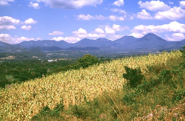
Coatepeque Caldera is located in El Salvador, within the Central America Volcanic Arc of the broader Middle America-Caribbean Volcanic Regions. Situated at 13.87° N, 89.55° W in the Northern Hemisphere, the volcano lies within a tropical climate zone. With a summit elevation of 746 meters above sea level, Coatepeque Caldera is a moderately sized peak that remains accessible to hikers and researchers for much of the year. The volcanic landform is characterized as a caldera, which describes the physical shape and structure of the volcanic edifice as observed from the surface.
Geological Context
Coatepeque Caldera sits in a subduction zone, where one tectonic plate dives beneath another, creating intense heat and pressure that generates magma. Subduction zones are responsible for many of the world's most explosive volcanoes and deadliest eruptions. For communities in El Salvador near Coatepeque Caldera, this tectonic setting means the volcano is capable of producing powerful explosive eruptions, pyroclastic flows, and lahars that can threaten populated areas within tens of kilometers of the summit. The dominant rock type is rhyolite, a silica-rich volcanic rock associated with highly viscous magma. Rhyolitic eruptions can be extremely explosive and are responsible for some of the largest volcanic events in Earth's history, including supervolcanic caldera-forming eruptions. The high silica content traps dissolved gases, building enormous pressure that can lead to catastrophic explosive releases.
GVP Reference Summary
Coatepeque is a 6.5 x 11.5 km collapse caldera ~50 km W of San Salvador that is largely occupied by a lake with hot springs near the margins. The height of the caldera rim increases on its W side, where it intersects the E flank of Santa Ana. The caldera was formed during a series of major rhyolitic explosive eruptions between ~72,000 and 51,000 years ago. Post-caldera eruptions included the formation of basaltic cinder cones and lava flows near the western margin of the caldera and the extrusion of rhyodacitic lava domes along a NE-SW line near the caldera lake margins. The highest dome forms Isla de Cabra, or Cerro Grande. The age of the domes is not known precisely, but the youngest dome, Cerro Pacho, was estimated to have formed less than 10,000 years ago. No verified eruptions have been recorded.
— Smithsonian Institution, Global Volcanism Program
0 Recorded Eruptions
No eruption records available for Coatepeque Caldera.
Real-Time Data
Frequently Asked Questions About Coatepeque Caldera
Is Coatepeque Caldera an active volcano?+
Coatepeque Caldera is classified as active based on credible evidence of past eruptions. Although its last known eruption was in prehistoric times, volcanologists consider it capable of erupting again.
How high is Coatepeque Caldera?+
Coatepeque Caldera has a summit elevation of 746 meters (2,448 feet) above sea level. At 746 meters, it is a relatively low-elevation volcano.
What type of volcano is Coatepeque Caldera?+
Coatepeque Caldera is classified as a Caldera. Calderas are large volcanic depressions formed when a volcano erupts so powerfully that its magma chamber collapses, creating a basin that can be kilometers wide. They are often sites of some of Earth's largest eruptions.
Where is Coatepeque Caldera located?+
Coatepeque Caldera is located in El Salvador, in the Middle America-Caribbean Volcanic Regions. More specifically, it lies within the Central America Volcanic Arc. Its exact coordinates are 13.870° latitude, -89.550° longitude.
Is it safe to visit Coatepeque Caldera?+
Coatepeque Caldera can generally be visited, but as with any volcano, visitors should check local conditions and any advisory notices before traveling. El Salvador may have specific regulations for accessing volcanic areas. Guided tours are often the safest and most informative way to experience a volcano.