About Santa Ana
Santa Ana is a stratovolcano rising to 2,381 meters (7,812 feet) in El Salvador's Middle America-Caribbean Volcanic Regions. It has been active in recent decades, with its last eruption in 2005 CE. The volcano has produced 18 recorded eruptions, with a maximum Volcanic Explosivity Index (VEI) of 3.
Geography & Climate
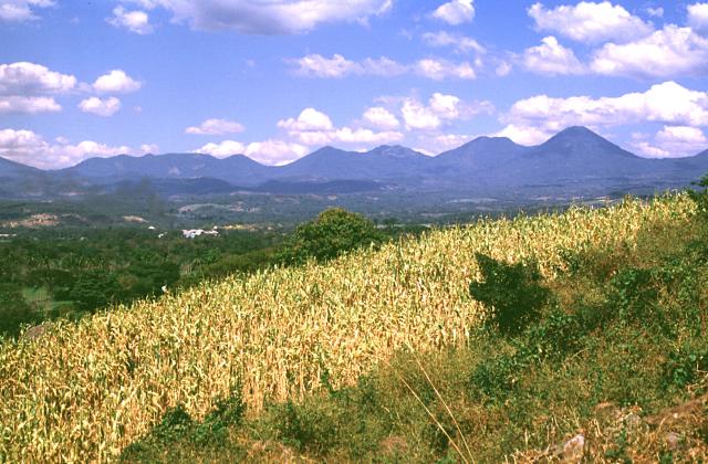
Santa Ana is located in El Salvador, within the Central America Volcanic Arc of the broader Middle America-Caribbean Volcanic Regions. Situated at 13.85° N, 89.63° W in the Northern Hemisphere, the volcano lies within a tropical climate zone. At 2,381 meters above sea level, Santa Ana rises above the surrounding terrain into montane or subalpine conditions. The elevation creates distinct ecological zones along its flanks, from forested lower slopes to exposed rocky terrain near the summit. The volcanic landform is characterized as a composite, which describes the physical shape and structure of the volcanic edifice as observed from the surface.
Geological Context
Santa Ana sits in a subduction zone, where one tectonic plate dives beneath another, creating intense heat and pressure that generates magma. Subduction zones are responsible for many of the world's most explosive volcanoes and deadliest eruptions. For communities in El Salvador near Santa Ana, this tectonic setting means the volcano is capable of producing powerful explosive eruptions, pyroclastic flows, and lahars that can threaten populated areas within tens of kilometers of the summit. The dominant rock type is andesite / basaltic andesite, a dark, fine-grained volcanic rock that forms from rapidly cooling, low-viscosity lava. Basaltic eruptions tend to be less explosive and produce fluid lava flows that can travel long distances. While less immediately dangerous than explosive eruptions, basaltic lava flows can destroy structures and infrastructure in their path, and volcanic gases released during these eruptions can affect air quality over a wide area.
Eruption History Summary
Santa Ana has 18 recorded eruptions in the geological database, spanning from 1520 CE to 2005 CE. The most powerful recorded event was a severe eruption capable of regional ash fall and pyroclastic flows in 2005 CE, reaching VEI 3 on the Volcanic Explosivity Index. Notable eruptions include 2005 CE (VEI 3), 1880 CE (VEI 3), 1874 CE (VEI 3). This level of eruptive frequency indicates a persistently active volcanic system that warrants ongoing monitoring. With eruptive activity as recently as 2005 CE, Santa Ana remains an actively monitored volcano.
Significance
With a maximum recorded VEI of 3, Santa Ana has produced eruptions capable of generating pyroclastic flows and significant ash fall in the surrounding area. While not among the largest eruptions globally, VEI 3 events pose serious hazards to local populations and can disrupt regional air travel. With 18 recorded eruptions, Santa Ana has a substantial eruptive history that provides valuable data for understanding volcanic behavior and assessing future hazards in the Middle America-Caribbean Volcanic Regions region. Given its recent activity, Santa Ana is closely monitored by geological survey organizations to provide early warning of future unrest.
GVP Reference Summary
Santa Ana (also known as Ilamatepec), is a massive, dominantly andesitic-to-trachyandesitic stratovolcano in El Salvador immediately W of Coatepeque Caldera. Collapse during the late Pleistocene produced a voluminous debris avalanche that swept into the Pacific Ocean, forming the Acajutla Peninsula. Reconstruction of the volcano subsequently filled most of the collapse scarp. The broad summit is cut by several crescentic craters, and a series of vents and cones have formed along a 20-km-long fissure system that extends from near the town of Chalchuapa NNW of the volcano to the San Marcelino and Cerro la Olla cinder cones on the SE flank. Small to moderate explosive eruptions from both summit and flank vents have been documented since the 16th century. The San Marcelino cinder cone on the SE flank produced a lava flow in 1722 that traveled 13 km E.
— Smithsonian Institution, Global Volcanism Program
18 Recorded Eruptions
| Year | VEI | Type | Area |
|---|---|---|---|
| 2005 | 3 | Confirmed Eruption | — |
| 1954 | 2 | Confirmed Eruption | — |
| 1920 | 2 | Uncertain Eruption | — |
| 1904 | 2 | Confirmed Eruption | — |
| 1884 | 2 | Confirmed Eruption | — |
| 1882 | — | Uncertain Eruption | — |
| 1880 | 3 | Confirmed Eruption | NW flank (Mala Cara) |
| 1879 | 2 | Confirmed Eruption | — |
| 1878 | 2 | Uncertain Eruption | — |
| 1874 | 3 | Confirmed Eruption | — |
| 1734 | 2 | Confirmed Eruption | — |
| 1722 | 2 | Confirmed Eruption | SE flank (San Marcelino) |
| 1621 | — | Uncertain Eruption | — |
| 1576 | 3 | Confirmed Eruption | — |
| 1570 | — | Confirmed Eruption | — |
| 1524 | 3 | Confirmed Eruption | — |
| 1521 | 3 | Confirmed Eruption | — |
| 1520 | — | Uncertain Eruption | — |
Real-Time Data
Frequently Asked Questions About Santa Ana
Is Santa Ana an active volcano?+
Yes, Santa Ana is considered an active volcano. Its most recent eruption was in 2005 CE. The volcano is monitored by geological agencies, and its activity status is based on observed eruptions within recorded history.
When did Santa Ana last erupt?+
The most recent recorded eruption of Santa Ana occurred in 2005 CE with a Volcanic Explosivity Index (VEI) of 3. The eruption was classified as a "Confirmed Eruption." Santa Ana has 18 recorded eruptions in total.
How high is Santa Ana?+
Santa Ana has a summit elevation of 2,381 meters (7,812 feet) above sea level. At 2,381 meters, it is comparable in height to many significant mountain peaks and stands well above the tree line.
What type of volcano is Santa Ana?+
Santa Ana is classified as a Stratovolcano. Stratovolcanoes (also called composite volcanoes) are steep, conical volcanoes built up by many layers of hardened lava, tephra, and volcanic ash. They are among the most common and dangerous types, known for explosive eruptions.
Where is Santa Ana located?+
Santa Ana is located in El Salvador, in the Middle America-Caribbean Volcanic Regions. More specifically, it lies within the Central America Volcanic Arc. Its exact coordinates are 13.853° latitude, -89.630° longitude.
Is it safe to visit Santa Ana?+
Visiting Santa Ana requires checking current volcanic activity and alert levels. As an active volcano with eruptions as recent as 2005 CE, conditions can change rapidly. Always consult local geological authorities and follow official warnings before visiting. Many active volcanoes have designated safe viewing areas and guided tour options.