About Cuilapa-Barbarena
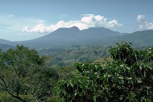
Cuilapa-Barbarena is a volcanic field rising to 1,454 meters (4,771 feet) in Guatemala's Middle America-Caribbean Volcanic Regions. No historical eruptions have been recorded, though the volcano is classified based on geological evidence of past activity.
Geography & Climate
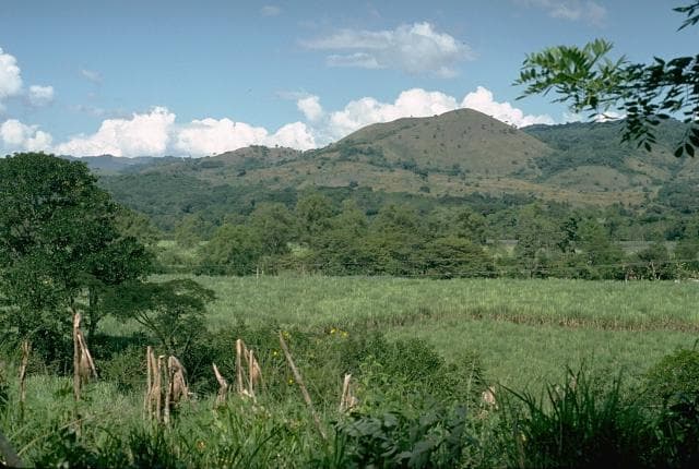
Cuilapa-Barbarena is located in Guatemala, within the Central America Volcanic Arc of the broader Middle America-Caribbean Volcanic Regions. Situated at 14.33° N, 90.40° W in the Northern Hemisphere, the volcano lies within a tropical climate zone. With a summit elevation of 1,454 meters above sea level, Cuilapa-Barbarena is a moderately sized peak that remains accessible to hikers and researchers for much of the year. The volcanic landform is characterized as a cluster, which describes the physical shape and structure of the volcanic edifice as observed from the surface.
Geological Context
Cuilapa-Barbarena sits in a subduction zone, where one tectonic plate dives beneath another, creating intense heat and pressure that generates magma. Subduction zones are responsible for many of the world's most explosive volcanoes and deadliest eruptions. For communities in Guatemala near Cuilapa-Barbarena, this tectonic setting means the volcano is capable of producing powerful explosive eruptions, pyroclastic flows, and lahars that can threaten populated areas within tens of kilometers of the summit. The dominant rock type is basalt / picro-basalt, a dark, fine-grained volcanic rock that forms from rapidly cooling, low-viscosity lava. Basaltic eruptions tend to be less explosive and produce fluid lava flows that can travel long distances. While less immediately dangerous than explosive eruptions, basaltic lava flows can destroy structures and infrastructure in their path, and volcanic gases released during these eruptions can affect air quality over a wide area.
GVP Reference Summary
The Cuilapa-Barbarena volcanic field contains approximately 70 Quaternary cinder cones, generally less than 100 m high. Many of the mostly basaltic cones are located along the strike of the major regional Jalpatagua fault, which extends SE from Guatemala City, north of the chain of stratovolcanoes stretching across Guatemala. The cones were erupted from fracture systems related to the intersection of the Jalpatagua fault with the southern and western margins of the Miocene Santa Rosa de Lima caldera, and overlie pyroclastic-flow deposits from Amatitlán caldera to the NW. The age of the most recent eruptions is not known, although the youngest cones post-date the last phase of eruptive activity at Tecuamburro volcano and could be Holocene (Reynolds, 1987). Williams (1960) considered the most recent eruptions to have occurred within the last few thousand years.
— Smithsonian Institution, Global Volcanism Program
0 Recorded Eruptions
No eruption records available for Cuilapa-Barbarena.
Real-Time Data
Frequently Asked Questions About Cuilapa-Barbarena
Is Cuilapa-Barbarena an active volcano?+
Cuilapa-Barbarena is classified as active based on credible evidence of past eruptions. Although its last known eruption was in prehistoric times, volcanologists consider it capable of erupting again.
How high is Cuilapa-Barbarena?+
Cuilapa-Barbarena has a summit elevation of 1,454 meters (4,771 feet) above sea level. At 1,454 meters, it is a moderately sized volcanic peak, roughly comparable to Mount Vesuvius (1,281m).
What type of volcano is Cuilapa-Barbarena?+
Cuilapa-Barbarena is classified as a Volcanic field. Volcanic fields consist of clusters of small volcanic vents and cinder cones spread across a region. Rather than a single central vent, eruptions can occur at many points across the field.
Where is Cuilapa-Barbarena located?+
Cuilapa-Barbarena is located in Guatemala, in the Middle America-Caribbean Volcanic Regions. More specifically, it lies within the Central America Volcanic Arc. Its exact coordinates are 14.330° latitude, -90.400° longitude.
Is it safe to visit Cuilapa-Barbarena?+
Cuilapa-Barbarena can generally be visited, but as with any volcano, visitors should check local conditions and any advisory notices before traveling. Guatemala may have specific regulations for accessing volcanic areas. Guided tours are often the safest and most informative way to experience a volcano.