About Tecuamburro
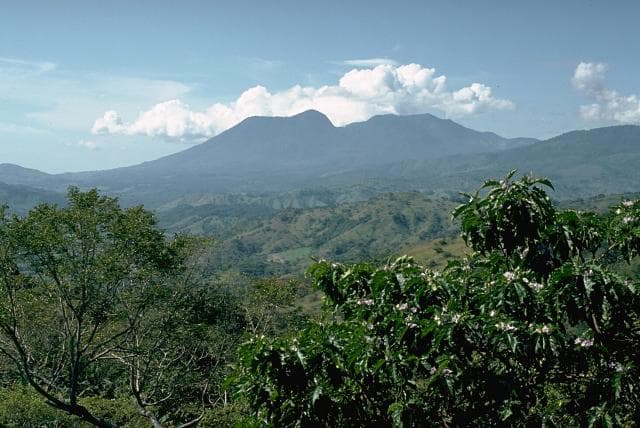
Tecuamburro is a stratovolcano rising to 1,845 meters (6,053 feet) in Guatemala's Middle America-Caribbean Volcanic Regions. Its last known eruption dates to 960 BCE, in prehistoric times. The volcano has produced 1 recorded eruption.
Geography & Climate
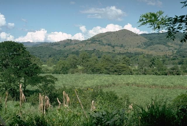
Tecuamburro is located in Guatemala, within the Central America Volcanic Arc of the broader Middle America-Caribbean Volcanic Regions. Situated at 14.16° N, 90.41° W in the Northern Hemisphere, the volcano lies within a tropical climate zone. With a summit elevation of 1,845 meters above sea level, Tecuamburro is a moderately sized peak that remains accessible to hikers and researchers for much of the year. The volcanic landform is characterized as a composite, which describes the physical shape and structure of the volcanic edifice as observed from the surface.
Geological Context
Tecuamburro sits in a subduction zone, where one tectonic plate dives beneath another, creating intense heat and pressure that generates magma. Subduction zones are responsible for many of the world's most explosive volcanoes and deadliest eruptions. For communities in Guatemala near Tecuamburro, this tectonic setting means the volcano is capable of producing powerful explosive eruptions, pyroclastic flows, and lahars that can threaten populated areas within tens of kilometers of the summit. The dominant rock type is andesite / basaltic andesite, a dark, fine-grained volcanic rock that forms from rapidly cooling, low-viscosity lava. Basaltic eruptions tend to be less explosive and produce fluid lava flows that can travel long distances. While less immediately dangerous than explosive eruptions, basaltic lava flows can destroy structures and infrastructure in their path, and volcanic gases released during these eruptions can affect air quality over a wide area.
Eruption History Summary
Tecuamburro has 1 recorded eruption in the geological database, spanning from 960 BCE to 960 BCE.
GVP Reference Summary
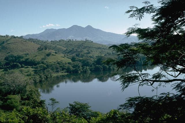
Tecuamburro is a small forested stratovolcano, or large lava-dome complex, about 50 km ESE of Guatemala City and 20 km S of the main volcanic chain. An older andesitic stratovolcano, Miraflores, was formed about 100,000 years ago. Tecuamburro and other lava domes were constructed during the late Pleistocene or early Holocene within an open E-facing scarp produced by structural failure of Miraflores more than 38,000 years ago. One of the largest of these domes, Peña Blanca, overtops the NW rim of the collapse scarp. Two nested craters, the larger of which is Chupadero, lie at the NW end of the complex. The smaller crater is a phreatic tuff ring, Laguna Ixpaco, that was formed about 2,900 years ago during the latest dated eruption of the complex. Numerous fumaroles, hot springs, and boiling mud pots are found in the area around the acidic lake.
— Smithsonian Institution, Global Volcanism Program
1 Recorded Eruption
| Year | VEI | Type | Area |
|---|---|---|---|
| 960 BCE | — | Confirmed Eruption | NW flank (Ixpaco Crater) |
Real-Time Data
Frequently Asked Questions About Tecuamburro
Is Tecuamburro an active volcano?+
Tecuamburro is not currently classified as active. Its activity evidence is listed as "Eruption Dated." The last known eruption was in 960 BCE. However, no volcano is ever considered permanently extinct.
When did Tecuamburro last erupt?+
The most recent recorded eruption of Tecuamburro occurred in 960 BCE. The eruption was classified as a "Confirmed Eruption." Tecuamburro has 1 recorded eruption in total.
How high is Tecuamburro?+
Tecuamburro has a summit elevation of 1,845 meters (6,053 feet) above sea level. At 1,845 meters, it is a moderately sized volcanic peak, roughly comparable to Mount Vesuvius (1,281m).
What type of volcano is Tecuamburro?+
Tecuamburro is classified as a Stratovolcano. Stratovolcanoes (also called composite volcanoes) are steep, conical volcanoes built up by many layers of hardened lava, tephra, and volcanic ash. They are among the most common and dangerous types, known for explosive eruptions.
Where is Tecuamburro located?+
Tecuamburro is located in Guatemala, in the Middle America-Caribbean Volcanic Regions. More specifically, it lies within the Central America Volcanic Arc. Its exact coordinates are 14.156° latitude, -90.407° longitude.
Is it safe to visit Tecuamburro?+
Tecuamburro can generally be visited, but as with any volcano, visitors should check local conditions and any advisory notices before traveling. Guatemala may have specific regulations for accessing volcanic areas. Guided tours are often the safest and most informative way to experience a volcano.