About Zuni-Bandera
Zuni-Bandera is a volcanic field rising to 2,550 meters (8,367 feet) in United States's North America Volcanic Regions. Its last known eruption dates to 1170 BCE, in prehistoric times. The volcano has produced 2 recorded eruptions.
Geography & Climate
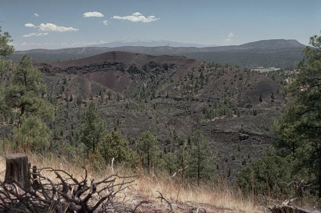
Zuni-Bandera is located in United States, within the Basin and Range Volcanic Province of the broader North America Volcanic Regions. Situated at 34.80° N, 108.00° W in the Northern Hemisphere, the volcano lies within a subtropical climate zone. At 2,550 meters above sea level, Zuni-Bandera rises above the surrounding terrain into montane or subalpine conditions. The elevation creates distinct ecological zones along its flanks, from forested lower slopes to exposed rocky terrain near the summit. The volcanic landform is characterized as a cluster, which describes the physical shape and structure of the volcanic edifice as observed from the surface.
Geological Context
Zuni-Bandera is situated along a rift zone, where tectonic plates are pulling apart. As the crust thins and fractures, magma rises to fill the gap, creating volcanic activity. Rift volcanism typically produces more fluid lava flows rather than explosive blasts, which means communities near Zuni-Bandera in United States generally face slower-moving hazards like lava flows and ground fissures rather than sudden pyroclastic events. However, rift volcanoes can still generate significant ash emissions and gas releases that affect local air quality. The dominant rock type is basalt / picro-basalt, a dark, fine-grained volcanic rock that forms from rapidly cooling, low-viscosity lava. Basaltic eruptions tend to be less explosive and produce fluid lava flows that can travel long distances. While less immediately dangerous than explosive eruptions, basaltic lava flows can destroy structures and infrastructure in their path, and volcanic gases released during these eruptions can affect air quality over a wide area.
Eruption History Summary
Zuni-Bandera has 2 recorded eruptions in the geological database, spanning from 8710 BCE to 1170 BCE. These eruptions span roughly 7,540 years of volcanic history.
GVP Reference Summary
The Zuni-Bandera volcanic field covers 2,460 km2 along the Jemez lineament west of the Rio Grande Rift. An older volcanic episode, mostly from vents along the Chain of Craters, took place about 3.8-3.7 million years ago (Ma); the younger episode began about 1.7 Ma and formed an extensive area of lava flows known as El Malpais. The youngest lava flow, the McCartys flow, traveled 60 km NE, fed by lava tubes up to 29 km long. The McCartys flow was recorded in native legends and was thought to have been erupted about 1,000 years ago, but radiocarbon dating indicates an age of about 3,000 years before present. The only other dated flow of Holocene age originated from Bandera Crater about 9,000-10,000 radiocarbon years ago. An earlier flow, the massive Pleistocene Fence Lake lava flow, traveled as far as 90 km W.
— Smithsonian Institution, Global Volcanism Program
2 Recorded Eruptions
| Year | VEI | Type | Area |
|---|---|---|---|
| 1170 BCE | 0 | Confirmed Eruption | McCartys flow |
| 8710 BCE | — | Confirmed Eruption | Bandera Crater |
Real-Time Data
Frequently Asked Questions About Zuni-Bandera
Is Zuni-Bandera an active volcano?+
Zuni-Bandera is not currently classified as active. Its activity evidence is listed as "Eruption Dated." The last known eruption was in 1170 BCE. However, no volcano is ever considered permanently extinct.
When did Zuni-Bandera last erupt?+
The most recent recorded eruption of Zuni-Bandera occurred in 1170 BCE with a Volcanic Explosivity Index (VEI) of 0. The eruption was classified as a "Confirmed Eruption." Zuni-Bandera has 2 recorded eruptions in total.
How high is Zuni-Bandera?+
Zuni-Bandera has a summit elevation of 2,550 meters (8,367 feet) above sea level. At 2,550 meters, it is comparable in height to many significant mountain peaks and stands well above the tree line.
What type of volcano is Zuni-Bandera?+
Zuni-Bandera is classified as a Volcanic field. Volcanic fields consist of clusters of small volcanic vents and cinder cones spread across a region. Rather than a single central vent, eruptions can occur at many points across the field.
Where is Zuni-Bandera located?+
Zuni-Bandera is located in United States, in the North America Volcanic Regions. More specifically, it lies within the Basin and Range Volcanic Province. Its exact coordinates are 34.800° latitude, -108.000° longitude.
Is it safe to visit Zuni-Bandera?+
Zuni-Bandera can generally be visited, but as with any volcano, visitors should check local conditions and any advisory notices before traveling. United States may have specific regulations for accessing volcanic areas. Guided tours are often the safest and most informative way to experience a volcano.


