About Ubehebe Craters
Ubehebe Craters is a maar(s) rising to 752 meters (2,467 feet) in United States's North America Volcanic Regions. Its last known eruption dates to 150 BCE, in prehistoric times. The volcano has produced 1 recorded eruption.
Geography & Climate
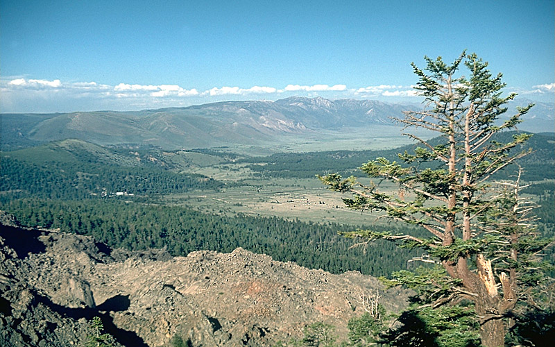
Ubehebe Craters is located in United States, within the Basin and Range Volcanic Province of the broader North America Volcanic Regions. Situated at 37.02° N, 117.45° W in the Northern Hemisphere, the volcano lies within a temperate climate zone. With a summit elevation of 752 meters above sea level, Ubehebe Craters is a moderately sized peak that remains accessible to hikers and researchers for much of the year. The volcanic landform is characterized as a minor, which describes the physical shape and structure of the volcanic edifice as observed from the surface.
Geological Context
Ubehebe Craters is situated along a rift zone, where tectonic plates are pulling apart. As the crust thins and fractures, magma rises to fill the gap, creating volcanic activity. Rift volcanism typically produces more fluid lava flows rather than explosive blasts, which means communities near Ubehebe Craters in United States generally face slower-moving hazards like lava flows and ground fissures rather than sudden pyroclastic events. However, rift volcanoes can still generate significant ash emissions and gas releases that affect local air quality. The dominant rock type is basalt / picro-basalt, a dark, fine-grained volcanic rock that forms from rapidly cooling, low-viscosity lava. Basaltic eruptions tend to be less explosive and produce fluid lava flows that can travel long distances. While less immediately dangerous than explosive eruptions, basaltic lava flows can destroy structures and infrastructure in their path, and volcanic gases released during these eruptions can affect air quality over a wide area.
Eruption History Summary
Ubehebe Craters has 1 recorded eruption in the geological database, spanning from 150 BCE to 150 BCE.
GVP Reference Summary
The Ubehebe Craters (pronounced you-bee-HEE-bee) consist of an isolated group of overlapping maars formed during eruptions of alkali basalt along a fault cutting alluvial fan deposits on the flanks of Tin Mountain in Death Valley National Park. Ubehebe Crater is a 0.8-km-wide, 235-m-deep maar surrounded by a tuff ring. Little Hebe Crater, the second youngest vent located immediately south, is a small tuff cone with a 100-m-wide crater overlain by pyroclastic-surge deposits. At least a dozen craters are located within an area of 3 km2, and bedded pyroclastic-surge deposits cover an area of 15 km2. Early scoria cone formation was followed by hydrovolcanic explosions that formed two clusters of explosion craters and tuff rings. Field work and revised dating (Calzia et al., 2016; Fierstein et al., 2016) based on paleomagnetic and 10Be evidence has shown that the craters were formed during a single short-lived phreatic, phreatomagmatic, and magmatic eruptive episode about 2,100 years ago.
— Smithsonian Institution, Global Volcanism Program
1 Recorded Eruption
| Year | VEI | Type | Area |
|---|---|---|---|
| 150 BCE | — | Confirmed Eruption | — |
Real-Time Data
Frequently Asked Questions About Ubehebe Craters
Is Ubehebe Craters an active volcano?+
Ubehebe Craters is not currently classified as active. Its activity evidence is listed as "Eruption Dated." The last known eruption was in 150 BCE. However, no volcano is ever considered permanently extinct.
When did Ubehebe Craters last erupt?+
The most recent recorded eruption of Ubehebe Craters occurred in 150 BCE. The eruption was classified as a "Confirmed Eruption." Ubehebe Craters has 1 recorded eruption in total.
How high is Ubehebe Craters?+
Ubehebe Craters has a summit elevation of 752 meters (2,467 feet) above sea level. At 752 meters, it is a relatively low-elevation volcano.
What type of volcano is Ubehebe Craters?+
Ubehebe Craters is classified as a Maar(s). Maar(s) volcanoes have distinct geological characteristics that set them apart from other volcanic types.
Where is Ubehebe Craters located?+
Ubehebe Craters is located in United States, in the North America Volcanic Regions. More specifically, it lies within the Basin and Range Volcanic Province. Its exact coordinates are 37.020° latitude, -117.450° longitude.
Is it safe to visit Ubehebe Craters?+
Ubehebe Craters can generally be visited, but as with any volcano, visitors should check local conditions and any advisory notices before traveling. United States may have specific regulations for accessing volcanic areas. Guided tours are often the safest and most informative way to experience a volcano.