About West Crater
West Crater is a volcanic field rising to 1,329 meters (4,360 feet) in United States's North America Volcanic Regions. The volcano is currently active, with its most recent eruption in 5750 BCE. The volcano has produced 2 recorded eruptions, with a maximum Volcanic Explosivity Index (VEI) of 2.
Geography & Climate
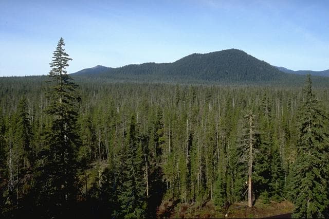
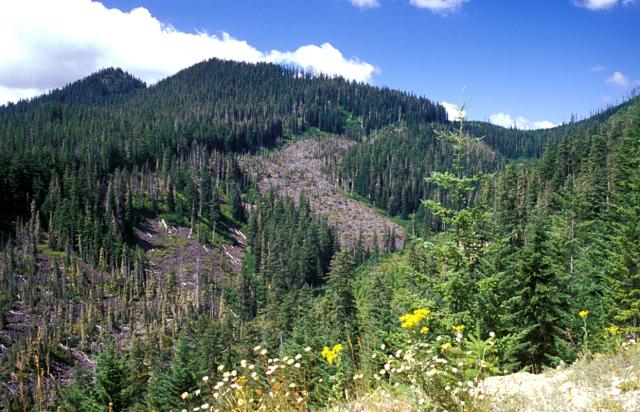
West Crater is located in United States, within the High Cascades Volcanic Arc of the broader North America Volcanic Regions. Situated at 45.88° N, 122.08° W in the Northern Hemisphere, the volcano lies within a temperate climate zone. With a summit elevation of 1,329 meters above sea level, West Crater is a moderately sized peak that remains accessible to hikers and researchers for much of the year. The volcanic landform is characterized as a cluster, which describes the physical shape and structure of the volcanic edifice as observed from the surface.
Geological Context
West Crater sits in a subduction zone, where one tectonic plate dives beneath another, creating intense heat and pressure that generates magma. Subduction zones are responsible for many of the world's most explosive volcanoes and deadliest eruptions. For communities in United States near West Crater, this tectonic setting means the volcano is capable of producing powerful explosive eruptions, pyroclastic flows, and lahars that can threaten populated areas within tens of kilometers of the summit. The dominant rock type is andesite / basaltic andesite, a dark, fine-grained volcanic rock that forms from rapidly cooling, low-viscosity lava. Basaltic eruptions tend to be less explosive and produce fluid lava flows that can travel long distances. While less immediately dangerous than explosive eruptions, basaltic lava flows can destroy structures and infrastructure in their path, and volcanic gases released during these eruptions can affect air quality over a wide area.
Eruption History Summary
West Crater has 2 recorded eruptions in the geological database, spanning from 6110 BCE to 5750 BCE. The most powerful recorded event was an explosive event producing ash plumes up to several kilometers in 5750 BCE, reaching VEI 2 on the Volcanic Explosivity Index. These eruptions span roughly 360 years of volcanic history.
GVP Reference Summary
West Crater, a small andesitic lava dome with associated lava flows, is part of a Quaternary volcanic field in southern Washington consisting primarily of small basaltic and basaltic andesite cinder cones and shield volcanoes, oriented along a NW-SE zone to the SE of St. Helens. This 20-km-wide zone extends from Marble Mountain, north of Swift Reservoir, to south of Trout Creek Hill. The Pleistocene basaltic Trout Creek Hill shield volcano produced a lava flow about 340,000 years ago that traveled 20 km SE, temporarily damming the Columbia River. At least three vents in this field are of Holocene age: West Crater, a small cone at Hackamore Creek, and a phreatic crater at the summit of Bare Mountain. The latest eruptions at these locations have been dated at about 8,000 years before present, and have included emplacement of an andesitic lava dome and associated lava flow at West Crater and formation of a phreatic explosion crater at Bare Mountain.
— Smithsonian Institution, Global Volcanism Program
2 Recorded Eruptions
| Year | VEI | Type | Area |
|---|---|---|---|
| 5750 BCE | 2 | Confirmed Eruption | Bare Mountain |
| 6110 BCE | 2 | Confirmed Eruption | West Crater, Hackamore Creek cone |
Real-Time Data
Frequently Asked Questions About West Crater
Is West Crater an active volcano?+
West Crater is not currently classified as active. Its activity evidence is listed as "Eruption Dated." The last known eruption was in 5750 BCE. However, no volcano is ever considered permanently extinct.
When did West Crater last erupt?+
The most recent recorded eruption of West Crater occurred in 5750 BCE with a Volcanic Explosivity Index (VEI) of 2. The eruption was classified as a "Confirmed Eruption." West Crater has 2 recorded eruptions in total.
How high is West Crater?+
West Crater has a summit elevation of 1,329 meters (4,360 feet) above sea level. At 1,329 meters, it is a moderately sized volcanic peak, roughly comparable to Mount Vesuvius (1,281m).
What type of volcano is West Crater?+
West Crater is classified as a Volcanic field. Volcanic fields consist of clusters of small volcanic vents and cinder cones spread across a region. Rather than a single central vent, eruptions can occur at many points across the field.
Where is West Crater located?+
West Crater is located in United States, in the North America Volcanic Regions. More specifically, it lies within the High Cascades Volcanic Arc. Its exact coordinates are 45.880° latitude, -122.080° longitude.
Is it safe to visit West Crater?+
West Crater can generally be visited, but as with any volcano, visitors should check local conditions and any advisory notices before traveling. United States may have specific regulations for accessing volcanic areas. Guided tours are often the safest and most informative way to experience a volcano.