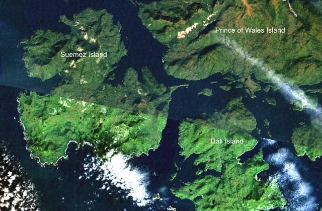
About Duncan Canal
Duncan Canal is a volcanic field rising to 15 meters (49 feet) in United States's North America Volcanic Regions. No historical eruptions have been recorded, though the volcano is classified based on geological evidence of past activity.
Geography & Climate
Duncan Canal is located in United States, within the Queen Charlotte Volcano Group of the broader North America Volcanic Regions. Situated at 56.50° N, 133.10° W in the Northern Hemisphere, the volcano lies within a subarctic climate zone. At just 15 meters above sea level, Duncan Canal is a relatively low-elevation volcanic feature. Despite its modest height, it remains an active geological formation with the same underlying magmatic processes as its taller counterparts. The volcanic landform is characterized as a cluster, which describes the physical shape and structure of the volcanic edifice as observed from the surface.
Geological Context
Duncan Canal sits in a subduction zone, where one tectonic plate dives beneath another, creating intense heat and pressure that generates magma. Subduction zones are responsible for many of the world's most explosive volcanoes and deadliest eruptions. For communities in United States near Duncan Canal, this tectonic setting means the volcano is capable of producing powerful explosive eruptions, pyroclastic flows, and lahars that can threaten populated areas within tens of kilometers of the summit. The dominant rock type is basalt / picro-basalt, a dark, fine-grained volcanic rock that forms from rapidly cooling, low-viscosity lava. Basaltic eruptions tend to be less explosive and produce fluid lava flows that can travel long distances. While less immediately dangerous than explosive eruptions, basaltic lava flows can destroy structures and infrastructure in their path, and volcanic gases released during these eruptions can affect air quality over a wide area.
GVP Reference Summary
Basaltic flows in the Duncan Canal area of the central SE Alaska panhandle are both subaerial and submarine. Pahoehoe and aa lava flows overlie glacial till at Kupreanof Island. Quaternary basaltic lava flows up to 10 m thick form several broad peninsulas and scattered outcrops on the shores of Sumner Strait at the southern end of Kupreanof Island (Brew et al., 1985). On a peninsula in Kah Sheets Bay a basaltic flow depositionally overlies till of the youngest glaciation, and youthful-looking flows are exposed along a broad 12-km-wide front westward toward Douglas Bay. Two probable vents are found to the north within Mesozoic and Paleozoic rocks at the northern end of the Castle Islands in the Duncan Canal fault zone, and at Indian Point the flows contain inclusions of picrite. At High Castle Island, the basaltic flows are columnar-jointed and overlie planar to cross-bedded coarse sandstone and poorly sorted volcaniclastic conglomerate.
— Smithsonian Institution, Global Volcanism Program
0 Recorded Eruptions
No eruption records available for Duncan Canal.
Real-Time Data
Frequently Asked Questions About Duncan Canal
Is Duncan Canal an active volcano?+
Duncan Canal is classified as active based on credible evidence of past eruptions. Although its last known eruption was in prehistoric times, volcanologists consider it capable of erupting again.
How high is Duncan Canal?+
Duncan Canal has a summit elevation of 15 meters (49 feet) above sea level. At 15 meters, it is a relatively low-elevation volcano.
What type of volcano is Duncan Canal?+
Duncan Canal is classified as a Volcanic field. Volcanic fields consist of clusters of small volcanic vents and cinder cones spread across a region. Rather than a single central vent, eruptions can occur at many points across the field.
Where is Duncan Canal located?+
Duncan Canal is located in United States, in the North America Volcanic Regions. More specifically, it lies within the Queen Charlotte Volcano Group. Its exact coordinates are 56.500° latitude, -133.100° longitude.
Is it safe to visit Duncan Canal?+
Duncan Canal can generally be visited, but as with any volcano, visitors should check local conditions and any advisory notices before traveling. United States may have specific regulations for accessing volcanic areas. Guided tours are often the safest and most informative way to experience a volcano.