About Akan
Akan is a caldera rising to 1,499 meters (4,918 feet) in Japan's Northwestern Pacific Volcanic Regions. The volcano is currently active, with its most recent eruption in 2025 CE. The volcano has produced 38 recorded eruptions, with a maximum Volcanic Explosivity Index (VEI) of 4.
Geography & Climate
Akan is located in Japan, within the Kuril Volcanic Arc of the broader Northwestern Pacific Volcanic Regions. Situated at 43.38° N, 144.01° E in the Northern Hemisphere, the volcano lies within a temperate climate zone. With a summit elevation of 1,499 meters above sea level, Akan is a moderately sized peak that remains accessible to hikers and researchers for much of the year. The volcanic landform is characterized as a caldera, which describes the physical shape and structure of the volcanic edifice as observed from the surface.
Geological Context
Akan sits in a subduction zone, where one tectonic plate dives beneath another, creating intense heat and pressure that generates magma. Subduction zones are responsible for many of the world's most explosive volcanoes and deadliest eruptions. For communities in Japan near Akan, this tectonic setting means the volcano is capable of producing powerful explosive eruptions, pyroclastic flows, and lahars that can threaten populated areas within tens of kilometers of the summit. The dominant rock type is andesite / basaltic andesite, a dark, fine-grained volcanic rock that forms from rapidly cooling, low-viscosity lava. Basaltic eruptions tend to be less explosive and produce fluid lava flows that can travel long distances. While less immediately dangerous than explosive eruptions, basaltic lava flows can destroy structures and infrastructure in their path, and volcanic gases released during these eruptions can affect air quality over a wide area.
Eruption History Summary
Akan has 38 recorded eruptions in the geological database, spanning from 7050 BCE to 2025 CE. The most powerful recorded event was a cataclysmic eruption with ash columns reaching the stratosphere in 50 BCE, reaching VEI 4 on the Volcanic Explosivity Index. Notable eruptions include 50 BCE (VEI 4), 3550 BCE (VEI 3), 7050 BCE (VEI 4). With an average interval of roughly 239 years between eruptions over a span of 9,075 years, this is one of the more frequently active volcanoes in the database. This persistent activity suggests a robust and well-supplied magma system beneath the volcano. With eruptive activity as recently as 2025 CE, Akan remains an actively monitored volcano.
Significance
With a maximum recorded VEI of 4, Akan has demonstrated the capacity for significant explosive eruptions that can impact regional aviation, agriculture, and communities tens of kilometers from the summit. VEI 4 eruptions produce ash columns reaching 15-25 kilometers into the atmosphere. Its 38 recorded eruptions make it one of the most prolific volcanoes in our database, reflecting a persistent and well-documented eruptive history that has provided volcanologists with extensive data for understanding eruption patterns and forecasting future activity. Given its recent activity, Akan is closely monitored by geological survey organizations to provide early warning of future unrest.
GVP Reference Summary
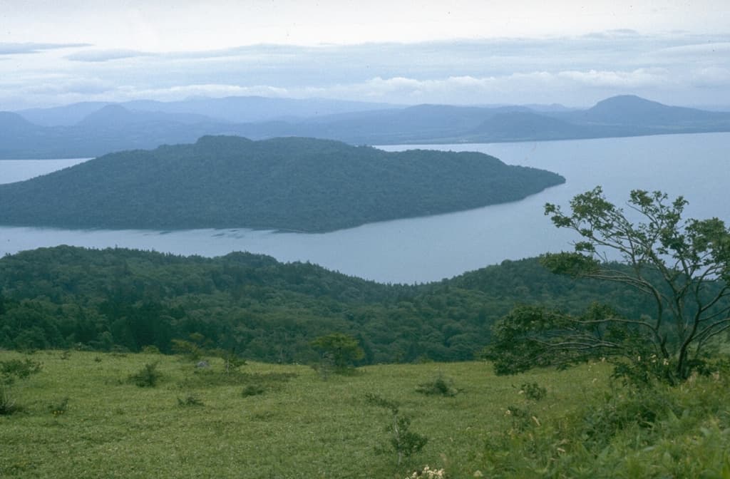
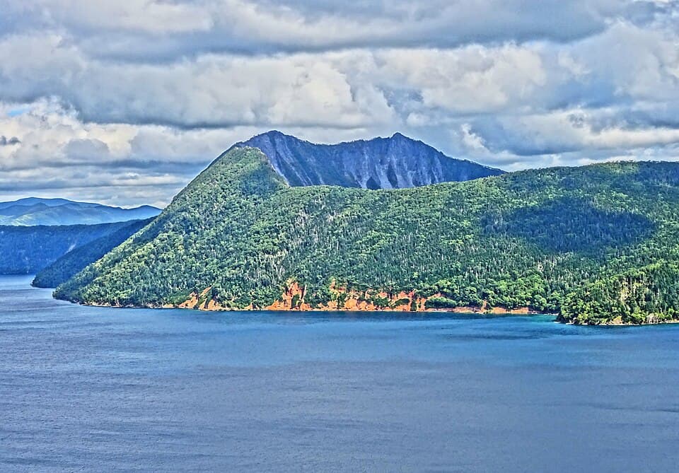
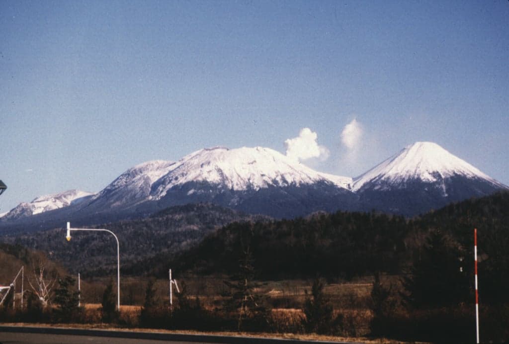
Akan is a 13 x 24 km caldera located immediately SW of Kussharo caldera in eastern Hokkaido. The elongated, irregular outline of the caldera rim reflects its incremental formation during major explosive eruptions from the early to mid-Pleistocene. There are four post-caldera stratovolcanoes, three at the SW end of the caldera and the other on the NE side. Conical Oakandake was frequently active during the Holocene. The 1-km-wide Nakamachineshiri crater of Meakandake was formed during a major pumice-and-scoria eruption about 13,500 years ago. The Meakandake group, composed of nine overlapping cones E of Lake Akan, has produced mild phreatic eruptions since the beginning of the 19th century. The main cone of Meakandake proper has a triple crater at its summit. Although recorded eruptions at Meakandake have consisted of minor phreatic explosions, four major magmatic eruptions with pyroclastic flows have also occurred during the Holocene.
— Smithsonian Institution, Global Volcanism Program
38 Recorded Eruptions
How Akan's 23 size-rated eruptions break down by Volcanic Explosivity Index. Select a bar to see what that size means.
Gentle — small ash plumes, minor explosive activity.
Of Akan's 23 size-rated eruptions on record, the most common was VEI 1 (20 of 23, 87%). It is overwhelmingly effusive, erupting gently at nearly the same small size again and again — classic shield-building behaviour. The largest on record reached VEI 4.
Based on the Smithsonian GVP eruption record. This describes Akan's past eruptions only — it does not predict future activity. What is the VEI? · Most explosive volcanoes
| Year | VEI | Type | Area |
|---|---|---|---|
| 2025 | — | Confirmed Eruption | — |
| 2008 | 1 | Confirmed Eruption | Me-Akan (Ponmachineshiri) |
| 2006 | 1 | Confirmed Eruption | NE flank of Me-Akan |
| 1998 | 1 | Confirmed Eruption | Me-Akan (Ponmachineshiri) |
| 1996 | 1 | Confirmed Eruption | Me-Akan (Ponmachineshiri crater no. 4) |
| 1988 | 1 | Confirmed Eruption | Me-Akan (SE rim of Ponmachineshiri) |
| 1984 | 1 | Confirmed Eruption | Me-Akan (Ponmachineshiri) |
| 1966 | 1 | Confirmed Eruption | Me-Akan (Nakamachineshiri) |
| 1965 | 1 | Confirmed Eruption | Me-Akan (Nakamachineshiri) |
| 1964 | 1 | Confirmed Eruption | Me-Akan (Nakamachineshiri) |
| 1962 | 1 | Confirmed Eruption | Me-Akan (Nakamachineshiri) |
| 1960 | 1 | Confirmed Eruption | Me-Akan (Ponmachineshiri) |
| 1959 | 1 | Confirmed Eruption | Me-Akan (Naka- and Ponmachineshiri) |
| 1958 | 1 | Confirmed Eruption | Me-Akan (Ponmachineshiri) |
| 1957 | 1 | Confirmed Eruption | Me-Akan (Ponmachineshiri) |
| 1956 | 1 | Confirmed Eruption | Me-Akan (Ponmachineshiri) |
| 1955 | 1 | Confirmed Eruption | Me-Akan (Ponmachineshiri) |
| 1954 | 1 | Confirmed Eruption | Me-Akan (Nakamachineshiri) |
| 1951 – 1952 | 1 | Uncertain Eruption | Me-Akan (NE foot) |
| 1927 | 1 | Uncertain Eruption | Me-Akan |
| 1808 | — | Confirmed Eruption | Me-Akan |
| 1780 | 1 | Confirmed Eruption | Me-Akan |
| 1600 | — | Confirmed Eruption | Me-Akan |
| 1550 | — | Confirmed Eruption | Me-Akan |
| 1250 | — | Confirmed Eruption | Me-Akan (Ponmachineshiri) |
| 950 | — | Confirmed Eruption | Me-Akan (Ponmachineshiri) |
| 600 | — | Confirmed Eruption | Akan-Fuji |
| 250 | — | Confirmed Eruption | Akan-Fuji |
| 100 | — | Confirmed Eruption | Akan-Fuji |
| 50 BCE | 4 | Confirmed Eruption | Akan-Fuji |
| 300 BCE | — | Confirmed Eruption | Akan-Fuji |
| 550 BCE | — | Confirmed Eruption | Akan-Fuji |
| 800 BCE | — | Confirmed Eruption | Me-Akan (Ponmachineshiri) |
| 2050 BCE | — | Confirmed Eruption | Kita-yama, Me-Akan (Ponmachineshiri) |
| 3050 BCE | — | Confirmed Eruption | Nishi-yama, O-Akan |
| 3550 BCE | 3 | Confirmed Eruption | Me-Akan (Nakamachineshiri) |
| 4550 BCE | — | Confirmed Eruption | Me-Akan (Ponmachineshiri) |
| 7050 BCE | 4 | Confirmed Eruption | Me-Akan (Nakamachineshiri) |
Real-Time Data
Frequently Asked Questions About Akan
Is Akan an active volcano?+
Yes, Akan is considered an active volcano. Its most recent eruption was in 2025 CE. The volcano is monitored by geological agencies, and its activity status is based on observed eruptions within recorded history.
When did Akan last erupt?+
The most recent recorded eruption of Akan occurred in 2025 CE. The eruption was classified as a "Confirmed Eruption." Akan has 38 recorded eruptions in total.
How high is Akan?+
Akan has a summit elevation of 1,499 meters (4,918 feet) above sea level. At 1,499 meters, it is a moderately sized volcanic peak, roughly comparable to Mount Vesuvius (1,281m).
What type of volcano is Akan?+
Akan is classified as a Caldera. Calderas are large volcanic depressions formed when a volcano erupts so powerfully that its magma chamber collapses, creating a basin that can be kilometers wide. They are often sites of some of Earth's largest eruptions.
Where is Akan located?+
Akan is located in Japan, in the Northwestern Pacific Volcanic Regions. More specifically, it lies within the Kuril Volcanic Arc. Its exact coordinates are 43.384° latitude, 144.013° longitude.
Is it safe to visit Akan?+
Visiting Akan requires checking current volcanic activity and alert levels. As an active volcano with eruptions as recent as 2025 CE, conditions can change rapidly. Always consult local geological authorities and follow official warnings before visiting. Many active volcanoes have designated safe viewing areas and guided tour options.