About Alayta
Alayta is a shield rising to 1,496 meters (4,908 feet) in Ethiopia's Eastern Africa Volcanic Regions. It last erupted in 1915 CE, and volcanologists consider it an active volcanic system. The volcano has produced 2 recorded eruptions, with a maximum Volcanic Explosivity Index (VEI) of 2.
Geography & Climate
Alayta is located in Ethiopia, within the Afar Rift Volcanic Province of the broader Eastern Africa Volcanic Regions. Situated at 12.89° N, 40.57° E in the Northern Hemisphere, the volcano lies within a tropical climate zone. With a summit elevation of 1,496 meters above sea level, Alayta is a moderately sized peak that remains accessible to hikers and researchers for much of the year. The volcanic landform is characterized as a shield, which describes the physical shape and structure of the volcanic edifice as observed from the surface.
Geological Context
Alayta is situated along a rift zone, where tectonic plates are pulling apart. As the crust thins and fractures, magma rises to fill the gap, creating volcanic activity. Rift volcanism typically produces more fluid lava flows rather than explosive blasts, which means communities near Alayta in Ethiopia generally face slower-moving hazards like lava flows and ground fissures rather than sudden pyroclastic events. However, rift volcanoes can still generate significant ash emissions and gas releases that affect local air quality. The dominant rock type is basalt / picro-basalt, a dark, fine-grained volcanic rock that forms from rapidly cooling, low-viscosity lava. Basaltic eruptions tend to be less explosive and produce fluid lava flows that can travel long distances. While less immediately dangerous than explosive eruptions, basaltic lava flows can destroy structures and infrastructure in their path, and volcanic gases released during these eruptions can affect air quality over a wide area.
Eruption History Summary
Alayta has 2 recorded eruptions in the geological database, spanning from 1907 CE to 1915 CE. The most powerful recorded event was an explosive event producing ash plumes up to several kilometers in 1915 CE, reaching VEI 2 on the Volcanic Explosivity Index. These eruptions span roughly 8 years of volcanic history. The most recent eruption in 1915 CE places this volcano within the modern era of volcanological observation.
GVP Reference Summary
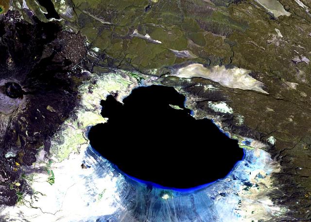
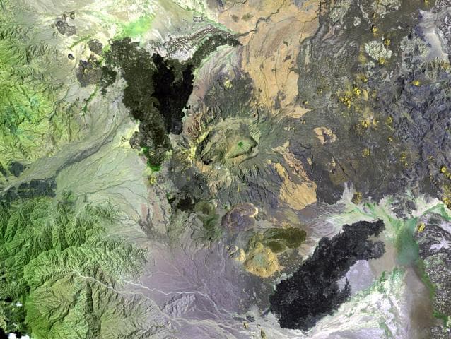
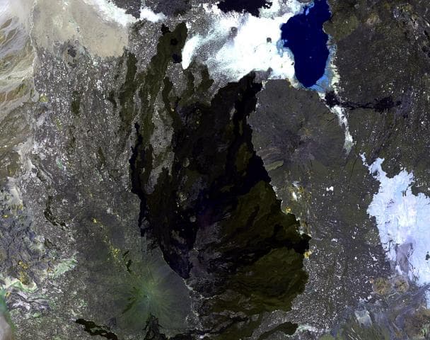
The massive Alayta shield volcano covers an area of 2700 km2 in the western Danakil depression SW of Lake Afrera. A series of very recent craters is aligned along the NNW-trending axis of the basaltic-to-trachytic shield. The lava field, covered by very fresh flows, was erupted from N-S fissures along the east side of the shield volcano and laps up against the western flank of Afderà volcano. Two historical eruptions that were formerly attributed to Afderà actually originated from Alayta. One of those eruptions, in 1907, produced a large lava flow from a SE-flank vent. Fumarolic activity occurs at two locations in the southern part of the complex.
— Smithsonian Institution, Global Volcanism Program
2 Recorded Eruptions
| Year | VEI | Type | Area |
|---|---|---|---|
| 1915 | 2 | Confirmed Eruption | — |
| 1907 | 2 | Confirmed Eruption | SE flank |
Real-Time Data
Frequently Asked Questions About Alayta
Is Alayta an active volcano?+
Yes, Alayta is considered an active volcano. Its most recent eruption was in 1915 CE. The volcano is monitored by geological agencies, and its activity status is based on observed eruptions within recorded history.
When did Alayta last erupt?+
The most recent recorded eruption of Alayta occurred in 1915 CE with a Volcanic Explosivity Index (VEI) of 2. The eruption was classified as a "Confirmed Eruption." Alayta has 2 recorded eruptions in total.
How high is Alayta?+
Alayta has a summit elevation of 1,496 meters (4,908 feet) above sea level. At 1,496 meters, it is a moderately sized volcanic peak, roughly comparable to Mount Vesuvius (1,281m).
What type of volcano is Alayta?+
Alayta is classified as a Shield. Shield volcanoes have distinct geological characteristics that set them apart from other volcanic types.
Where is Alayta located?+
Alayta is located in Ethiopia, in the Eastern Africa Volcanic Regions. More specifically, it lies within the Afar Rift Volcanic Province. Its exact coordinates are 12.888° latitude, 40.573° longitude.
Is it safe to visit Alayta?+
Visiting Alayta requires checking current volcanic activity and alert levels. As an active volcano with eruptions as recent as 1915 CE, conditions can change rapidly. Always consult local geological authorities and follow official warnings before visiting. Many active volcanoes have designated safe viewing areas and guided tour options.