About Sarigan
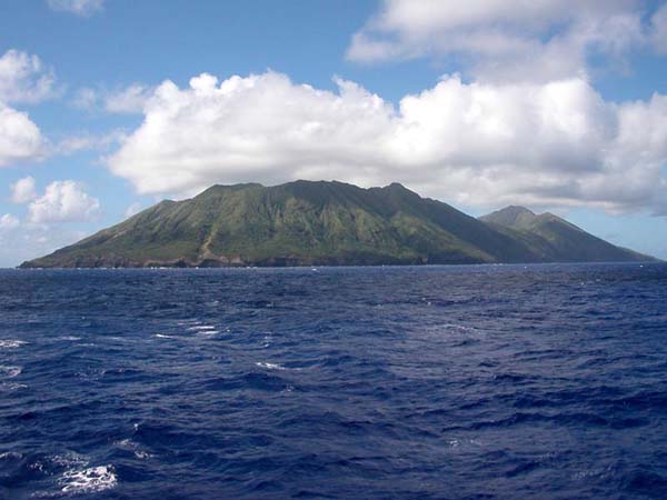
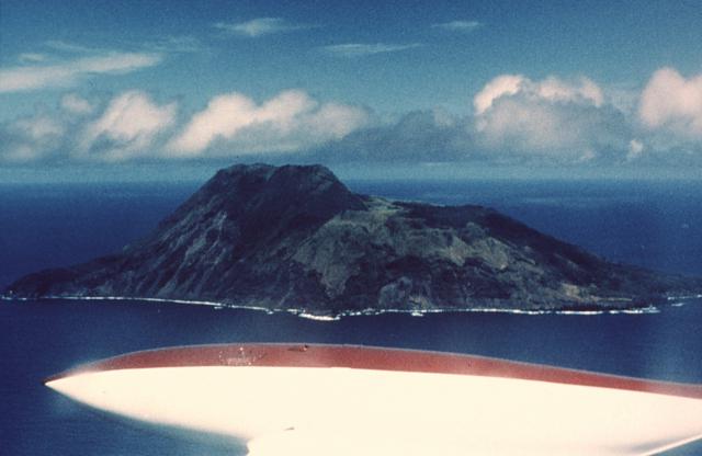
Sarigan is a stratovolcano rising to 494 meters (1,621 feet) in United States's Northwestern Pacific Volcanic Regions. No historical eruptions have been recorded, though the volcano is classified based on geological evidence of past activity.
Geography & Climate
Sarigan is located in United States, within the Mariana Volcanic Arc of the broader Northwestern Pacific Volcanic Regions. Situated at 16.70° N, 145.78° E in the Northern Hemisphere, the volcano lies within a tropical climate zone. At just 494 meters above sea level, Sarigan is a relatively low-elevation volcanic feature. Despite its modest height, it remains an active geological formation with the same underlying magmatic processes as its taller counterparts. The volcanic landform is characterized as a composite, which describes the physical shape and structure of the volcanic edifice as observed from the surface.
Geological Context
Sarigan sits in a subduction zone, where one tectonic plate dives beneath another, creating intense heat and pressure that generates magma. Subduction zones are responsible for many of the world's most explosive volcanoes and deadliest eruptions. For communities in United States near Sarigan, this tectonic setting means the volcano is capable of producing powerful explosive eruptions, pyroclastic flows, and lahars that can threaten populated areas within tens of kilometers of the summit. The dominant rock type is andesite / basaltic andesite, a dark, fine-grained volcanic rock that forms from rapidly cooling, low-viscosity lava. Basaltic eruptions tend to be less explosive and produce fluid lava flows that can travel long distances. While less immediately dangerous than explosive eruptions, basaltic lava flows can destroy structures and infrastructure in their path, and volcanic gases released during these eruptions can affect air quality over a wide area.
GVP Reference Summary
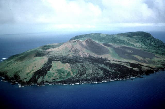
Sarigan volcano forms an irregular 3-km-long island consisting of a low truncated cone with a 750-m-wide summit crater that contains a small ash cone. The most recent eruptions produced two lava domes from vents above and near the south crater rim. Lava flows from each dome reached the coast and extended out to sea. The northern flow overtopped the crater rim on the N and NW sides. The sparse vegetation on the flows indicated to Meijer and Reagan (1981) that they are of Holocene age.
— Smithsonian Institution, Global Volcanism Program
0 Recorded Eruptions
No eruption records available for Sarigan.
Real-Time Data
Frequently Asked Questions About Sarigan
Is Sarigan an active volcano?+
Sarigan is classified as active based on credible evidence of past eruptions. Although its last known eruption was in prehistoric times, volcanologists consider it capable of erupting again.
How high is Sarigan?+
Sarigan has a summit elevation of 494 meters (1,621 feet) above sea level. At 494 meters, it is a relatively low-elevation volcano.
What type of volcano is Sarigan?+
Sarigan is classified as a Stratovolcano. Stratovolcanoes (also called composite volcanoes) are steep, conical volcanoes built up by many layers of hardened lava, tephra, and volcanic ash. They are among the most common and dangerous types, known for explosive eruptions.
Where is Sarigan located?+
Sarigan is located in United States, in the Northwestern Pacific Volcanic Regions. More specifically, it lies within the Mariana Volcanic Arc. Its exact coordinates are 16.699° latitude, 145.780° longitude.
Is it safe to visit Sarigan?+
Sarigan can generally be visited, but as with any volcano, visitors should check local conditions and any advisory notices before traveling. United States may have specific regulations for accessing volcanic areas. Guided tours are often the safest and most informative way to experience a volcano.