About Fujisan
Fujisan is a stratovolcano rising to 3,776 meters (12,389 feet) in Japan's Northwestern Pacific Volcanic Regions. Its last known eruption was in 1708 CE. The volcano has produced 20 recorded eruptions, with a maximum Volcanic Explosivity Index (VEI) of 5.
Geography & Climate
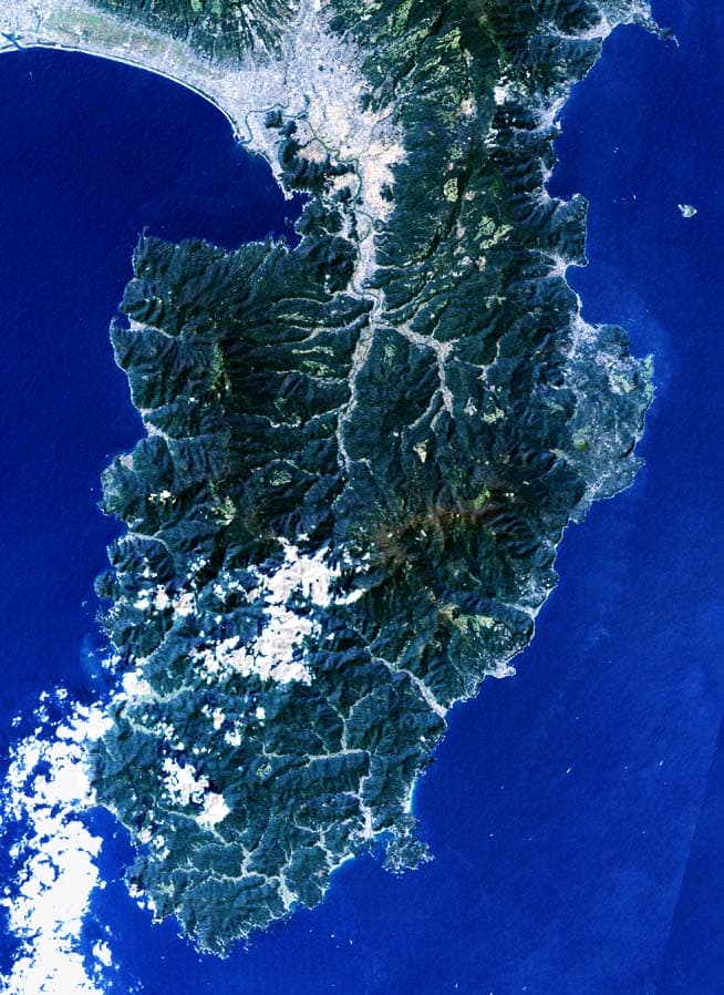
Fujisan is located in Japan, within the Izu Volcanic Arc of the broader Northwestern Pacific Volcanic Regions. Situated at 35.36° N, 138.73° E in the Northern Hemisphere, the volcano lies within a temperate climate zone. Standing at 3,776 meters above sea level, Fujisan towers above the alpine zone, where vegetation gives way to bare rock, snow, and ice for much of the year. The high elevation means the upper slopes experience significantly colder temperatures than surrounding lowlands. The volcanic landform is characterized as a composite, which describes the physical shape and structure of the volcanic edifice as observed from the surface.
Geological Context
Fujisan sits in a subduction zone, where one tectonic plate dives beneath another, creating intense heat and pressure that generates magma. Subduction zones are responsible for many of the world's most explosive volcanoes and deadliest eruptions. For communities in Japan near Fujisan, this tectonic setting means the volcano is capable of producing powerful explosive eruptions, pyroclastic flows, and lahars that can threaten populated areas within tens of kilometers of the summit. The dominant rock type is basalt / picro-basalt, a dark, fine-grained volcanic rock that forms from rapidly cooling, low-viscosity lava. Basaltic eruptions tend to be less explosive and produce fluid lava flows that can travel long distances. While less immediately dangerous than explosive eruptions, basaltic lava flows can destroy structures and infrastructure in their path, and volcanic gases released during these eruptions can affect air quality over a wide area.
Eruption History Summary
Fujisan has 20 recorded eruptions in the geological database, spanning from 864 CE to 1854 CE. The most powerful recorded event was a paroxysmal eruption with devastating regional consequences in 1707 CE, reaching VEI 5 on the Volcanic Explosivity Index. Notable eruptions include 1707 CE (VEI 5), 864 CE (VEI 3). With an average interval of roughly 50 years between eruptions over a span of 990 years, this is one of the more frequently active volcanoes in the database. This persistent activity suggests a robust and well-supplied magma system beneath the volcano.
Significance
With a maximum recorded VEI of 5, Fujisan has demonstrated the capacity for paroxysmal eruptions comparable to the 1980 eruption of Mount St. Helens. Eruptions of this scale can devastate areas within 20-30 kilometers and produce ash fall that disrupts aviation and agriculture across hundreds of kilometers. Its 20 recorded eruptions make it one of the most prolific volcanoes in our database, reflecting a persistent and well-documented eruptive history that has provided volcanologists with extensive data for understanding eruption patterns and forecasting future activity.
GVP Reference Summary
The conical form of Fujisan, Japan's highest and most noted volcano, belies its complex origin. The modern postglacial stratovolcano is constructed above a group of overlapping volcanoes, remnants of which form irregularities on Fuji's profile. Growth of the Younger Fuji volcano began with a period of voluminous lava flows from 11,000 to 8000 years before present (BP), accounting for four-fifths of the volume of the Younger Fuji volcano. Minor explosive eruptions dominated activity from 8000 to 4500 BP, with another period of major lava flows occurring from 4500 to 3000 BP. Subsequently, intermittent major explosive eruptions occurred, with subordinate lava flows and small pyroclastic flows. Summit eruptions dominated from 3000 to 2000 BP, after which flank vents were active. The extensive basaltic lava flows from the summit and some of the more than 100 flank cones and vents blocked drainages against the Tertiary Misaka Mountains on the north side of the volcano, forming the Fuji Five Lakes, popular resort destinations. The last confirmed eruption of this dominantly basaltic volcano in 1707 was Fuji's largest during historical time. It deposited ash on Edo (Tokyo) and formed a large new crater on the east flank.
— Smithsonian Institution, Global Volcanism Program
20 Recorded Eruptions
| Year | VEI | Type | Area |
|---|---|---|---|
| 1854 | — | Uncertain Eruption | — |
| 1770 | — | Uncertain Eruption | South flank? |
| 1708 | — | Uncertain Eruption | — |
| 1707 | 5 | Confirmed Eruption | SE flank (Hoei Craters) |
| 1700 | 2 | Confirmed Eruption | — |
| 1627 | — | Uncertain Eruption | — |
| 1560 | — | Uncertain Eruption | — |
| 1511 | 2 | Confirmed Eruption | — |
| 1435 | 2 | Confirmed Eruption | North flank (Onagare lava?) |
| 1427 | — | Uncertain Eruption | — |
| 1083 | 2 | Confirmed Eruption | — |
| 1033 | 2 | Confirmed Eruption | Summit, SSE flank (Nishi-Asakizuka) |
| 1017 | — | Uncertain Eruption | North flank |
| 999 | 2 | Confirmed Eruption | South flank ? |
| 993 | — | Uncertain Eruption | — |
| 952 | — | Uncertain Eruption | NE flank |
| 937 | 2 | Confirmed Eruption | North flank (Kenmarubi II?) |
| 932 | 2 | Confirmed Eruption | North flank (Kenmarubi I) |
| 870 | 2 | Confirmed Eruption | — |
| 864 | 3 | Confirmed Eruption | NW flank (Nagao-yama, Kudari-yama) |
Real-Time Data
Frequently Asked Questions About Fujisan
Is Fujisan an active volcano?+
Fujisan is classified as active based on credible evidence of past eruptions. Although its last known eruption was in 1708 CE, volcanologists consider it capable of erupting again.
When did Fujisan last erupt?+
The most recent recorded eruption of Fujisan occurred in 1854 CE. The eruption was classified as a "Uncertain Eruption." Fujisan has 20 recorded eruptions in total.
How high is Fujisan?+
Fujisan has a summit elevation of 3,776 meters (12,389 feet) above sea level. At 3,776 meters, it is comparable in height to many significant mountain peaks and stands well above the tree line.
What type of volcano is Fujisan?+
Fujisan is classified as a Stratovolcano. Stratovolcanoes (also called composite volcanoes) are steep, conical volcanoes built up by many layers of hardened lava, tephra, and volcanic ash. They are among the most common and dangerous types, known for explosive eruptions.
Where is Fujisan located?+
Fujisan is located in Japan, in the Northwestern Pacific Volcanic Regions. More specifically, it lies within the Izu Volcanic Arc. Its exact coordinates are 35.361° latitude, 138.728° longitude.
Is it safe to visit Fujisan?+
Fujisan can generally be visited, but as with any volcano, visitors should check local conditions and any advisory notices before traveling. Japan may have specific regulations for accessing volcanic areas. Guided tours are often the safest and most informative way to experience a volcano.