About Colo
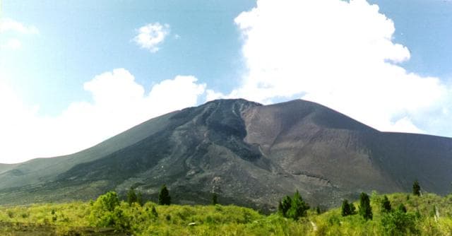
Colo is a stratovolcano rising to 404 meters (1,326 feet) in Indonesia's Western Pacific Volcanic Regions. It last erupted in 1983 CE, and volcanologists consider it an active volcanic system. The volcano has produced 3 recorded eruptions, with a maximum Volcanic Explosivity Index (VEI) of 4.
Geography & Climate
Colo is located in Indonesia, within the Sangihe Volcanic Arc of the broader Western Pacific Volcanic Regions. Situated at 0.16° S, 121.60° E in the Southern Hemisphere, the volcano lies within a tropical climate zone. At just 404 meters above sea level, Colo is a relatively low-elevation volcanic feature. Despite its modest height, it remains an active geological formation with the same underlying magmatic processes as its taller counterparts. The volcanic landform is characterized as a composite, which describes the physical shape and structure of the volcanic edifice as observed from the surface.
Geological Context
Colo sits in a subduction zone, where one tectonic plate dives beneath another, creating intense heat and pressure that generates magma. Subduction zones are responsible for many of the world's most explosive volcanoes and deadliest eruptions. For communities in Indonesia near Colo, this tectonic setting means the volcano is capable of producing powerful explosive eruptions, pyroclastic flows, and lahars that can threaten populated areas within tens of kilometers of the summit. The dominant rock type is trachyandesite / basaltic trachyandesite, a dark, fine-grained volcanic rock that forms from rapidly cooling, low-viscosity lava. Basaltic eruptions tend to be less explosive and produce fluid lava flows that can travel long distances. While less immediately dangerous than explosive eruptions, basaltic lava flows can destroy structures and infrastructure in their path, and volcanic gases released during these eruptions can affect air quality over a wide area.
Eruption History Summary
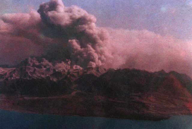
Colo has 3 recorded eruptions in the geological database, spanning from 1898 CE to 1983 CE. The most powerful recorded event was a cataclysmic eruption with ash columns reaching the stratosphere in 1983 CE, reaching VEI 4 on the Volcanic Explosivity Index. Notable eruptions include 1983 CE (VEI 4), 1898 CE (VEI 3). These eruptions span roughly 85 years of volcanic history. The most recent eruption in 1983 CE places this volcano within the modern era of volcanological observation.
Significance
With a maximum recorded VEI of 4, Colo has demonstrated the capacity for significant explosive eruptions that can impact regional aviation, agriculture, and communities tens of kilometers from the summit. VEI 4 eruptions produce ash columns reaching 15-25 kilometers into the atmosphere. Given its recent activity, Colo is closely monitored by geological survey organizations to provide early warning of future unrest.
GVP Reference Summary
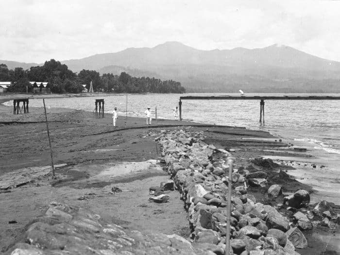
Colo volcano forms the isolated small island of Una Una in the middle of the Gulf of Tomini in northern Sulawesi. The broad, low volcano contains a 2-km-wide caldera with a small central cone. Three eruptions have been recorded since the late 1800's, but two of those caused widespread damage over the island. The last eruption, in 1983, produced pyroclastic flows that swept over most of the island shortly after all residents had been evacuated.
— Smithsonian Institution, Global Volcanism Program
3 Recorded Eruptions
| Year | VEI | Type | Area |
|---|---|---|---|
| 1983 | 4 | Confirmed Eruption | Gunung Colo |
| 1938 | 1 | Confirmed Eruption | Gunung Colo |
| 1898 | 3 | Confirmed Eruption | Gunung Colo |
Real-Time Data
Frequently Asked Questions About Colo
Is Colo an active volcano?+
Yes, Colo is considered an active volcano. Its most recent eruption was in 1983 CE. The volcano is monitored by geological agencies, and its activity status is based on observed eruptions within recorded history.
When did Colo last erupt?+
The most recent recorded eruption of Colo occurred in 1983 CE with a Volcanic Explosivity Index (VEI) of 4. The eruption was classified as a "Confirmed Eruption." Colo has 3 recorded eruptions in total.
How high is Colo?+
Colo has a summit elevation of 404 meters (1,326 feet) above sea level. At 404 meters, it is a relatively low-elevation volcano.
What type of volcano is Colo?+
Colo is classified as a Stratovolcano. Stratovolcanoes (also called composite volcanoes) are steep, conical volcanoes built up by many layers of hardened lava, tephra, and volcanic ash. They are among the most common and dangerous types, known for explosive eruptions.
Where is Colo located?+
Colo is located in Indonesia, in the Western Pacific Volcanic Regions. More specifically, it lies within the Sangihe Volcanic Arc. Its exact coordinates are -0.162° latitude, 121.601° longitude.
Is it safe to visit Colo?+
Visiting Colo requires checking current volcanic activity and alert levels. As an active volcano with eruptions as recent as 1983 CE, conditions can change rapidly. Always consult local geological authorities and follow official warnings before visiting. Many active volcanoes have designated safe viewing areas and guided tour options.