About Kelimutu
Kelimutu is a complex rising to 1,639 meters (5,378 feet) in Indonesia's Sunda-Banda Volcanic Regions. It last erupted in 1968 CE, and volcanologists consider it an active volcanic system. The volcano has produced 3 recorded eruptions, with a maximum Volcanic Explosivity Index (VEI) of 2.
Geography & Climate
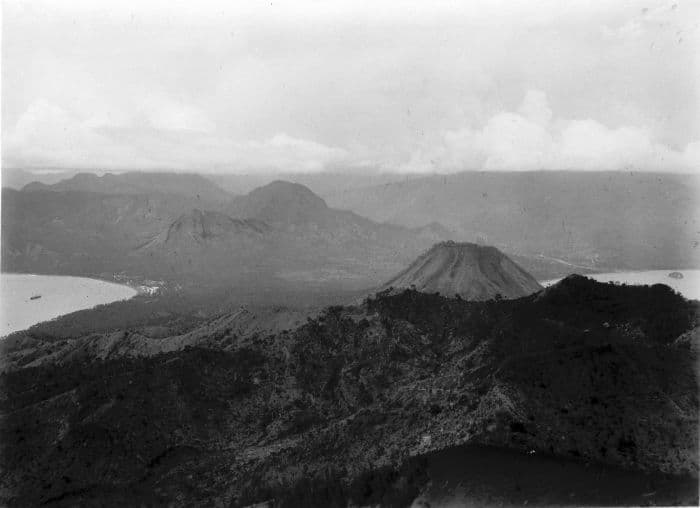
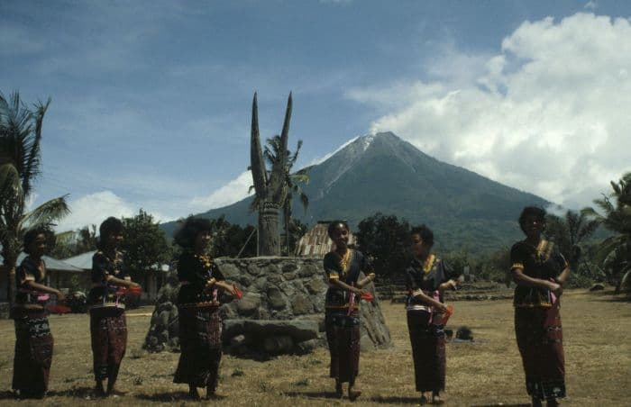
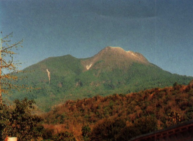
Kelimutu is located in Indonesia, within the Sunda Volcanic Arc of the broader Sunda-Banda Volcanic Regions. Situated at 8.77° S, 121.82° E in the Southern Hemisphere, the volcano lies within a tropical climate zone. With a summit elevation of 1,639 meters above sea level, Kelimutu is a moderately sized peak that remains accessible to hikers and researchers for much of the year. The volcanic landform is characterized as a composite, which describes the physical shape and structure of the volcanic edifice as observed from the surface.
Geological Context
Kelimutu sits in a subduction zone, where one tectonic plate dives beneath another, creating intense heat and pressure that generates magma. Subduction zones are responsible for many of the world's most explosive volcanoes and deadliest eruptions. For communities in Indonesia near Kelimutu, this tectonic setting means the volcano is capable of producing powerful explosive eruptions, pyroclastic flows, and lahars that can threaten populated areas within tens of kilometers of the summit. The dominant rock type is andesite / basaltic andesite, a dark, fine-grained volcanic rock that forms from rapidly cooling, low-viscosity lava. Basaltic eruptions tend to be less explosive and produce fluid lava flows that can travel long distances. While less immediately dangerous than explosive eruptions, basaltic lava flows can destroy structures and infrastructure in their path, and volcanic gases released during these eruptions can affect air quality over a wide area.
Eruption History Summary
Kelimutu has 3 recorded eruptions in the geological database, spanning from 1865 CE to 1968 CE. The most powerful recorded event was an explosive event producing ash plumes up to several kilometers in 1938 CE, reaching VEI 2 on the Volcanic Explosivity Index. These eruptions span roughly 103 years of volcanic history. The most recent eruption in 1968 CE places this volcano within the modern era of volcanological observation.
GVP Reference Summary
Kelimutu is a small, but well-known, Indonesian compound volcano in central Flores Island with three summit crater lakes of varying colors. The western lake, Tiwi Ata Mbupu (Lake of Old People) is commonly blue. Tiwu Nua Muri Kooh Tai (Lake of Young Men and Maidens) and Tiwu Ata Polo (Bewitched, or Enchanted Lake), which share a common crater wall, are commonly colored green and red, respectively, although lake colors periodically vary. Active upwelling, probably fed by subaqueous fumaroles, occurs at the two eastern lakes. The scenic lakes are a popular tourist destination and have been the source of minor phreatic eruptions in historical time. The summit is elongated 2 km in a WNW-ESE direction; the older cones of Kelido (3 km N) and Kelibara (2 km S).
— Smithsonian Institution, Global Volcanism Program
3 Recorded Eruptions
| Year | VEI | Type | Area |
|---|---|---|---|
| 1968 | 1 | Confirmed Eruption | Tiwu Nua Muri |
| 1938 | 2 | Confirmed Eruption | — |
| 1865 | 2 | Confirmed Eruption | — |
Real-Time Data
Frequently Asked Questions About Kelimutu
Is Kelimutu an active volcano?+
Yes, Kelimutu is considered an active volcano. Its most recent eruption was in 1968 CE. The volcano is monitored by geological agencies, and its activity status is based on observed eruptions within recorded history.
When did Kelimutu last erupt?+
The most recent recorded eruption of Kelimutu occurred in 1968 CE with a Volcanic Explosivity Index (VEI) of 1. The eruption was classified as a "Confirmed Eruption." Kelimutu has 3 recorded eruptions in total.
How high is Kelimutu?+
Kelimutu has a summit elevation of 1,639 meters (5,378 feet) above sea level. At 1,639 meters, it is a moderately sized volcanic peak, roughly comparable to Mount Vesuvius (1,281m).
What type of volcano is Kelimutu?+
Kelimutu is classified as a Complex. Complex volcanoes have distinct geological characteristics that set them apart from other volcanic types.
Where is Kelimutu located?+
Kelimutu is located in Indonesia, in the Sunda-Banda Volcanic Regions. More specifically, it lies within the Sunda Volcanic Arc. Its exact coordinates are -8.770° latitude, 121.820° longitude.
Is it safe to visit Kelimutu?+
Visiting Kelimutu requires checking current volcanic activity and alert levels. As an active volcano with eruptions as recent as 1968 CE, conditions can change rapidly. Always consult local geological authorities and follow official warnings before visiting. Many active volcanoes have designated safe viewing areas and guided tour options.