About Toba
Toba is a caldera rising to 2,157 meters (7,077 feet) in Indonesia's Sunda-Banda Volcanic Regions. No historical eruptions have been recorded, though the volcano is classified based on geological evidence of past activity.
Geography & Climate
Toba is located in Indonesia, within the Sunda Volcanic Arc of the broader Sunda-Banda Volcanic Regions. Situated at 2.61° N, 98.84° E in the Northern Hemisphere, the volcano lies within a tropical climate zone. At 2,157 meters above sea level, Toba rises above the surrounding terrain into montane or subalpine conditions. The elevation creates distinct ecological zones along its flanks, from forested lower slopes to exposed rocky terrain near the summit. The volcanic landform is characterized as a caldera, which describes the physical shape and structure of the volcanic edifice as observed from the surface.
GVP Reference Summary
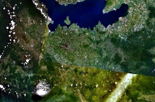
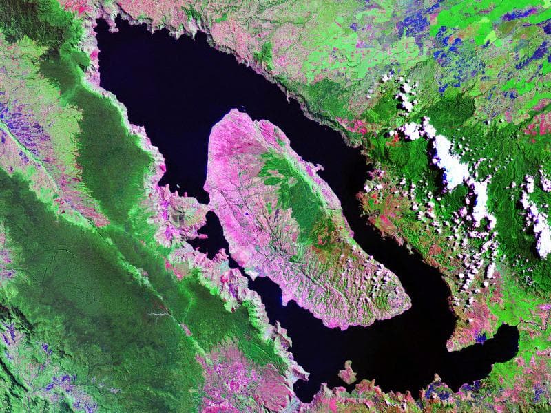
The 35 x 100 km Toba volcano, the Earth's largest Quaternary caldera, was formed during four major Pleistocene ignimbrite-producing eruptions beginning at 1.2 million years ago. The latest of these produced the Young Toba Tuff (YTT) about 74,000 years ago from vents at the NW and SE ends of present-day Lake Toba. The YTT represents the largest known Quaternary eruption, ejecting about 3,800 km3 (dense rock equivalent) of ash that covered ~40 million km2 to a depth greater than 5 mm, plus another 1,500 km3 of pyroclastic density current (PDC) deposits (Costa et al., 2014). Resurgent doming formed the massive Samosir Island and Uluan Peninsula structural blocks after the YTT eruption. Additional post-YTT eruptions include emplacement of a series of lava domes, growth of the solfatarically active Pusukbukit volcano on the south margin of the caldera, and formation of Tandukbenua volcano at the NW-most rim of the caldera. Lack of vegetation suggests that Tandukbenua may be only a few hundred years old (Chesner and Rose, 1991), but no radiometric dating has been done.
— Smithsonian Institution, Global Volcanism Program
0 Recorded Eruptions
No eruption records available for Toba.
Real-Time Data
Frequently Asked Questions About Toba
Is Toba an active volcano?+
Toba is not currently classified as active. Its activity evidence is listed as "unknown." No recorded eruptions have been documented. However, no volcano is ever considered permanently extinct.
How high is Toba?+
Toba has a summit elevation of 2,157 meters (7,077 feet) above sea level. At 2,157 meters, it is comparable in height to many significant mountain peaks and stands well above the tree line.
What type of volcano is Toba?+
Toba is classified as a Caldera. Calderas are large volcanic depressions formed when a volcano erupts so powerfully that its magma chamber collapses, creating a basin that can be kilometers wide. They are often sites of some of Earth's largest eruptions.
Where is Toba located?+
Toba is located in Indonesia, in the Sunda-Banda Volcanic Regions. More specifically, it lies within the Sunda Volcanic Arc. Its exact coordinates are 2.608° latitude, 98.842° longitude.
Is it safe to visit Toba?+
Toba can generally be visited, but as with any volcano, visitors should check local conditions and any advisory notices before traveling. Indonesia may have specific regulations for accessing volcanic areas. Guided tours are often the safest and most informative way to experience a volcano.