About Traitor's Head
Traitor's Head is a stratovolcano rising to 817 meters (2,681 feet) in Vanuatu's Southwestern Pacific Volcanic Regions. Its last known eruption was in 1881 CE. The volcano has produced 2 recorded eruptions.
Geography & Climate
Traitor's Head is located in Vanuatu, within the Vanuatu Volcanic Arc of the broader Southwestern Pacific Volcanic Regions. Situated at 18.75° S, 169.24° E in the Southern Hemisphere, the volcano lies within a tropical climate zone. With a summit elevation of 817 meters above sea level, Traitor's Head is a moderately sized peak that remains accessible to hikers and researchers for much of the year. The volcanic landform is characterized as a composite, which describes the physical shape and structure of the volcanic edifice as observed from the surface.
Geological Context
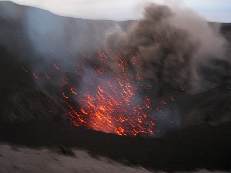
Traitor's Head sits in a subduction zone, where one tectonic plate dives beneath another, creating intense heat and pressure that generates magma. Subduction zones are responsible for many of the world's most explosive volcanoes and deadliest eruptions. For communities in Vanuatu near Traitor's Head, this tectonic setting means the volcano is capable of producing powerful explosive eruptions, pyroclastic flows, and lahars that can threaten populated areas within tens of kilometers of the summit. The dominant rock type is basalt / picro-basalt, a dark, fine-grained volcanic rock that forms from rapidly cooling, low-viscosity lava. Basaltic eruptions tend to be less explosive and produce fluid lava flows that can travel long distances. While less immediately dangerous than explosive eruptions, basaltic lava flows can destroy structures and infrastructure in their path, and volcanic gases released during these eruptions can affect air quality over a wide area.
Eruption History Summary
Traitor's Head has 2 recorded eruptions in the geological database, spanning from 1881 CE to 1959 CE. These eruptions span roughly 78 years of volcanic history. The most recent eruption in 1959 CE places this volcano within the modern era of volcanological observation.
GVP Reference Summary
The Traitor's Head peninsula north of Cook Bay on eastern Erromango Island is comprised of three Holocene volcanic cones that are the youngest on the 50-km-long island. Mounts Rantop, Nagat, and Oulenou are small basaltic-to-andesitic stratovolcanoes with well-preserved morphologies. Rantop is the largest, but Oulenou is the most youthful looking, with an unbreached crater. A low plateau to the NW is underlain by ash deposits distributed by southeasterly trade winds. The volcanoes initially formed an offshore island that was joined to the mainland by uplift after volcanism ceased. A submarine vent offshore between the tip of the peninsula and Goat Island, 5 km to the NE, erupted in 1881, the only recorded activity of the Erromango volcanoes.
— Smithsonian Institution, Global Volcanism Program
2 Recorded Eruptions
| Year | VEI | Type | Area |
|---|---|---|---|
| 1959 | — | Uncertain Eruption | Four submarine vents N of Erromango |
| 1881 | 0 | Confirmed Eruption | NE flank submarine vent |
Real-Time Data
Frequently Asked Questions About Traitor's Head
Is Traitor's Head an active volcano?+
Traitor's Head is classified as active based on credible evidence of past eruptions. Although its last known eruption was in 1881 CE, volcanologists consider it capable of erupting again.
When did Traitor's Head last erupt?+
The most recent recorded eruption of Traitor's Head occurred in 1959 CE. The eruption was classified as a "Uncertain Eruption." Traitor's Head has 2 recorded eruptions in total.
How high is Traitor's Head?+
Traitor's Head has a summit elevation of 817 meters (2,681 feet) above sea level. At 817 meters, it is a relatively low-elevation volcano.
What type of volcano is Traitor's Head?+
Traitor's Head is classified as a Stratovolcano. Stratovolcanoes (also called composite volcanoes) are steep, conical volcanoes built up by many layers of hardened lava, tephra, and volcanic ash. They are among the most common and dangerous types, known for explosive eruptions.
Where is Traitor's Head located?+
Traitor's Head is located in Vanuatu, in the Southwestern Pacific Volcanic Regions. More specifically, it lies within the Vanuatu Volcanic Arc. Its exact coordinates are -18.754° latitude, 169.238° longitude.
Is it safe to visit Traitor's Head?+
Traitor's Head can generally be visited, but as with any volcano, visitors should check local conditions and any advisory notices before traveling. Vanuatu may have specific regulations for accessing volcanic areas. Guided tours are often the safest and most informative way to experience a volcano.