About Bamus
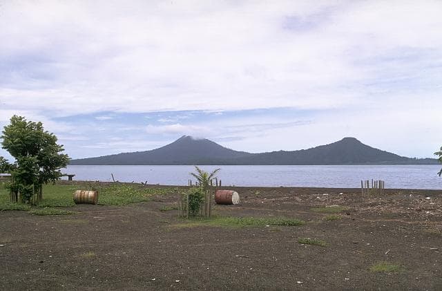
Bamus is a stratovolcano rising to 2,248 meters (7,376 feet) in Papua New Guinea's Southwestern Pacific Volcanic Regions. Its last known eruption was in 1886 CE. The volcano has produced 4 recorded eruptions, with a maximum Volcanic Explosivity Index (VEI) of 3.
Geography & Climate
Bamus is located in Papua New Guinea, within the Bismarck Volcanic Arc of the broader Southwestern Pacific Volcanic Regions. Situated at 5.20° S, 151.23° E in the Southern Hemisphere, the volcano lies within a tropical climate zone. At 2,248 meters above sea level, Bamus rises above the surrounding terrain into montane or subalpine conditions. The elevation creates distinct ecological zones along its flanks, from forested lower slopes to exposed rocky terrain near the summit. The volcanic landform is characterized as a composite, which describes the physical shape and structure of the volcanic edifice as observed from the surface.
Geological Context
Bamus sits in a subduction zone, where one tectonic plate dives beneath another, creating intense heat and pressure that generates magma. Subduction zones are responsible for many of the world's most explosive volcanoes and deadliest eruptions. For communities in Papua New Guinea near Bamus, this tectonic setting means the volcano is capable of producing powerful explosive eruptions, pyroclastic flows, and lahars that can threaten populated areas within tens of kilometers of the summit. The dominant rock type is andesite / basaltic andesite, a dark, fine-grained volcanic rock that forms from rapidly cooling, low-viscosity lava. Basaltic eruptions tend to be less explosive and produce fluid lava flows that can travel long distances. While less immediately dangerous than explosive eruptions, basaltic lava flows can destroy structures and infrastructure in their path, and volcanic gases released during these eruptions can affect air quality over a wide area.
Eruption History Summary
Bamus has 4 recorded eruptions in the geological database, spanning from 350 BCE to 1886 CE. The most powerful recorded event was a severe eruption capable of regional ash fall and pyroclastic flows in 1886 CE, reaching VEI 3 on the Volcanic Explosivity Index. These eruptions span roughly 2,236 years of volcanic history.
Significance
With a maximum recorded VEI of 3, Bamus has produced eruptions capable of generating pyroclastic flows and significant ash fall in the surrounding area. While not among the largest eruptions globally, VEI 3 events pose serious hazards to local populations and can disrupt regional air travel.
GVP Reference Summary
Symmetrical Bamus volcano, also referred to locally as the South Son, is located SW of Ulawun volcano, known as the Father. The andesitic stratovolcano is covered in rainforest and contains a breached summit crater filled with a lava dome. There is a cone on the southern flank, and a prominent 1.5-km-wide crater with two small adjacent cones halfway up the SE flank. Young pyroclastic-flow deposits are found on the flanks, and residents describe an eruption that took place during the late 19th century.
— Smithsonian Institution, Global Volcanism Program
4 Recorded Eruptions
| Year | VEI | Type | Area |
|---|---|---|---|
| 1886 | 3 | Confirmed Eruption | — |
| 1650 | — | Confirmed Eruption | — |
| 270 BCE | — | Confirmed Eruption | — |
| 350 BCE | — | Confirmed Eruption | — |
Real-Time Data
Frequently Asked Questions About Bamus
Is Bamus an active volcano?+
Bamus is classified as active based on credible evidence of past eruptions. Although its last known eruption was in 1886 CE, volcanologists consider it capable of erupting again.
When did Bamus last erupt?+
The most recent recorded eruption of Bamus occurred in 1886 CE with a Volcanic Explosivity Index (VEI) of 3. The eruption was classified as a "Confirmed Eruption." Bamus has 4 recorded eruptions in total.
How high is Bamus?+
Bamus has a summit elevation of 2,248 meters (7,376 feet) above sea level. At 2,248 meters, it is comparable in height to many significant mountain peaks and stands well above the tree line.
What type of volcano is Bamus?+
Bamus is classified as a Stratovolcano. Stratovolcanoes (also called composite volcanoes) are steep, conical volcanoes built up by many layers of hardened lava, tephra, and volcanic ash. They are among the most common and dangerous types, known for explosive eruptions.
Where is Bamus located?+
Bamus is located in Papua New Guinea, in the Southwestern Pacific Volcanic Regions. More specifically, it lies within the Bismarck Volcanic Arc. Its exact coordinates are -5.200° latitude, 151.230° longitude.
Is it safe to visit Bamus?+
Bamus can generally be visited, but as with any volcano, visitors should check local conditions and any advisory notices before traveling. Papua New Guinea may have specific regulations for accessing volcanic areas. Guided tours are often the safest and most informative way to experience a volcano.