About Montagu Island
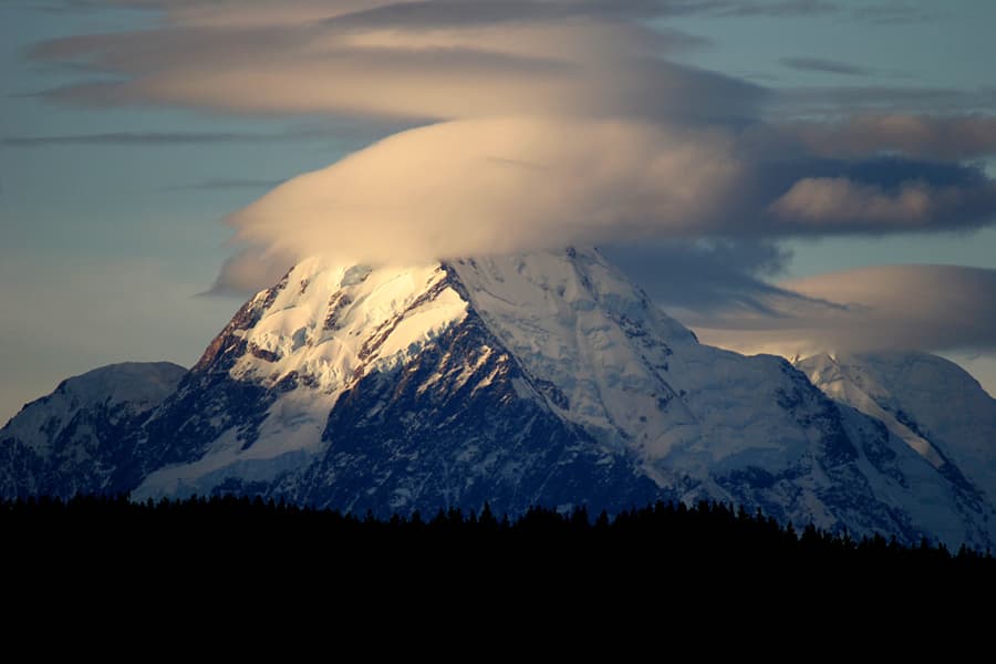
Montagu Island is a shield rising to 1,370 meters (4,495 feet) in United Kingdom's Antarctic-Scotia Volcanic Regions. It has been active in recent decades, with its last eruption in 2007 CE. The volcano has produced 2 recorded eruptions, with a maximum Volcanic Explosivity Index (VEI) of 1.
Geography & Climate
Montagu Island is located in United Kingdom, within the South Sandwich Volcanic Arc of the broader Antarctic-Scotia Volcanic Regions. Situated at 58.45° S, 26.37° W in the Southern Hemisphere, the volcano lies within a subarctic climate zone. With a summit elevation of 1,370 meters above sea level, Montagu Island is a moderately sized peak that remains accessible to hikers and researchers for much of the year. The volcanic landform is characterized as a shield, which describes the physical shape and structure of the volcanic edifice as observed from the surface.
Geological Context
Montagu Island sits in a subduction zone, where one tectonic plate dives beneath another, creating intense heat and pressure that generates magma. Subduction zones are responsible for many of the world's most explosive volcanoes and deadliest eruptions. For communities in United Kingdom near Montagu Island, this tectonic setting means the volcano is capable of producing powerful explosive eruptions, pyroclastic flows, and lahars that can threaten populated areas within tens of kilometers of the summit. The dominant rock type is basalt / picro-basalt, a dark, fine-grained volcanic rock that forms from rapidly cooling, low-viscosity lava. Basaltic eruptions tend to be less explosive and produce fluid lava flows that can travel long distances. While less immediately dangerous than explosive eruptions, basaltic lava flows can destroy structures and infrastructure in their path, and volcanic gases released during these eruptions can affect air quality over a wide area.
Eruption History Summary
Montagu Island has 2 recorded eruptions in the geological database, spanning from 1996 CE to 2001 CE. The most powerful recorded event was a gentle, effusive event in 2001 CE, reaching VEI 1 on the Volcanic Explosivity Index. These eruptions span roughly 5 years of volcanic history. With eruptive activity as recently as 2001 CE, Montagu Island remains an actively monitored volcano.
GVP Reference Summary
The largest of the South Sandwich Islands, Montagu consists of a massive shield volcano cut by a 6-km-wide ice-filled summit caldera. The summit of the 11 x 15 km island rises about 3,000 m from the sea floor between Bristol and Saunders Islands. Around 90% of the island is ice-covered; glaciers extending to the sea typically form vertical ice cliffs. The name Mount Belinda has been applied both to the high point at the southern end of the summit caldera and to the young central cone. Mount Oceanite, an isolated peak at the SE tip of the island, was the source of lava flows exposed at Mathias Point and Allen Point. There was no record of Holocene activity until MODIS satellite data, beginning in late 2001, revealed thermal anomalies consistent with lava lake activity. Apparent plumes and single anomalous pixels were observed intermittently on AVHRR images from March 1995 to February 1998, possibly indicating earlier volcanic activity.
— Smithsonian Institution, Global Volcanism Program
2 Recorded Eruptions
| Year | VEI | Type | Area |
|---|---|---|---|
| 2001 | 1 | Confirmed Eruption | NW of Mount Belinda |
| 1996 | 1 | Uncertain Eruption | — |
Real-Time Data
Frequently Asked Questions About Montagu Island
Is Montagu Island an active volcano?+
Yes, Montagu Island is considered an active volcano. Its most recent eruption was in 2007 CE. The volcano is monitored by geological agencies, and its activity status is based on observed eruptions within recorded history.
When did Montagu Island last erupt?+
The most recent recorded eruption of Montagu Island occurred in 2001 CE with a Volcanic Explosivity Index (VEI) of 1. The eruption was classified as a "Confirmed Eruption." Montagu Island has 2 recorded eruptions in total.
How high is Montagu Island?+
Montagu Island has a summit elevation of 1,370 meters (4,495 feet) above sea level. At 1,370 meters, it is a moderately sized volcanic peak, roughly comparable to Mount Vesuvius (1,281m).
What type of volcano is Montagu Island?+
Montagu Island is classified as a Shield. Shield volcanoes have distinct geological characteristics that set them apart from other volcanic types.
Where is Montagu Island located?+
Montagu Island is located in United Kingdom, in the Antarctic-Scotia Volcanic Regions. More specifically, it lies within the South Sandwich Volcanic Arc. Its exact coordinates are -58.445° latitude, -26.374° longitude.
Is it safe to visit Montagu Island?+
Visiting Montagu Island requires checking current volcanic activity and alert levels. As an active volcano with eruptions as recent as 2007 CE, conditions can change rapidly. Always consult local geological authorities and follow official warnings before visiting. Many active volcanoes have designated safe viewing areas and guided tour options.