McBride Volcanic Province
Volcanic field · 1,020m · Australia
About McBride Volcanic Province
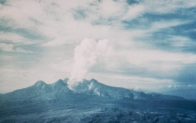
McBride Volcanic Province is a volcanic field rising to 1,020 meters (3,347 feet) in Australia's Eastern Australia Volcanic Regions. The volcano is currently active, with its most recent eruption in 5050 BCE. The volcano has produced 1 recorded eruption.
Geography & Climate
McBride Volcanic Province is located in Australia, within the Northeastern Australia Volcanic Province of the broader Eastern Australia Volcanic Regions. Situated at 18.37° S, 144.57° E in the Southern Hemisphere, the volcano lies within a tropical climate zone. With a summit elevation of 1,020 meters above sea level, McBride Volcanic Province is a moderately sized peak that remains accessible to hikers and researchers for much of the year. The volcanic landform is characterized as a cluster, which describes the physical shape and structure of the volcanic edifice as observed from the surface.
Geological Context
McBride Volcanic Province is an intraplate volcano, meaning it formed away from any plate boundary. These volcanoes are often powered by hotspots — plumes of abnormally hot mantle material rising from deep within the Earth. Hotspot volcanoes like McBride Volcanic Province tend to produce effusive eruptions with lava flows that can be relatively predictable, giving nearby communities in Australia more time to prepare. However, they can also produce explosive phases, particularly when magma interacts with groundwater.
Eruption History Summary
McBride Volcanic Province has 1 recorded eruption in the geological database, spanning from 5050 BCE to 5050 BCE.
GVP Reference Summary
An area of around 5,500 km2 is covered by the broad lava plains and cones of the McBride Volcanic Province. The 164 volcanic centers form a broad topographic dome. One lava flow traveled 160 km from Undara crater. Lava from the Kinrara cone was Ar-Ar dated at 7,000 +/- 2,000 (Cohen et al., 2017).
— Smithsonian Institution, Global Volcanism Program
1 Recorded Eruption
| Year | VEI | Type | Area |
|---|---|---|---|
| 5050 BCE | — | Confirmed Eruption | — |
Real-Time Data
Frequently Asked Questions About McBride Volcanic Province
Is McBride Volcanic Province an active volcano?+
McBride Volcanic Province is not currently classified as active. Its activity evidence is listed as "Eruption Dated." The last known eruption was in 5050 BCE. However, no volcano is ever considered permanently extinct.
When did McBride Volcanic Province last erupt?+
The most recent recorded eruption of McBride Volcanic Province occurred in 5050 BCE. The eruption was classified as a "Confirmed Eruption." McBride Volcanic Province has 1 recorded eruption in total.
How high is McBride Volcanic Province?+
McBride Volcanic Province has a summit elevation of 1,020 meters (3,347 feet) above sea level. At 1,020 meters, it is a moderately sized volcanic peak, roughly comparable to Mount Vesuvius (1,281m).
What type of volcano is McBride Volcanic Province?+
McBride Volcanic Province is classified as a Volcanic field. Volcanic fields consist of clusters of small volcanic vents and cinder cones spread across a region. Rather than a single central vent, eruptions can occur at many points across the field.
Where is McBride Volcanic Province located?+
McBride Volcanic Province is located in Australia, in the Eastern Australia Volcanic Regions. More specifically, it lies within the Northeastern Australia Volcanic Province. Its exact coordinates are -18.367° latitude, 144.567° longitude.
Is it safe to visit McBride Volcanic Province?+
McBride Volcanic Province can generally be visited, but as with any volcano, visitors should check local conditions and any advisory notices before traveling. Australia may have specific regulations for accessing volcanic areas. Guided tours are often the safest and most informative way to experience a volcano.