About Chaiten
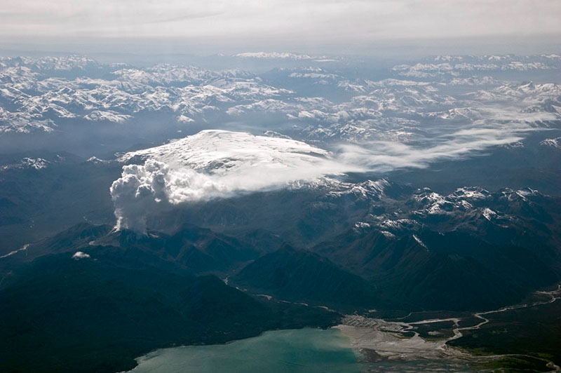
Chaiten is a caldera rising to 1,122 meters (3,681 feet) in Chile's South America Volcanic Regions. It has been active in recent decades, with its last eruption in 2011 CE. The volcano has produced 5 recorded eruptions, with a maximum Volcanic Explosivity Index (VEI) of 5.
Geography & Climate
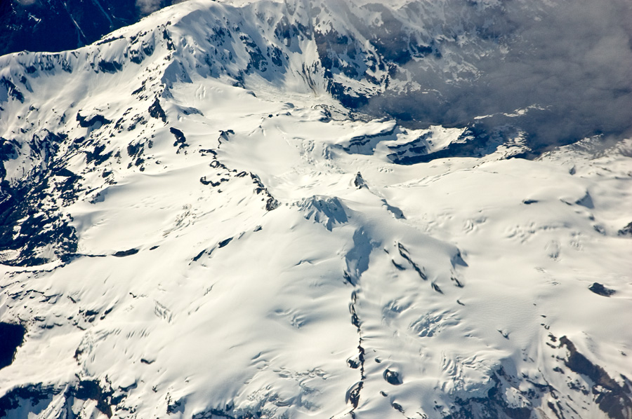
Chaiten is located in Chile, within the Southern Andean Volcanic Arc of the broader South America Volcanic Regions. Situated at 42.83° S, 72.65° W in the Southern Hemisphere, the volcano lies within a temperate climate zone. With a summit elevation of 1,122 meters above sea level, Chaiten is a moderately sized peak that remains accessible to hikers and researchers for much of the year. The volcanic landform is characterized as a caldera, which describes the physical shape and structure of the volcanic edifice as observed from the surface.
Geological Context
Chaiten sits in a subduction zone, where one tectonic plate dives beneath another, creating intense heat and pressure that generates magma. Subduction zones are responsible for many of the world's most explosive volcanoes and deadliest eruptions. For communities in Chile near Chaiten, this tectonic setting means the volcano is capable of producing powerful explosive eruptions, pyroclastic flows, and lahars that can threaten populated areas within tens of kilometers of the summit. The dominant rock type is rhyolite, a silica-rich volcanic rock associated with highly viscous magma. Rhyolitic eruptions can be extremely explosive and are responsible for some of the largest volcanic events in Earth's history, including supervolcanic caldera-forming eruptions. The high silica content traps dissolved gases, building enormous pressure that can lead to catastrophic explosive releases.
Eruption History Summary
Chaiten has 5 recorded eruptions in the geological database, spanning from 7750 BCE to 2008 CE. The most powerful recorded event was a paroxysmal eruption with devastating regional consequences in 3100 BCE, reaching VEI 5 on the Volcanic Explosivity Index. Notable eruptions include 2008 CE (VEI 4), 1640 CE (VEI 4), 3100 BCE (VEI 5). This eruption frequency indicates a moderately active volcanic system with periodic reawakenings. With eruptive activity as recently as 2008 CE, Chaiten remains an actively monitored volcano.
Significance
With a maximum recorded VEI of 5, Chaiten has demonstrated the capacity for paroxysmal eruptions comparable to the 1980 eruption of Mount St. Helens. Eruptions of this scale can devastate areas within 20-30 kilometers and produce ash fall that disrupts aviation and agriculture across hundreds of kilometers. With 5 recorded eruptions on file, Chaiten has enough documented activity to help scientists identify patterns in its eruptive behavior. Given its recent activity, Chaiten is closely monitored by geological survey organizations to provide early warning of future unrest.
GVP Reference Summary
Chaitén is a small caldera (~3 km in diameter) located 10 km NE of the town of Chaitén on the Gulf of Corcovado. Multiple explosive eruptions throughout the Holocene have been identified. A rhyolitic obsidian lava dome occupies much of the caldera floor. Obsidian cobbles from this dome found in the Blanco River are the source of artifacts from archaeological sites along the Pacific coast as far as 400 km from the volcano to the N and S. The caldera is breached on the SW side by a river that drains to the bay of Chaitén. The first recorded eruption, beginning in 2008, produced major rhyolitic explosive activity and building a new dome and tephra cone on the older rhyolite dome.
— Smithsonian Institution, Global Volcanism Program
5 Recorded Eruptions
| Year | VEI | Type | Area |
|---|---|---|---|
| 2008 | 4 | Confirmed Eruption | — |
| 1640 | 4 | Confirmed Eruption | — |
| 3100 BCE | 5 | Confirmed Eruption | — |
| 6650 BCE | — | Confirmed Eruption | — |
| 7750 BCE | 5 | Confirmed Eruption | — |
Real-Time Data
Frequently Asked Questions About Chaiten
Is Chaiten an active volcano?+
Yes, Chaiten is considered an active volcano. Its most recent eruption was in 2011 CE. The volcano is monitored by geological agencies, and its activity status is based on observed eruptions within recorded history.
When did Chaiten last erupt?+
The most recent recorded eruption of Chaiten occurred in 2008 CE with a Volcanic Explosivity Index (VEI) of 4. The eruption was classified as a "Confirmed Eruption." Chaiten has 5 recorded eruptions in total.
How high is Chaiten?+
Chaiten has a summit elevation of 1,122 meters (3,681 feet) above sea level. At 1,122 meters, it is a moderately sized volcanic peak, roughly comparable to Mount Vesuvius (1,281m).
What type of volcano is Chaiten?+
Chaiten is classified as a Caldera. Calderas are large volcanic depressions formed when a volcano erupts so powerfully that its magma chamber collapses, creating a basin that can be kilometers wide. They are often sites of some of Earth's largest eruptions.
Where is Chaiten located?+
Chaiten is located in Chile, in the South America Volcanic Regions. More specifically, it lies within the Southern Andean Volcanic Arc. Its exact coordinates are -42.835° latitude, -72.651° longitude.
Is it safe to visit Chaiten?+
Visiting Chaiten requires checking current volcanic activity and alert levels. As an active volcano with eruptions as recent as 2011 CE, conditions can change rapidly. Always consult local geological authorities and follow official warnings before visiting. Many active volcanoes have designated safe viewing areas and guided tour options.