About Sairecabur
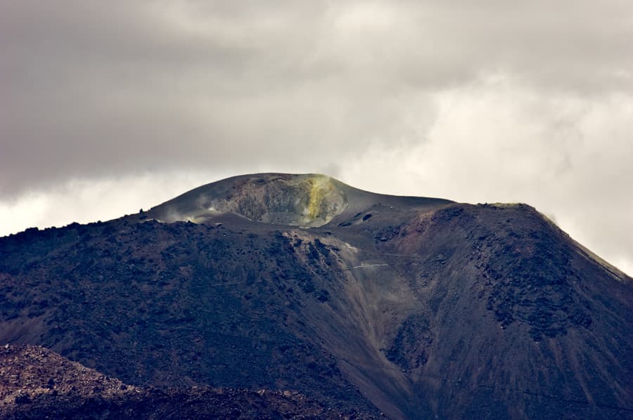
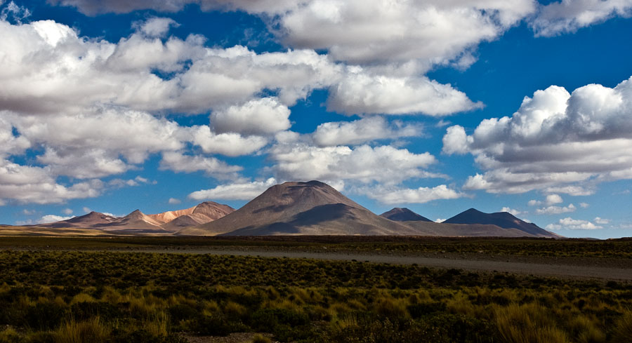
Sairecabur is a stratovolcano(es) rising to 5,961 meters (19,558 feet) in Chile-Bolivia's South America Volcanic Regions. No historical eruptions have been recorded, though the volcano is classified based on geological evidence of past activity.
Geography & Climate
Sairecabur is located in Chile-Bolivia, within the Central Andean Volcanic Arc of the broader South America Volcanic Regions. Situated at 22.72° S, 67.89° W in the Southern Hemisphere, the volcano lies within a tropical climate zone. At 5,961 meters above sea level, Sairecabur reaches well into the permanent snow and ice zone. Glaciers and snowpack on the upper slopes create the potential for lahars — destructive volcanic mudflows — during eruptions, as heat rapidly melts ice and snow. The volcanic landform is characterized as a composite, which describes the physical shape and structure of the volcanic edifice as observed from the surface.
Geological Context
Sairecabur sits in a subduction zone, where one tectonic plate dives beneath another, creating intense heat and pressure that generates magma. Subduction zones are responsible for many of the world's most explosive volcanoes and deadliest eruptions. For communities in Chile-Bolivia near Sairecabur, this tectonic setting means the volcano is capable of producing powerful explosive eruptions, pyroclastic flows, and lahars that can threaten populated areas within tens of kilometers of the summit. The dominant rock type is andesite / basaltic andesite, a dark, fine-grained volcanic rock that forms from rapidly cooling, low-viscosity lava. Basaltic eruptions tend to be less explosive and produce fluid lava flows that can travel long distances. While less immediately dangerous than explosive eruptions, basaltic lava flows can destroy structures and infrastructure in their path, and volcanic gases released during these eruptions can affect air quality over a wide area.
GVP Reference Summary
This chain of andesitic-dacitic volcanoes along the Chile-Bolivia border contains at least 10 postglacial centers and stretches from Escalante volcano in the N to Sairecábur volcano in the S. Nomenclature reflecting local usage results in conflicting names applied to these features on Chilean and Bolivian topographic maps. The highest peak, Sairecábur, is located on the northern margin of a 4.5-km-wide caldera. Postglacial activity began S of the summit, but most recently produced a pristine lava flow to the NW. An active sulfur mine is located N of the volcano. Escalante, slightly older than Sairecábur, has a crater lake at its summit and youthful lava flows on its flanks, and other eruptive centers have also produced Holocene lava flows. The Pleistocene-Holocene Curinquinca volcano lies at the NE end of the complex; Cerro Colorado volcano lies at the NW end.
— Smithsonian Institution, Global Volcanism Program
0 Recorded Eruptions
No eruption records available for Sairecabur.
Real-Time Data
Frequently Asked Questions About Sairecabur
Is Sairecabur an active volcano?+
Sairecabur is classified as active based on credible evidence of past eruptions. Although its last known eruption was in prehistoric times, volcanologists consider it capable of erupting again.
How high is Sairecabur?+
Sairecabur has a summit elevation of 5,961 meters (19,558 feet) above sea level. At 5,961 meters, it stands taller than Mount Rainier (4,392m) and is among the world's major volcanic peaks.
What type of volcano is Sairecabur?+
Sairecabur is classified as a Stratovolcano(es). Stratovolcano(es) volcanoes have distinct geological characteristics that set them apart from other volcanic types.
Where is Sairecabur located?+
Sairecabur is located in Chile-Bolivia, in the South America Volcanic Regions. More specifically, it lies within the Central Andean Volcanic Arc. Its exact coordinates are -22.719° latitude, -67.891° longitude.
Is it safe to visit Sairecabur?+
Sairecabur can generally be visited, but as with any volcano, visitors should check local conditions and any advisory notices before traveling. Chile-Bolivia may have specific regulations for accessing volcanic areas. Guided tours are often the safest and most informative way to experience a volcano.