About Barva
Barva is a complex rising to 2,906 meters (9,535 feet) in Costa Rica's Middle America-Caribbean Volcanic Regions. The volcano is currently active, with its most recent eruption in 6050 BCE. The volcano has produced 2 recorded eruptions, with a maximum Volcanic Explosivity Index (VEI) of 4.
Geography & Climate
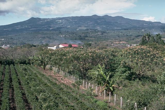
Barva is located in Costa Rica, within the Central America Volcanic Arc of the broader Middle America-Caribbean Volcanic Regions. Situated at 10.13° N, 84.10° W in the Northern Hemisphere, the volcano lies within a tropical climate zone. At 2,906 meters above sea level, Barva rises above the surrounding terrain into montane or subalpine conditions. The elevation creates distinct ecological zones along its flanks, from forested lower slopes to exposed rocky terrain near the summit. The volcanic landform is characterized as a composite, which describes the physical shape and structure of the volcanic edifice as observed from the surface.
Geological Context
Barva sits in a subduction zone, where one tectonic plate dives beneath another, creating intense heat and pressure that generates magma. Subduction zones are responsible for many of the world's most explosive volcanoes and deadliest eruptions. For communities in Costa Rica near Barva, this tectonic setting means the volcano is capable of producing powerful explosive eruptions, pyroclastic flows, and lahars that can threaten populated areas within tens of kilometers of the summit. The dominant rock type is andesite / basaltic andesite, a dark, fine-grained volcanic rock that forms from rapidly cooling, low-viscosity lava. Basaltic eruptions tend to be less explosive and produce fluid lava flows that can travel long distances. While less immediately dangerous than explosive eruptions, basaltic lava flows can destroy structures and infrastructure in their path, and volcanic gases released during these eruptions can affect air quality over a wide area.
Eruption History Summary
Barva has 2 recorded eruptions in the geological database, spanning from 6050 BCE to 1867 CE. The most powerful recorded event was a cataclysmic eruption with ash columns reaching the stratosphere in 6050 BCE, reaching VEI 4 on the Volcanic Explosivity Index. These eruptions span roughly 7,917 years of volcanic history.
Significance
With a maximum recorded VEI of 4, Barva has demonstrated the capacity for significant explosive eruptions that can impact regional aviation, agriculture, and communities tens of kilometers from the summit. VEI 4 eruptions produce ash columns reaching 15-25 kilometers into the atmosphere.
GVP Reference Summary
One of three massive volcanoes close to the capital city of San José, Volcán Barva (Barba) is a complex volcano with multiple peaks and flank vents. Three peaks visible from the Central Valley give it the common local name of Las Tres Marías. The voluminous andesitic-to-dacitic Tiribí Tuff, exposed in the Central Valley, was erupted about 322,000 years ago. The summit area is dominated by a 2 x 3 km crater open to the ESE. One of the cones on the upper N flank contains a crater lake. Cones are also found on the S flanks, along with lava flows. The Los Angeles flow, one of the most recent, descends nearly to the city of Heredia. A large Plinian eruption occurred during the early Holocene. Eruptions were reported in 1760 or 1766, 1776? (also a mudflow), and 1867, but later visits to the summit did not provide evidence for recent activity.
— Smithsonian Institution, Global Volcanism Program
2 Recorded Eruptions
| Year | VEI | Type | Area |
|---|---|---|---|
| 1867 | — | Uncertain Eruption | — |
| 6050 BCE | 4 | Confirmed Eruption | — |
Real-Time Data
Frequently Asked Questions About Barva
Is Barva an active volcano?+
Barva is not currently classified as active. Its activity evidence is listed as "Eruption Dated." The last known eruption was in 6050 BCE. However, no volcano is ever considered permanently extinct.
When did Barva last erupt?+
The most recent recorded eruption of Barva occurred in 1867 CE. The eruption was classified as a "Uncertain Eruption." Barva has 2 recorded eruptions in total.
How high is Barva?+
Barva has a summit elevation of 2,906 meters (9,535 feet) above sea level. At 2,906 meters, it is comparable in height to many significant mountain peaks and stands well above the tree line.
What type of volcano is Barva?+
Barva is classified as a Complex. Complex volcanoes have distinct geological characteristics that set them apart from other volcanic types.
Where is Barva located?+
Barva is located in Costa Rica, in the Middle America-Caribbean Volcanic Regions. More specifically, it lies within the Central America Volcanic Arc. Its exact coordinates are 10.135° latitude, -84.100° longitude.
Is it safe to visit Barva?+
Barva can generally be visited, but as with any volcano, visitors should check local conditions and any advisory notices before traveling. Costa Rica may have specific regulations for accessing volcanic areas. Guided tours are often the safest and most informative way to experience a volcano.


