About Chinameca
Chinameca is a stratovolcano rising to 1,300 meters (4,265 feet) in El Salvador's Middle America-Caribbean Volcanic Regions. No historical eruptions have been recorded, though the volcano is classified based on geological evidence of past activity.
Geography & Climate
Chinameca is located in El Salvador, within the Central America Volcanic Arc of the broader Middle America-Caribbean Volcanic Regions. Situated at 13.48° N, 88.33° W in the Northern Hemisphere, the volcano lies within a tropical climate zone. With a summit elevation of 1,300 meters above sea level, Chinameca is a moderately sized peak that remains accessible to hikers and researchers for much of the year. The volcanic landform is characterized as a composite, which describes the physical shape and structure of the volcanic edifice as observed from the surface.
Geological Context
Chinameca sits in a subduction zone, where one tectonic plate dives beneath another, creating intense heat and pressure that generates magma. Subduction zones are responsible for many of the world's most explosive volcanoes and deadliest eruptions. For communities in El Salvador near Chinameca, this tectonic setting means the volcano is capable of producing powerful explosive eruptions, pyroclastic flows, and lahars that can threaten populated areas within tens of kilometers of the summit. The dominant rock type is andesite / basaltic andesite, a dark, fine-grained volcanic rock that forms from rapidly cooling, low-viscosity lava. Basaltic eruptions tend to be less explosive and produce fluid lava flows that can travel long distances. While less immediately dangerous than explosive eruptions, basaltic lava flows can destroy structures and infrastructure in their path, and volcanic gases released during these eruptions can affect air quality over a wide area.
GVP Reference Summary
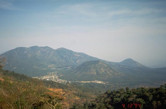
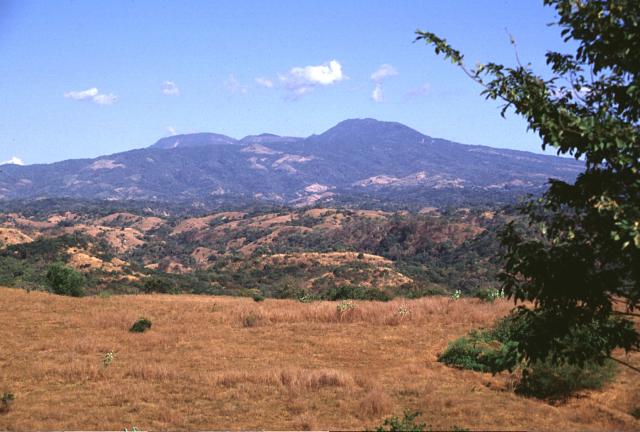
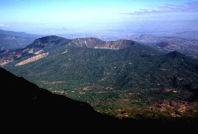
The small Chinameca stratovolcano (also known as El Pacayal) lies across a low saddle abotu 7 km NW of the large San Miguel volcano. A 2-km-wide, steep-sided caldera, Laguna Seca el Pacayal, truncates the summit, whose flanks are covered with coffee plantations. The Holocene cone of Cerro el Limbo on the W flank rises above the level of the caldera rim, and a Holocene lava flow extends from a NNW-flank vent into the lowlands to the N beyond the town of Chinameca (Weber and Weisemann, 1978). A group of fumarole fields on the N flank surrounds the city of Chinameca, and the volcano has been the site of a geothermal exploration program.
— Smithsonian Institution, Global Volcanism Program
0 Recorded Eruptions
No eruption records available for Chinameca.
Real-Time Data
Frequently Asked Questions About Chinameca
Is Chinameca an active volcano?+
Chinameca is classified as active based on credible evidence of past eruptions. Although its last known eruption was in prehistoric times, volcanologists consider it capable of erupting again.
How high is Chinameca?+
Chinameca has a summit elevation of 1,300 meters (4,265 feet) above sea level. At 1,300 meters, it is a moderately sized volcanic peak, roughly comparable to Mount Vesuvius (1,281m).
What type of volcano is Chinameca?+
Chinameca is classified as a Stratovolcano. Stratovolcanoes (also called composite volcanoes) are steep, conical volcanoes built up by many layers of hardened lava, tephra, and volcanic ash. They are among the most common and dangerous types, known for explosive eruptions.
Where is Chinameca located?+
Chinameca is located in El Salvador, in the Middle America-Caribbean Volcanic Regions. More specifically, it lies within the Central America Volcanic Arc. Its exact coordinates are 13.478° latitude, -88.330° longitude.
Is it safe to visit Chinameca?+
Chinameca can generally be visited, but as with any volcano, visitors should check local conditions and any advisory notices before traveling. El Salvador may have specific regulations for accessing volcanic areas. Guided tours are often the safest and most informative way to experience a volcano.