Tumble Buttes
Pyroclastic cone(s) · 2,191m · United States
About Tumble Buttes
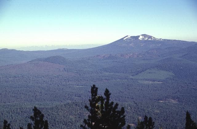
Tumble Buttes is a pyroclastic cone(s) rising to 2,191 meters (7,189 feet) in United States's North America Volcanic Regions. No historical eruptions have been recorded, though the volcano is classified based on geological evidence of past activity.
Geography & Climate
Tumble Buttes is located in United States, within the Basin and Range Volcanic Province of the broader North America Volcanic Regions. Situated at 40.68° N, 121.55° W in the Northern Hemisphere, the volcano lies within a temperate climate zone. At 2,191 meters above sea level, Tumble Buttes rises above the surrounding terrain into montane or subalpine conditions. The elevation creates distinct ecological zones along its flanks, from forested lower slopes to exposed rocky terrain near the summit. The volcanic landform is characterized as a minor, which describes the physical shape and structure of the volcanic edifice as observed from the surface.
GVP Reference Summary
A line of cinder cones along a NNW-SSE fissure produced a series of lava flows. Bear Wallow Butte, the source of unvegetated lava flows on its eastern and western flanks, lies at the southern end of the chain. At the northern end is Eiler Butte, constructed on a topographic high, which has also produced blocky lava flows. The most prominent feature is Devils Rock Garden, a thick, blocky andesitic lava flow complex that erupted from Tumble Butte south; it is the youngest of the Tumble Buttes flows and was considered by Miller (1989) to be Holocene. The Devils Rock Garden flow blocks glacial outwash channels and overlies glacial gravels, and thus is younger than about 15,000 years, but was mapped as latest Pleistocene by Clynne and Muffler (2010) and estimated to have been erupted between 10,000-15,000 years ago.
— Smithsonian Institution, Global Volcanism Program
0 Recorded Eruptions
No eruption records available for Tumble Buttes.
Real-Time Data
Frequently Asked Questions About Tumble Buttes
Is Tumble Buttes an active volcano?+
Tumble Buttes is not currently classified as active. Its activity evidence is listed as "unknown." No recorded eruptions have been documented. However, no volcano is ever considered permanently extinct.
How high is Tumble Buttes?+
Tumble Buttes has a summit elevation of 2,191 meters (7,189 feet) above sea level. At 2,191 meters, it is comparable in height to many significant mountain peaks and stands well above the tree line.
What type of volcano is Tumble Buttes?+
Tumble Buttes is classified as a Pyroclastic cone(s). Pyroclastic cones (or cinder cones) are small, steep-sided volcanic cones built from fragments of lava blasted into the air. They are the simplest type of volcano and often form in groups.
Where is Tumble Buttes located?+
Tumble Buttes is located in United States, in the North America Volcanic Regions. More specifically, it lies within the Basin and Range Volcanic Province. Its exact coordinates are 40.680° latitude, -121.550° longitude.
Is it safe to visit Tumble Buttes?+
Tumble Buttes can generally be visited, but as with any volcano, visitors should check local conditions and any advisory notices before traveling. United States may have specific regulations for accessing volcanic areas. Guided tours are often the safest and most informative way to experience a volcano.

