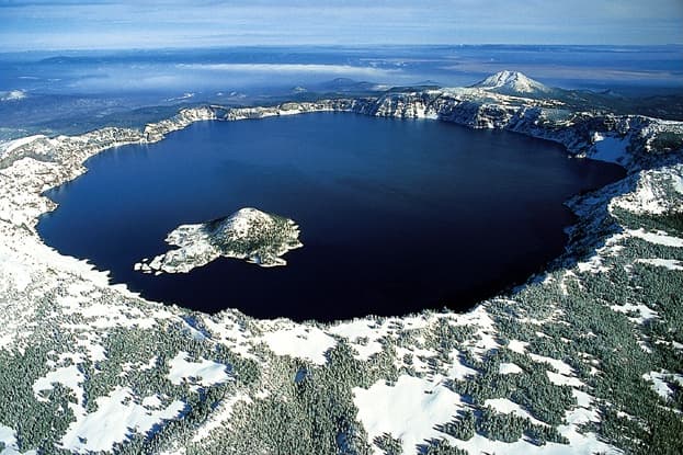
About Jefferson
Jefferson is a stratovolcano rising to 3,199 meters (10,496 feet) in United States's North America Volcanic Regions. Its last known eruption was in 950 CE. The volcano has produced 2 recorded eruptions.
Geography & Climate
Jefferson is located in United States, within the High Cascades Volcanic Arc of the broader North America Volcanic Regions. Situated at 44.67° N, 121.80° W in the Northern Hemisphere, the volcano lies within a temperate climate zone. At 3,199 meters above sea level, Jefferson rises above the surrounding terrain into montane or subalpine conditions. The elevation creates distinct ecological zones along its flanks, from forested lower slopes to exposed rocky terrain near the summit. The volcanic landform is characterized as a composite, which describes the physical shape and structure of the volcanic edifice as observed from the surface.
Geological Context
Jefferson sits in a subduction zone, where one tectonic plate dives beneath another, creating intense heat and pressure that generates magma. Subduction zones are responsible for many of the world's most explosive volcanoes and deadliest eruptions. For communities in United States near Jefferson, this tectonic setting means the volcano is capable of producing powerful explosive eruptions, pyroclastic flows, and lahars that can threaten populated areas within tens of kilometers of the summit. The dominant rock type is andesite / basaltic andesite, a dark, fine-grained volcanic rock that forms from rapidly cooling, low-viscosity lava. Basaltic eruptions tend to be less explosive and produce fluid lava flows that can travel long distances. While less immediately dangerous than explosive eruptions, basaltic lava flows can destroy structures and infrastructure in their path, and volcanic gases released during these eruptions can affect air quality over a wide area.
Eruption History Summary
Jefferson has 2 recorded eruptions in the geological database, spanning from 4500 BCE to 950 CE. These eruptions span roughly 5,450 years of volcanic history.
GVP Reference Summary
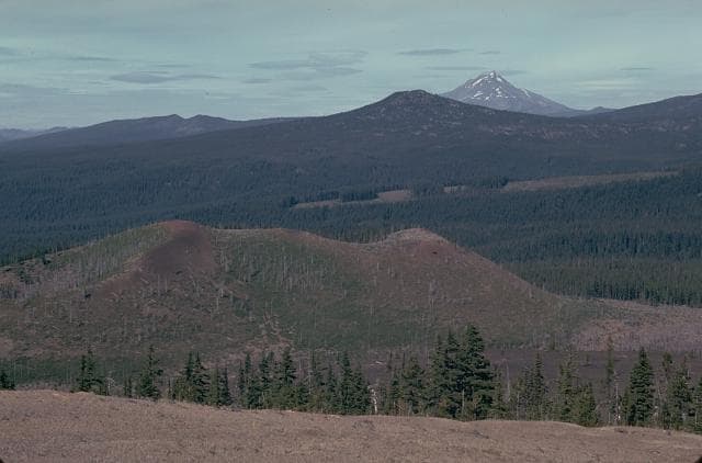
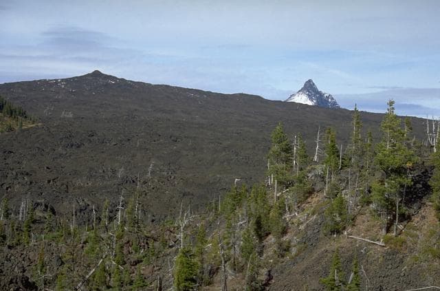
Mount Jefferson, Oregon's second highest peak, is a deeply eroded stratovolcano. The glacier-clad landmark prominent from both sides of the Cascade Range was named by Lewis and Clark for the president that sponsored their expedition. Jefferson was constructed in two episodes interrupted by extensive glacial erosion. The first of these, beginning about 290,000 years ago, produced an andesitic-to-dacitic volcano possibly higher than the current summit. Dacitic lava domes were emplaced during a second cycle beginning about 70,000 years ago which included ash flows that traveled 15 km E and W. Several Holocene cinder cones near the Cascade crest south of Jefferson have produced lava flows that traveled down glacially carved valleys, including those from Forked Butte and North Cinder Peak. The most recent eruption, from a cinder cone on the flank of the South Cinder Peak cone, produced a lava flow that traveled west into Marion Lake about 1,000 years ago.
— Smithsonian Institution, Global Volcanism Program
2 Recorded Eruptions
| Year | VEI | Type | Area |
|---|---|---|---|
| 950 | — | Confirmed Eruption | S of Jefferson (South Cinder Peak) |
| 4500 BCE | — | Confirmed Eruption | SSE of Jefferson (Forked Butte) |
Real-Time Data
Frequently Asked Questions About Jefferson
Is Jefferson an active volcano?+
Jefferson is not currently classified as active. Its activity evidence is listed as "Eruption Dated." The last known eruption was in 950 CE. However, no volcano is ever considered permanently extinct.
When did Jefferson last erupt?+
The most recent recorded eruption of Jefferson occurred in 950 CE. The eruption was classified as a "Confirmed Eruption." Jefferson has 2 recorded eruptions in total.
How high is Jefferson?+
Jefferson has a summit elevation of 3,199 meters (10,496 feet) above sea level. At 3,199 meters, it is comparable in height to many significant mountain peaks and stands well above the tree line.
What type of volcano is Jefferson?+
Jefferson is classified as a Stratovolcano. Stratovolcanoes (also called composite volcanoes) are steep, conical volcanoes built up by many layers of hardened lava, tephra, and volcanic ash. They are among the most common and dangerous types, known for explosive eruptions.
Where is Jefferson located?+
Jefferson is located in United States, in the North America Volcanic Regions. More specifically, it lies within the High Cascades Volcanic Arc. Its exact coordinates are 44.674° latitude, -121.800° longitude.
Is it safe to visit Jefferson?+
Jefferson can generally be visited, but as with any volcano, visitors should check local conditions and any advisory notices before traveling. United States may have specific regulations for accessing volcanic areas. Guided tours are often the safest and most informative way to experience a volcano.