About Belknap
Belknap is a shield(s) rising to 2,094 meters (6,870 feet) in United States's North America Volcanic Regions. Its last known eruption was in 475 CE. The volcano has produced 4 recorded eruptions, with a maximum Volcanic Explosivity Index (VEI) of 2.
Geography & Climate
Belknap is located in United States, within the High Cascades Volcanic Arc of the broader North America Volcanic Regions. Situated at 44.28° N, 121.84° W in the Northern Hemisphere, the volcano lies within a temperate climate zone. At 2,094 meters above sea level, Belknap rises above the surrounding terrain into montane or subalpine conditions. The elevation creates distinct ecological zones along its flanks, from forested lower slopes to exposed rocky terrain near the summit. The volcanic landform is characterized as a shield, which describes the physical shape and structure of the volcanic edifice as observed from the surface.
Geological Context
Belknap sits in a subduction zone, where one tectonic plate dives beneath another, creating intense heat and pressure that generates magma. Subduction zones are responsible for many of the world's most explosive volcanoes and deadliest eruptions. For communities in United States near Belknap, this tectonic setting means the volcano is capable of producing powerful explosive eruptions, pyroclastic flows, and lahars that can threaten populated areas within tens of kilometers of the summit. The dominant rock type is andesite / basaltic andesite, a dark, fine-grained volcanic rock that forms from rapidly cooling, low-viscosity lava. Basaltic eruptions tend to be less explosive and produce fluid lava flows that can travel long distances. While less immediately dangerous than explosive eruptions, basaltic lava flows can destroy structures and infrastructure in their path, and volcanic gases released during these eruptions can affect air quality over a wide area.
Eruption History Summary
Belknap has 4 recorded eruptions in the geological database, spanning from 5050 BCE to 475 CE. The most powerful recorded event was an explosive event producing ash plumes up to several kilometers in 475 CE, reaching VEI 2 on the Volcanic Explosivity Index. These eruptions span roughly 5,525 years of volcanic history.
GVP Reference Summary
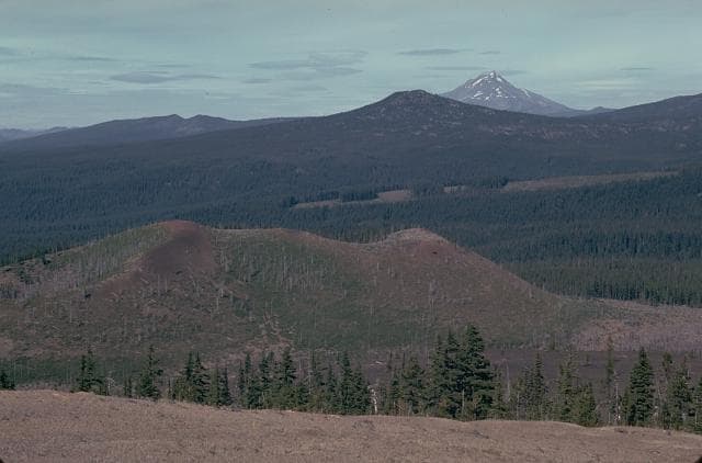
The Belknap Crater area near McKenzie Pass in Oregon, north of the Three Sisters volcanoes, was the source of one of the largest concentrations of youthful volcanism in the Cascade Range. The basaltic to basaltic andesite Belknap shield volcano, topped by the Belknap Crater pyroclastic cone and the Little Belknap shield volcano immediately to the east, have produced widespread late Holocene lava flows on all sides, much of which took place between about 3,000 and 1,500 years ago. Eruptions from the NE base of Belknap crater produced lava flows that traveled 15 km W into the McKenzie River valley.
— Smithsonian Institution, Global Volcanism Program
4 Recorded Eruptions
| Year | VEI | Type | Area |
|---|---|---|---|
| 475 | 2 | Confirmed Eruption | Belknap Crater |
| 685 BCE | 2 | Confirmed Eruption | South Belknap and Twin Craters |
| 1071 BCE | 0 | Confirmed Eruption | Little Belknap |
| 5050 BCE | — | Confirmed Eruption | — |
Real-Time Data
Frequently Asked Questions About Belknap
Is Belknap an active volcano?+
Belknap is not currently classified as active. Its activity evidence is listed as "Eruption Dated." The last known eruption was in 475 CE. However, no volcano is ever considered permanently extinct.
When did Belknap last erupt?+
The most recent recorded eruption of Belknap occurred in 475 CE with a Volcanic Explosivity Index (VEI) of 2. The eruption was classified as a "Confirmed Eruption." Belknap has 4 recorded eruptions in total.
How high is Belknap?+
Belknap has a summit elevation of 2,094 meters (6,870 feet) above sea level. At 2,094 meters, it is comparable in height to many significant mountain peaks and stands well above the tree line.
What type of volcano is Belknap?+
Belknap is classified as a Shield(s). Shield volcanoes are broad, gently sloping volcanoes built by fluid lava flows. They produce less explosive eruptions compared to stratovolcanoes and tend to have effusive lava rather than violent blasts.
Where is Belknap located?+
Belknap is located in United States, in the North America Volcanic Regions. More specifically, it lies within the High Cascades Volcanic Arc. Its exact coordinates are 44.285° latitude, -121.842° longitude.
Is it safe to visit Belknap?+
Belknap can generally be visited, but as with any volcano, visitors should check local conditions and any advisory notices before traveling. United States may have specific regulations for accessing volcanic areas. Guided tours are often the safest and most informative way to experience a volcano.