About Ardoukoba
Ardoukoba is a fissure vent(s) rising to 298 meters (978 feet) in Djibouti's Eastern Africa Volcanic Regions. It last erupted in 1978 CE, and volcanologists consider it an active volcanic system. The volcano has produced 1 recorded eruption, with a maximum Volcanic Explosivity Index (VEI) of 1.
Geography & Climate
Ardoukoba is located in Djibouti, within the Afar Rift Volcanic Province of the broader Eastern Africa Volcanic Regions. Situated at 11.58° N, 42.47° E in the Northern Hemisphere, the volcano lies within a tropical climate zone. At just 298 meters above sea level, Ardoukoba is a relatively low-elevation volcanic feature. Despite its modest height, it remains an active geological formation with the same underlying magmatic processes as its taller counterparts. The volcanic landform is characterized as a cluster, which describes the physical shape and structure of the volcanic edifice as observed from the surface.
Geological Context
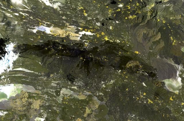
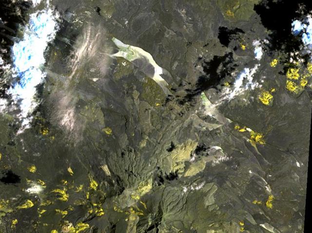
Ardoukoba is situated along a rift zone, where tectonic plates are pulling apart. As the crust thins and fractures, magma rises to fill the gap, creating volcanic activity. Rift volcanism typically produces more fluid lava flows rather than explosive blasts, which means communities near Ardoukoba in Djibouti generally face slower-moving hazards like lava flows and ground fissures rather than sudden pyroclastic events. However, rift volcanoes can still generate significant ash emissions and gas releases that affect local air quality. The dominant rock type is basalt / picro-basalt, a dark, fine-grained volcanic rock that forms from rapidly cooling, low-viscosity lava. Basaltic eruptions tend to be less explosive and produce fluid lava flows that can travel long distances. While less immediately dangerous than explosive eruptions, basaltic lava flows can destroy structures and infrastructure in their path, and volcanic gases released during these eruptions can affect air quality over a wide area.
Eruption History Summary
Ardoukoba has 1 recorded eruption in the geological database, spanning from 1978 CE to 1978 CE. The most powerful recorded event was a gentle, effusive event in 1978 CE, reaching VEI 1 on the Volcanic Explosivity Index. The most recent eruption in 1978 CE places this volcano within the modern era of volcanological observation.
GVP Reference Summary
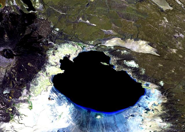
The Ardoukôba (Asal) Rift in Djibouti, trending NW from the Red Sea, contains a broad area of youthful fissure vents between Lake Asal and the Ghoubbat al Kharab gulf. It is subaerially exposed over 12 km between these two bodies of water and contains numerous basaltic cinder and spatter cones. The silicic centers of Eger Alayta and Asa Aleyta, on the N and S sides, are remnants of a Pleistocene silicic center that has been disrupted and spread apart. Magma-water interaction has produced tuff cones, some of which form islands or are breached by the sea. The most recent lava flows are younger than lake sediments deposited 5,300 years ago. These lavas were thought to have been erupted during the past 3,000 years (Delibrias et al., 1975). The fissure erupted in 1978, producing a small cinder cone and lava flows that covered part of the rift floor near the Red Sea.
— Smithsonian Institution, Global Volcanism Program
1 Recorded Eruption
| Year | VEI | Type | Area |
|---|---|---|---|
| 1978 | 1 | Confirmed Eruption | — |
Real-Time Data
Frequently Asked Questions About Ardoukoba
Is Ardoukoba an active volcano?+
Yes, Ardoukoba is considered an active volcano. Its most recent eruption was in 1978 CE. The volcano is monitored by geological agencies, and its activity status is based on observed eruptions within recorded history.
When did Ardoukoba last erupt?+
The most recent recorded eruption of Ardoukoba occurred in 1978 CE with a Volcanic Explosivity Index (VEI) of 1. The eruption was classified as a "Confirmed Eruption." Ardoukoba has 1 recorded eruption in total.
How high is Ardoukoba?+
Ardoukoba has a summit elevation of 298 meters (978 feet) above sea level. At 298 meters, it is a relatively low-elevation volcano.
What type of volcano is Ardoukoba?+
Ardoukoba is classified as a Fissure vent(s). Fissure vent(s) volcanoes have distinct geological characteristics that set them apart from other volcanic types.
Where is Ardoukoba located?+
Ardoukoba is located in Djibouti, in the Eastern Africa Volcanic Regions. More specifically, it lies within the Afar Rift Volcanic Province. Its exact coordinates are 11.580° latitude, 42.470° longitude.
Is it safe to visit Ardoukoba?+
Visiting Ardoukoba requires checking current volcanic activity and alert levels. As an active volcano with eruptions as recent as 1978 CE, conditions can change rapidly. Always consult local geological authorities and follow official warnings before visiting. Many active volcanoes have designated safe viewing areas and guided tour options.