About Tolmachev Dol
Tolmachev Dol is a pyroclastic cone(s) rising to 1,021 meters (3,350 feet) in Russia's Northwestern Pacific Volcanic Regions. Its last known eruption was in 300 CE. The volcano has produced 2 recorded eruptions, with a maximum Volcanic Explosivity Index (VEI) of 4.
Geography & Climate
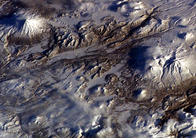
Tolmachev Dol is located in Russia, within the Kuril Volcanic Arc of the broader Northwestern Pacific Volcanic Regions. Situated at 52.63° N, 157.58° E in the Northern Hemisphere, the volcano lies within a temperate climate zone. With a summit elevation of 1,021 meters above sea level, Tolmachev Dol is a moderately sized peak that remains accessible to hikers and researchers for much of the year. The volcanic landform is characterized as a cluster, which describes the physical shape and structure of the volcanic edifice as observed from the surface.
Geological Context
Tolmachev Dol sits in a subduction zone, where one tectonic plate dives beneath another, creating intense heat and pressure that generates magma. Subduction zones are responsible for many of the world's most explosive volcanoes and deadliest eruptions. For communities in Russia near Tolmachev Dol, this tectonic setting means the volcano is capable of producing powerful explosive eruptions, pyroclastic flows, and lahars that can threaten populated areas within tens of kilometers of the summit. The dominant rock type is basalt / picro-basalt, a dark, fine-grained volcanic rock that forms from rapidly cooling, low-viscosity lava. Basaltic eruptions tend to be less explosive and produce fluid lava flows that can travel long distances. While less immediately dangerous than explosive eruptions, basaltic lava flows can destroy structures and infrastructure in their path, and volcanic gases released during these eruptions can affect air quality over a wide area.
Eruption History Summary
Tolmachev Dol has 2 recorded eruptions in the geological database, spanning from 2650 BCE to 300 CE. The most powerful recorded event was a cataclysmic eruption with ash columns reaching the stratosphere in 2650 BCE, reaching VEI 4 on the Volcanic Explosivity Index. These eruptions span roughly 2,950 years of volcanic history.
Significance
With a maximum recorded VEI of 4, Tolmachev Dol has demonstrated the capacity for significant explosive eruptions that can impact regional aviation, agriculture, and communities tens of kilometers from the summit. VEI 4 eruptions produce ash columns reaching 15-25 kilometers into the atmosphere.
GVP Reference Summary
Tolmachev Dol (Tomachev Plateau) is broad volcanic highland NE of Opala volcano that includes numerous late-Pleistocene and Holocene cinder cones and associated lava flows. The cones and lava fields cover a broad area on both sides of Lake Tolmachev, which lies in large depression halfway between Opala and Gorely volcanoes. The Pleistocene Tolmachev stratovolcano lies on the SE side of the lake. A major explosive eruption took place about 4,600 years ago from Chasha crater in the northern part of the plateau, during which about 1 km3 of rhyolitic tephra was ejected. The latest dated eruption occurred from a cinder cone in the NW part of the plateau about 1,600-1,700 years ago.
— Smithsonian Institution, Global Volcanism Program
2 Recorded Eruptions
| Year | VEI | Type | Area |
|---|---|---|---|
| 300 | — | Confirmed Eruption | NW part of Tolmachev Dol |
| 2650 BCE | 4 | Confirmed Eruption | Chasha crater |
Real-Time Data
Frequently Asked Questions About Tolmachev Dol
Is Tolmachev Dol an active volcano?+
Tolmachev Dol is not currently classified as active. Its activity evidence is listed as "Eruption Dated." The last known eruption was in 300 CE. However, no volcano is ever considered permanently extinct.
When did Tolmachev Dol last erupt?+
The most recent recorded eruption of Tolmachev Dol occurred in 300 CE. The eruption was classified as a "Confirmed Eruption." Tolmachev Dol has 2 recorded eruptions in total.
How high is Tolmachev Dol?+
Tolmachev Dol has a summit elevation of 1,021 meters (3,350 feet) above sea level. At 1,021 meters, it is a moderately sized volcanic peak, roughly comparable to Mount Vesuvius (1,281m).
What type of volcano is Tolmachev Dol?+
Tolmachev Dol is classified as a Pyroclastic cone(s). Pyroclastic cones (or cinder cones) are small, steep-sided volcanic cones built from fragments of lava blasted into the air. They are the simplest type of volcano and often form in groups.
Where is Tolmachev Dol located?+
Tolmachev Dol is located in Russia, in the Northwestern Pacific Volcanic Regions. More specifically, it lies within the Kuril Volcanic Arc. Its exact coordinates are 52.630° latitude, 157.580° longitude.
Is it safe to visit Tolmachev Dol?+
Tolmachev Dol can generally be visited, but as with any volcano, visitors should check local conditions and any advisory notices before traveling. Russia may have specific regulations for accessing volcanic areas. Guided tours are often the safest and most informative way to experience a volcano.

