About Kambalny
Kambalny is a stratovolcano rising to 2,116 meters (6,943 feet) in Russia's Northwestern Pacific Volcanic Regions. It has been active in recent decades, with its last eruption in 2017 CE. The volcano has produced 2 recorded eruptions, with a maximum Volcanic Explosivity Index (VEI) of 3.
Geography & Climate
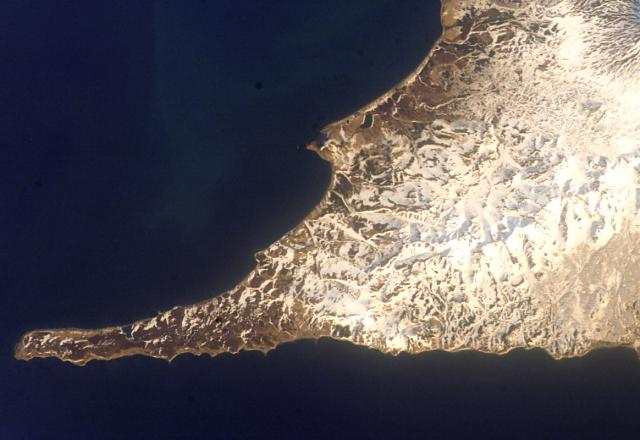
Kambalny is located in Russia, within the Kuril Volcanic Arc of the broader Northwestern Pacific Volcanic Regions. Situated at 51.31° N, 156.88° E in the Northern Hemisphere, the volcano lies within a temperate climate zone. At 2,116 meters above sea level, Kambalny rises above the surrounding terrain into montane or subalpine conditions. The elevation creates distinct ecological zones along its flanks, from forested lower slopes to exposed rocky terrain near the summit. The volcanic landform is characterized as a composite, which describes the physical shape and structure of the volcanic edifice as observed from the surface.
Geological Context
Kambalny sits in a subduction zone, where one tectonic plate dives beneath another, creating intense heat and pressure that generates magma. Subduction zones are responsible for many of the world's most explosive volcanoes and deadliest eruptions. For communities in Russia near Kambalny, this tectonic setting means the volcano is capable of producing powerful explosive eruptions, pyroclastic flows, and lahars that can threaten populated areas within tens of kilometers of the summit. The dominant rock type is basalt / picro-basalt, a dark, fine-grained volcanic rock that forms from rapidly cooling, low-viscosity lava. Basaltic eruptions tend to be less explosive and produce fluid lava flows that can travel long distances. While less immediately dangerous than explosive eruptions, basaltic lava flows can destroy structures and infrastructure in their path, and volcanic gases released during these eruptions can affect air quality over a wide area.
Eruption History Summary
Kambalny has 2 recorded eruptions in the geological database, spanning from 1350 CE to 2017 CE. The most powerful recorded event was a severe eruption capable of regional ash fall and pyroclastic flows in 2017 CE, reaching VEI 3 on the Volcanic Explosivity Index. These eruptions span roughly 667 years of volcanic history. With eruptive activity as recently as 2017 CE, Kambalny remains an actively monitored volcano.
Significance
With a maximum recorded VEI of 3, Kambalny has produced eruptions capable of generating pyroclastic flows and significant ash fall in the surrounding area. While not among the largest eruptions globally, VEI 3 events pose serious hazards to local populations and can disrupt regional air travel. Given its recent activity, Kambalny is closely monitored by geological survey organizations to provide early warning of future unrest.
GVP Reference Summary
The southernmost major stratovolcano on the Kamchatka peninsula, Kambalny has a summit crater that is breached to the SE. Five Holocene cinder cones on the W and SE flanks have produced fresh-looking lava flows. Beginning about 6,300 radiocarbon years ago, a series of major collapses of the edifice produced at least three debris-avalanche deposits. The last major eruption took place about 600 years ago, although younger tephra layers have been found, and an eruption was reported in 1767. Active fumarolic areas are found on the flanks of the volcano, which is located south of the massive Pauzhetka volcano-tectonic depression.
— Smithsonian Institution, Global Volcanism Program
2 Recorded Eruptions
| Year | VEI | Type | Area |
|---|---|---|---|
| 2017 | 3 | Confirmed Eruption | Summit crater |
| 1350 | — | Confirmed Eruption | — |
Real-Time Data
Frequently Asked Questions About Kambalny
Is Kambalny an active volcano?+
Kambalny is not currently classified as active. Its activity evidence is listed as "Eruption Dated." The last known eruption was in 2017 CE. However, no volcano is ever considered permanently extinct.
When did Kambalny last erupt?+
The most recent recorded eruption of Kambalny occurred in 2017 CE with a Volcanic Explosivity Index (VEI) of 3. The eruption was classified as a "Confirmed Eruption." Kambalny has 2 recorded eruptions in total.
How high is Kambalny?+
Kambalny has a summit elevation of 2,116 meters (6,943 feet) above sea level. At 2,116 meters, it is comparable in height to many significant mountain peaks and stands well above the tree line.
What type of volcano is Kambalny?+
Kambalny is classified as a Stratovolcano. Stratovolcanoes (also called composite volcanoes) are steep, conical volcanoes built up by many layers of hardened lava, tephra, and volcanic ash. They are among the most common and dangerous types, known for explosive eruptions.
Where is Kambalny located?+
Kambalny is located in Russia, in the Northwestern Pacific Volcanic Regions. More specifically, it lies within the Kuril Volcanic Arc. Its exact coordinates are 51.306° latitude, 156.875° longitude.
Is it safe to visit Kambalny?+
Kambalny can generally be visited, but as with any volcano, visitors should check local conditions and any advisory notices before traveling. Russia may have specific regulations for accessing volcanic areas. Guided tours are often the safest and most informative way to experience a volcano.