About Alamagan
Alamagan is a stratovolcano rising to 744 meters (2,441 feet) in United States's Northwestern Pacific Volcanic Regions. Its last known eruption was in 870 CE. The volcano has produced 4 recorded eruptions, with a maximum Volcanic Explosivity Index (VEI) of 4.
Geography & Climate
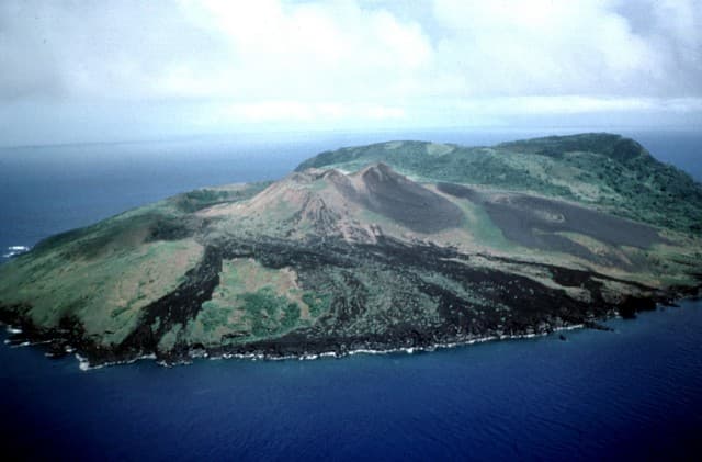
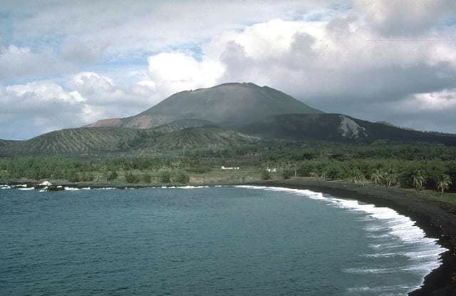
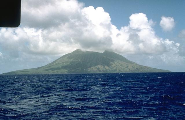
Alamagan is located in United States, within the Mariana Volcanic Arc of the broader Northwestern Pacific Volcanic Regions. Situated at 17.60° N, 145.83° E in the Northern Hemisphere, the volcano lies within a tropical climate zone. With a summit elevation of 744 meters above sea level, Alamagan is a moderately sized peak that remains accessible to hikers and researchers for much of the year. The volcanic landform is characterized as a composite, which describes the physical shape and structure of the volcanic edifice as observed from the surface.
Geological Context
Alamagan sits in a subduction zone, where one tectonic plate dives beneath another, creating intense heat and pressure that generates magma. Subduction zones are responsible for many of the world's most explosive volcanoes and deadliest eruptions. For communities in United States near Alamagan, this tectonic setting means the volcano is capable of producing powerful explosive eruptions, pyroclastic flows, and lahars that can threaten populated areas within tens of kilometers of the summit. The dominant rock type is andesite / basaltic andesite, a dark, fine-grained volcanic rock that forms from rapidly cooling, low-viscosity lava. Basaltic eruptions tend to be less explosive and produce fluid lava flows that can travel long distances. While less immediately dangerous than explosive eruptions, basaltic lava flows can destroy structures and infrastructure in their path, and volcanic gases released during these eruptions can affect air quality over a wide area.
Eruption History Summary
Alamagan has 4 recorded eruptions in the geological database, spanning from 540 CE to 1887 CE. The most powerful recorded event was a cataclysmic eruption with ash columns reaching the stratosphere in 870 CE, reaching VEI 4 on the Volcanic Explosivity Index. These eruptions span roughly 1,347 years of volcanic history.
Significance
With a maximum recorded VEI of 4, Alamagan has demonstrated the capacity for significant explosive eruptions that can impact regional aviation, agriculture, and communities tens of kilometers from the summit. VEI 4 eruptions produce ash columns reaching 15-25 kilometers into the atmosphere.
GVP Reference Summary
Alamagan is the emergent summit of a large stratovolcano in the central Mariana Islands with a roughly 350-m-deep summit crater east of the center of the island. The exposed cone is largely Holocene in age. A 1.6 x 1 km graben cuts the SW flank. An extensive basaltic andesite lava flow has extended the northern coast of the island, and a lava platform also occurs on the S flank. Pyroclastic-flow deposits erupted about 1000 years ago have been dated, but reports of historical eruptions were considered invalid (Moore and Trusdell, 1993).
— Smithsonian Institution, Global Volcanism Program
4 Recorded Eruptions
| Year | VEI | Type | Area |
|---|---|---|---|
| 1887 | — | Uncertain Eruption | — |
| 1864 | — | Uncertain Eruption | — |
| 870 | 4 | Confirmed Eruption | — |
| 540 | — | Confirmed Eruption | — |
Real-Time Data
Frequently Asked Questions About Alamagan
Is Alamagan an active volcano?+
Alamagan is not currently classified as active. Its activity evidence is listed as "Eruption Dated." The last known eruption was in 870 CE. However, no volcano is ever considered permanently extinct.
When did Alamagan last erupt?+
The most recent recorded eruption of Alamagan occurred in 1887 CE. The eruption was classified as a "Uncertain Eruption." Alamagan has 4 recorded eruptions in total.
How high is Alamagan?+
Alamagan has a summit elevation of 744 meters (2,441 feet) above sea level. At 744 meters, it is a relatively low-elevation volcano.
What type of volcano is Alamagan?+
Alamagan is classified as a Stratovolcano. Stratovolcanoes (also called composite volcanoes) are steep, conical volcanoes built up by many layers of hardened lava, tephra, and volcanic ash. They are among the most common and dangerous types, known for explosive eruptions.
Where is Alamagan located?+
Alamagan is located in United States, in the Northwestern Pacific Volcanic Regions. More specifically, it lies within the Mariana Volcanic Arc. Its exact coordinates are 17.600° latitude, 145.830° longitude.
Is it safe to visit Alamagan?+
Alamagan can generally be visited, but as with any volcano, visitors should check local conditions and any advisory notices before traveling. United States may have specific regulations for accessing volcanic areas. Guided tours are often the safest and most informative way to experience a volcano.