About Biliran
Biliran is a compound rising to 1,301 meters (4,269 feet) in Philippines's Western Pacific Volcanic Regions. It last erupted in 1939 CE, and volcanologists consider it an active volcanic system. The volcano has produced 1 recorded eruption, with a maximum Volcanic Explosivity Index (VEI) of 1.
Geography & Climate
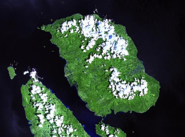
Biliran is located in Philippines, within the Eastern Philippine Volcanic Arc of the broader Western Pacific Volcanic Regions. Situated at 11.52° N, 124.53° E in the Northern Hemisphere, the volcano lies within a tropical climate zone. With a summit elevation of 1,301 meters above sea level, Biliran is a moderately sized peak that remains accessible to hikers and researchers for much of the year. The volcanic landform is characterized as a composite, which describes the physical shape and structure of the volcanic edifice as observed from the surface.
Geological Context
Biliran sits in a subduction zone, where one tectonic plate dives beneath another, creating intense heat and pressure that generates magma. Subduction zones are responsible for many of the world's most explosive volcanoes and deadliest eruptions. For communities in Philippines near Biliran, this tectonic setting means the volcano is capable of producing powerful explosive eruptions, pyroclastic flows, and lahars that can threaten populated areas within tens of kilometers of the summit. The dominant rock type is andesite / basaltic andesite, a dark, fine-grained volcanic rock that forms from rapidly cooling, low-viscosity lava. Basaltic eruptions tend to be less explosive and produce fluid lava flows that can travel long distances. While less immediately dangerous than explosive eruptions, basaltic lava flows can destroy structures and infrastructure in their path, and volcanic gases released during these eruptions can affect air quality over a wide area.
Eruption History Summary
Biliran has 1 recorded eruption in the geological database, spanning from 1939 CE to 1939 CE. The most powerful recorded event was a gentle, effusive event in 1939 CE, reaching VEI 1 on the Volcanic Explosivity Index. The most recent eruption in 1939 CE places this volcano within the modern era of volcanological observation.
GVP Reference Summary
The volcanic island of Biliran, located across the narrow Biliran Strait from the northern tip of Leyte Island, contains many prominent andesitic lava domes, the highest of which is 1301 m Surio. Several Pleistocene K-Ar dates have been obtained from volcanic centers on northern Biliran Island. Fumarole fields are scattered throughout the 20 x 35 km wide island. The only known historical activity was a phreatic explosive eruption and possible debris avalanche at a thermal area in 1939.
— Smithsonian Institution, Global Volcanism Program
1 Recorded Eruption
| Year | VEI | Type | Area |
|---|---|---|---|
| 1939 | 1 | Confirmed Eruption | — |
Real-Time Data
Frequently Asked Questions About Biliran
Is Biliran an active volcano?+
Yes, Biliran is considered an active volcano. Its most recent eruption was in 1939 CE. The volcano is monitored by geological agencies, and its activity status is based on observed eruptions within recorded history.
When did Biliran last erupt?+
The most recent recorded eruption of Biliran occurred in 1939 CE with a Volcanic Explosivity Index (VEI) of 1. The eruption was classified as a "Confirmed Eruption." Biliran has 1 recorded eruption in total.
How high is Biliran?+
Biliran has a summit elevation of 1,301 meters (4,269 feet) above sea level. At 1,301 meters, it is a moderately sized volcanic peak, roughly comparable to Mount Vesuvius (1,281m).
What type of volcano is Biliran?+
Biliran is classified as a Compound. Compound volcanoes have distinct geological characteristics that set them apart from other volcanic types.
Where is Biliran located?+
Biliran is located in Philippines, in the Western Pacific Volcanic Regions. More specifically, it lies within the Eastern Philippine Volcanic Arc. Its exact coordinates are 11.523° latitude, 124.535° longitude.
Is it safe to visit Biliran?+
Visiting Biliran requires checking current volcanic activity and alert levels. As an active volcano with eruptions as recent as 1939 CE, conditions can change rapidly. Always consult local geological authorities and follow official warnings before visiting. Many active volcanoes have designated safe viewing areas and guided tour options.

